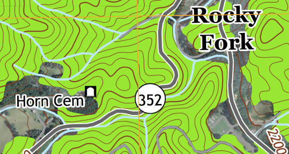
Check out the newest USGS topo maps!
This week in GPS is a weekly link roundup of (mostly) GPS related odds and ends, from GPS Tracklog and other places around the Web. To get a few of the biggest stories as they break, follow me on Twitter. This week’s lead image is from this article — Revised Kentucky and Tennessee USGS Maps Reveal New Design; via @GPSGIS_Eric. I have to wonder how these might change mapping software and maps on our handheld GPS units.
From GPS Tracklog
Our posts from the past week:
Also of note, Monday is the last day for REI’s $199.99 deal on the Oregon 450t and these other handheld and fitness GPS deals
.
Ship dates keep slipping
At least for the DeLorme inReach SE (6/1), Garmin Oregon 650 and 650t (6/3), and SPOT Gen3 (6/16).
Garmin
- The ruggedized nuvi 500 and 550 have been discontinued
- Tutorial: Make your own forest shading/landcover maps
- NYT on Garmin’s Smartphone Link app
- Garmin reminds us about their new air vent mount and says their new 5″ marine units are shipping
- How to download free maps to your Garmin Edge 705/800/810
- Garmin is out surveying lakes
- Updated NW trails and topo maps
- Here’s an interesting email tip re: shaping points that I got a few days ago (thanks Ron!):
If you use Trip Planner on the newer models and add at least three points, the intermediate destinations will have an orange flag beside it. Press the orange flag. Not the name of the intermediate destination, the orange flag beside the destination.
If you press the orange flag, a pop up will appear that says, “Duration and arrival times will be removed. Change to shaping point?” If you press yes, the nuvi no longer considers the point a destination, instead it uses the point to shape the route and does not require stopping at that point. This helps solve the problem for people who miss waypoints.
Again, I think this only works on the newer models.
- MINI Coopers get an integrated nuvi (image below); more info here

Garmin hits the MINI Cooper
TomTom
- TomTom launches live roadside video for app developers
The business of GPS
- Google Said to Consider Buying Waze Presaging Bidding War; Will They Shut It Down?
- How Google Made Maps Human, Savvy, and Monetizeable
Geocaching
- Geocachers Wanted By Police In Two Countries
- The Most Found Geocache in the World
- Five Tips for Logging Your Next Geocache
- More about Rove
- Colorado and Ohio geotours
- Geocaching the Lewis and Clark trail
- Instructor creates Wherigo-inspired game app for student visits to campus
GPS in the news
Satellites and such
- Chinese KillSats Threaten GPS Network
- Don’t worry though, “Beidou can function properly and independently even if something goes wrong with the GPS”
- Earthquakes Create Global-Scale GPS Errors
- Pakistan adopts Chinese GPS satellite system
- Robots to help improve accuracy of smartphone technology and GPS data; via @paul_myth
Drones
- Civilian drones raise privacy concerns, lawmakers get mixed advice on what to do about them
GPS tracking
- New SPOT Connect rebate
- Denver Public Schools unveils GPS tracking system for school bus riders
- Lawmakers hold up some funding for GPS tracking concerns about accuracy and false positives cited
- N.J. man found guilty of using GPS more than 500 times to stalk ex-wife
- 2 killed in plane crash – GPS led to wreckage
- GPS tracking of elephants
- TicTacs -sized eTrak GPS+ melds WiFi, cellular and GPS tracking
- Man wearing GPS monitoring device linked to more than 20 crimes; duh quote:
This rises to the level of not the most brilliant person
Updates
- Garmin updates this week: nuvi 2xx7, 27×7, 35×7
- Global Mapper 14.2
Mobile
- OtterBox Buys LifeProof
- ParkMe Launches Android App
- Android to get native support for Bluetooth 4.0
- Mireo Offline GPS Navigation App Adds BlackBerry Q10 Support & Free Trial
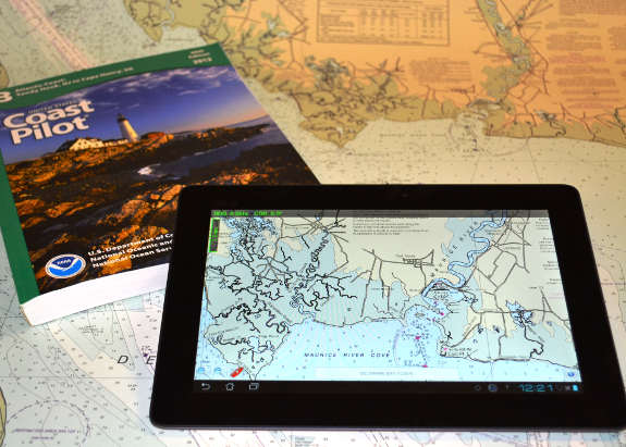
- NOAA’s latest mobile app provides free nautical charts for recreational boating

MyNOAA marine charts
Just geo
- Moore, Oklahoma Before and After; more from the BBC; via @deantaplin
- New Google Maps first impressions from Jonathan Crowe, and a hack letting you try it yourself
- Alex Trebek Speaks to Lack of Funding for U.S. Geography Education in No Child Left Behind
- The Cartography of BS
- Capturing the beauty and wonder of the Galapagos on Google Maps
- Google’s Street View Trekker Backpack Co-Creator Talks Unmanned Hikes, Pack Animal Street View
- Looks like XKCD has been playing with Geoguessr:
All the news that doesn’t fit
- Bridge strike causes I-5 bridge collapse (no indication that it was GPS-related though)
- IMBA beta of mountain biking trail maps and guides with .gpx files available
- May is National Bike Month! Share your favorite biking photo for a chance to win a Magellan Switch
- Rand McNally “Good Sam” RVND 7725-LM GPS – First Impressions
- Helios handlebars add GPS and more:

Helios GPS handlebars
Updated GPS reviews
I’ve updated these review and resource pages with the following links:
- DeLorme inReach — Reviewed for Seattle Backpackers Magazine
- Garmin nuvi 42LM – Wiscellaneous reviews this 2013 model

