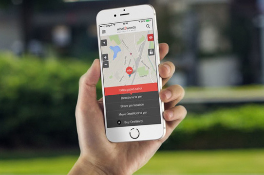
This week in GPS is a weekly link roundup of (mostly) GPS related odds and ends, from GPS Tracklog and other places around the Web. This week’s featured image is a screenshot of a new app that uses three words instead of lattitude and longitude for navigational purposes. It’s pretty nifty! Here’s some other things happening in the world of GPS this week: read more
New GPS/Nav App Provides 3D Views
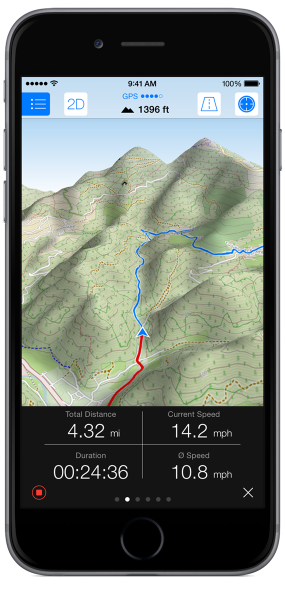
If you’re looking for off-road navigation then you probably have a dedicated GPS device that you use instead of a smartphone. Even with off-network capability, these apps aren’t incredibly helpful most of the time when you’re backpacking in the middle of nowhere, or trying to find your way through a rural area. And, while I’ll never try and sell you that smartphones are better than GPS (they aren’t) if you have an iPhone, this new app might be something worth looking into.
Maps 3D Pro costs about $5 on iTunes, and is actually designed for hikers, cyclists, skiers and outdoor enthusiasts. Not only does it give you terrain and altitude details and download to your phone, but you can actually select what kind of map you want based on where you’re going. Maps 3D Pro draws maps from NASA satellite views, 3D topographic maps, Open Street Maps (for city navigation) and USGS maps just to name a few. You can look at the maps in regular 2D or in beautifully rendered 3D, depending on your needs. You can even zoom and rotate around the 3D version–sort of like a Google Earth for your phone. If nothing else, it’s kind of pretty to play with. read more
NTSB Rules on FAA Appeal about Drones
I know we haven’t really covered drones all that much on here, but I saw a new ruling by the U.S. National Transportation Safety Board (NTSB) that clarifies the noncommercial use of drones a little further and wanted to share.
According to the GPS World article, the NTSB has ruled that the Federal Aviation Administration does have the authority take enforcement action against anyone operating an aircraft system a careless or reckless manner. They have defined aircraft as “any contrivance invented, used, or designed to navigate, or fly in, the air” which, of course, will include Unmanned Aircraft Systems (UAS) such as drones and larger model airplanes. This sort of muddies the drone regulatory water even further, as model airplanes were formerly not considered to be under the FAA regulatory rights (and are allowed to fly under 400 feet with no problems). read more
GPS Favored Over Navigational Beacon in Nome
I know this isn’t directly related to GPS, but thought I would pass along the word anyway…
According to a brief posted by Knom.org, the Federal Aviation Administration (FAA) is conducting a series of studies on the non-directional navigational beacon (NDB) in Nome, Alaska, and is looking for public comment on possibly disabling the beacon. read more
Wayward Galileo Satellite Repositioned, Transmitting
If you’ve been reading this blog over the last few months, we’ve been following the journey of two Galileo satellites that were launched into the wrong orbit in mid August. Intended to be in a circular orbit to complete the first stage of the usable constellation, the satellites ended up nearly 2,000 miles off-target due to a malfunction that caused internal pipes to freeze, stranding the expensive satellites in unusable orbits.
During the end of November, one of the two satellites performed a series of 11 maneuvers over the course of 17 days to try and correct the orbit slightly and nudge the satellite upwards. The maneuvers were successful and the satellite reportedly rose more than 3500 km and now has a more circular and slightly more usable orbit. Tests are currently underway now that the satellite is in a more advantageous position. read more
New App Replaces Latitude/Longitude with Words
There is no such thing as a foolproof addressing system. Lattitude/Longitude coordinates are extremely accurate, but most people are just confused by the string of numbers. Physical street addresses are easier to understand, but also harder to find in unfamiliar places and often inaccurate. Now, a new startup company is attempting to revolutionize the way we give directions and discover new locations.
The company what3words has taken the entire globe and divided it into a grid of 3 meter by 3 meter squares–a total of 57 trillion squares. Each square is then assigned three random common words to identify that particular spot. The ingenious thing about this mapping system is the level of accuracy without the need for special equipment or any additional knowledge (which is often the case for latitude/longitude). read more
This Week in GPS — December 5, 2014
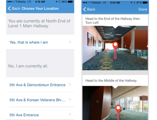
This week in GPS is a weekly link roundup of (mostly) GPS related odds and ends, from GPS Tracklog and other places around the Web. This week’s featured image is from a new app that uses pictures to direct users through complicated buildings. This week also had some pretty killer Cyber sales, but those are pretty well over by now. Here’s what else is going on in the GPS world… read more
App Helps Navigate Using Pictures
They say a picture is worth a thousand words. And maybe, just maybe, a string of pictures is worth more than a map when trying to navigate indoors. At least, that’s the thought behind a new app platform developed by Ziiio. This wayfinding app takes interior navigation down a different route that, to me, seems like it will be bit more useful in complicated buildings like hospitals or conference centers.
Using Bluetooth technology placed in hallways throughout the select building, the app is able to tell where the phone is and compare it to where the user wants to go. Then, using real pictures of hallways, the app will give literal turn by turn directions to any location inside that building. It doesn’t involve GPS, WiFi or any new technology and it’s so simple, I think it’s genius. read more
Last Chance for Garmin Cyber Deals
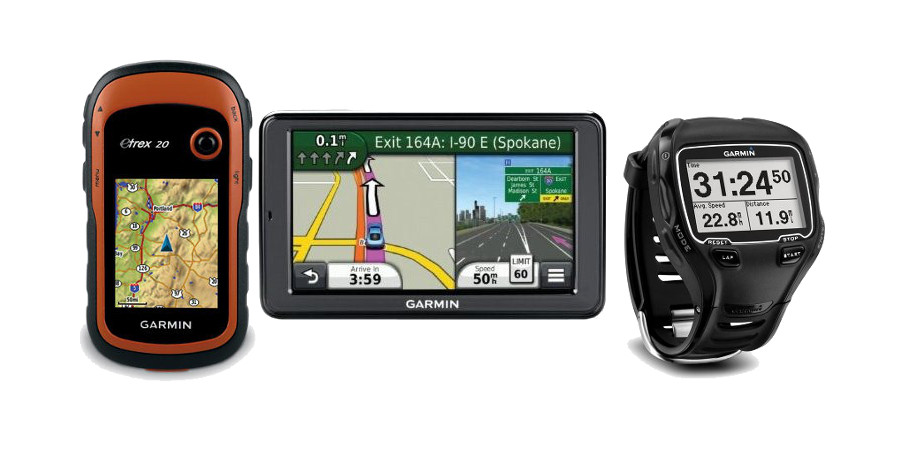
Cyber Week is half over, so I hope most of you have finished all of the electronics shopping. Just as a reminder, Garmin’s cyber deals are going to end today at 11:59 p.m. CST so if you wanted to purchase something on sale, this is the time!
The deal that really caught my attention was the Nuvi Lifetime Map subscription for $40 (normally priced at $90). If you purchased an older unit that doesn’t have lifetime maps, this is an excellent deal that will easily triple the life of your existing unit. I highly recommend it.
Here are some other deals from Garmin that will be ending today: read more
Top Ten Cyber Week GPS Deals
Black Friday and Cyber Monday are officially over, but that doesn’t mean that the deals are! If you’re looking for some new GPS units for a gift for someone (or maybe for yourself) then check out my top ten picks for good units at pretty nice prices: read more