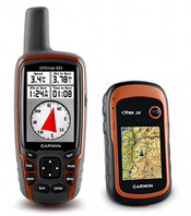
 The Garmin handheld GPS comparison chart below shows all current Garmin backcountry and marine handhelds (in alphabetical order) that include a high-sensitivity chipset. I do not recommend any units without such chipsets for backcountry use.
Links go to my Garmin handheld GPS review/resource pages for each model except where I’ve yet to post those; in that case the links go to the Garmin product page. Features in the headers are explained below the chart, while recently discontinued models are shown on a separate page. You might also find my handheld GPS buyers guide and specialty GPS buyers guides helpful. NEW: Click on column headers to sort chart.
Garmin handheld GPS comparison chart
| Model | Display type |
Display size | Rated battery life (hrs) | Weight with batt- eries | Pre-loaded detailed maps | Ability to add maps/ storage | Accepts custom maps | Elec- tronic compass | Paper- less geo- caching |
Turn by turn | Waypoints /Routes Trackpts. /Tracks | Miscell-aneous | Compare prices |
|---|---|---|---|---|---|---|---|---|---|---|---|---|---|
| Dakota 10 | Color, touch, hi-res |
1.43″ x 2.15″ | 20 | 5.25 oz | No | 850 MB | Yes | No | Yes | Yes | 1000/50 10K/200 |
Compare prices |
|
| Dakota 20 | Color, touch, hi-res |
1.43″ x 2.15″ | 20 | 5.25 oz | No | microSD | Yes | 3-axis | Yes | Yes | 1000/50 10K/200 |
Wireless data | Compare prices |
| eTrex 10 | Mono- chrome |
1.4″ x 1.7″ | 25 | 5 oz | No | No | No | No | Yes | No | 1000/50 10K/100 |
Compare prices |
|
| eTrex 20 | Color, hi-res |
1.4″ x 1.7″ | 25 | 5.25 oz | No | microSD | Yes | No | Yes | Yes | 2000/200 10K/200 |
Compare prices |
|
| eTrex 30 | Color, hi-res |
1.4″ x 1.7″ | 25 | 5.25 oz | No | microSD | Yes | 3-axis | Yes | Yes | 2000/200 10K/200 |
Wireless data | Compare prices |
| fenix | Mono- chrome |
1.2″ x 0.2″ | 50 | 2.9 oz | No | No | No | 3-axis | Yes | No | 1000/50 10K/100 |
Compare prices |
|
| Foretrex 301 | Mono- chrome |
1.4″ x 0.9″ | 18 | 3.1 oz | No | No | No | No | No | No | 500/20 10K/10 |
Compare prices |
|
| Foretrex 401 | Mono- chrome |
1.4″ x 0.9″ | 17 | 3.1 oz | No | No | No | 2-axis | No | No | 500/20 10K/10 |
Wireless data | Compare prices |
| GPS 72H | Mono- chrome |
1.6″ x 2.2″ | 18 | 7.7 oz | No | No | No | No | No | No | 500/50 2K/10 |
Floats | Compare prices |
| GPSMAP 62 | Color | 1.6″ x 2.2″ | 20 | 9.2 oz | No | 1.7 GB | Yes | No | Yes | Yes | 2000/200 10K/200 |
Compare prices |
|
| GPSMAP 62s | Color | 1.6″ x 2.2″ | 20 | 9.2 oz | No | microSD | Yes | 3-axis | Yes | Yes | 2000/200 10K/200 |
Compare prices |
|
| GPSMAP 62st | Color | 1.6″ x 2.2″ | 20 | 9.2 oz | Yes | microSD | Yes | 3-axis | Yes | Yes | 2000/200 10K/200 |
Compare prices |
|
| GPSMAP 62sc | Color | 1.6″ x 2.2″ | 16 | 9.3 oz | No | microSD | Yes | 3-axis | Yes | Yes | 2000/200 10K/200 |
Camera | Compare prices |
| GPSMAP 62stc | Color | 1.6″ x 2.2″ | 16 | 9.3 oz | Yes | microSD | Yes | 3-axis | Yes | Yes | 2000/200 10K/200 |
Camera | Compare prices |
| GPSMAP 64s | Color | 1.43″ x 2.15″ | 16 | 9.2 oz | No | microSD | Yes | 3-axis | Yes | Yes | 5000/200 10K/200 |
GLONASS | Compare at Amazon |
| GPSMAP 78 | Color | 1.6″ x 2.2″ | 20 | 7.7 oz | No | microSD | Yes | No | Yes | Yes | 2000/200 10K/200 |
Floats | Compare prices |
| GPSMAP 78s | Color | 1.6″ x 2.2″ | 20 | 7.7 oz | No | microSD | Yes | 3-axis | Yes | Yes | 2000/200 10K/200 |
Floats | Compare prices |
| Montana 600 | Color, touch, hi-res |
2″ x 3.5″ | 16/22 | 10.2 oz/11.7 oz | No | microSD | Yes | 3-axis | Yes | Yes | 4000/200 10K/200 |
Wireless data, Screen rotates, nuvi mode |
Compare prices |
| Montana 650 | Color, touch, hi-res |
2″ x 3.5″ | 16/22 | 10.2 oz/11.7 oz | No | microSD | Yes | 3-axis | Yes | Yes | 4000/200 10K/200 |
Wireless data, Screen rotates, nuvi mode, camera |
Compare prices |
| Montana 650t | Color, touch, hi-res |
2″ x 3.5″ | 16/22 | 11.7 oz/13.2 oz | Yes | microSD | Yes | 3-axis | Yes | Yes | 4000/200 10K/200 |
Wireless data, Screen rotates, nuvi mode, camera |
Compare prices |
Monterra | Color, touch, hi-res |
2″ x 3.5″ | 16/22 | 10.2 oz/11.7 oz | Varies | microSD | Yes | 3-axis | Yes | Yes | 4000/200 10K/200 |
Android-based, wireless data, screen rotates, nuvi mode, camera |
Compare at Amazon |
| Oregon 450 | Color, touch, hi-res |
1.53″ x 2.55″ | 16 | 6.8 oz | No | microSD | Yes | 3-axis | Yes | Yes | 2000/200 10K/200 |
Wireless data | Compare prices |
| Oregon 450t | Color, touch, hi-res |
1.53″ x 2.55″ | 16 | 6.8 oz | Topo | microSD | Yes | 3-axis | Yes | Yes | 2000/200 10K/200 |
Wireless data | Compare prices |
| Oregon 550 | Color, touch, hi-res |
1.53″ x 2.55″ | 16 | 6.8 oz | No | microSD | Yes | 3-axis | Yes | Yes | 2000/200 10K/200 |
Camera, Wireless data | Compare prices |
| Oregon 550t | Color, touch, hi-res |
1.53″ x 2.55″ | 16 | 6.8 oz | Topo | microSD | Yes | 3-axis | Yes | Yes | 2000/200 10K/200 |
Camera, Wireless data | Compare prices |
| Oregon 600 | Capacitive, color, touch, hi-res |
1.5″ x 2.5″ | 16 | 7.4 oz | No | microSD | Yes | 3-axis, auto | Yes | Yes | 4000/200 10K/200 |
Camera, Wireless data | Compare at Amazon |
| Oregon 650 | Color, touch, hi-res |
1.5″ x 2.5″ | 16 | 7.4 oz | No | microSD | Yes | 3-axis, auto | Yes | Yes | 4000/200 10K/200 |
Camera, Wireless data | Compare at Amazon |
| Oregon 650t | Color, touch, hi-res |
1.5″ x 2.5″ | 16 | 7.4 oz | Topo | microSD | Yes | 3-axis, auto | Yes | Yes | 4000/200 10K/200 |
Camera, Wireless data | Compare at Amazon |
| Rino 650 | Color, touch |
1.43″ x 2.15″ | 14 | 11.3 oz | No | microSD | Yes | 3-axis | ? | Yes | 2000/200 10K/200 |
Two-way radio | Compare prices |
| Rino 655t | Color, touch |
1.43″ x 2.15″ | 14 | 11.3 oz | Yes | microSD | Yes | 3-axis | ? | Yes | 2000/200 10K/200 |
Two-way radio | Compare prices |
Feature explanations
- Display type – Monochrome and older high resolution (hi-res) units tend to be more difficult to read in daylight conditions. Even so, the newer hi-res units are suitable for handheld use, where you will intuitively tilt the screen for the best view. They can also be customized to enhance viewing in bright conditions. The only “hi-res” units I recommend for fixed mount, non-external power use (e.g., bike handlebars) are the Dakota and Oregon 6xx series.
- Ability to add maps/storage – If a unit accepts maps, the storage medium or available internal memory is listed. Units with pre-loaded detailed maps also offer some internal storage, in addition to SD/microSD. Please note that there are lots of free maps available for these units.
- Accepts custom maps – These units can accept custom raster maps and Garmin BirdsEye imagery.
- Electronic compass – These units also have a barometric altimeter. You can read more about electronic compasses here. A two-axis compass must be held level; a three-axis (AKA tri-axial) compass does not need to be held level, but is more of a pain to calibrate. Units listed as auto generally do not need calibration.
- Paperless geocaching – These units will display the full geocache description, cache size, difficulty and terrain ratings, and recent logs.
- Turn by turn – These units can give turn-by-turn highway directions when the proper maps (usually City Navigator) are added, making them effective dual-use units.
- Waypoints/Routes and Trackpoints/Tracks – The numbers listed are the number of waypoints and routes that can be saved, followed by the tracklog capacity and number of tracks that can be saved.
- Miscellaneous – Wireless data refers to these unit’s ability to transfer data wirelessly with other compatible Garmin units. You can transfer waypoints, tracks, routes and geocache summaries (paperless caching details cannot be transferred).
I am looking for a recommendation. I currently have an Oregon 400t and am looking for a second unit to use while teaching a Geocaching class. Considering the Dakota 20 or the Nuvi 550 (because of its many features). Looks like the Nuvi is not so great on the geocaching side, lacking a compass. Have you tried the nuvi on a geocache?
You can check out my nuvi 500 review (same as the 550 except it has topo maps and drops the highway maps for Alaska)… http://gpstracklog.com/2008/09/garmin-nuvi-500-2.html
I’ve heard that it has improved somewhat, thanks to firmware updates. Still, I’d go with the Dakota 20 or Oregon 450.
Its a toss up between the 78s and the oregon 450, I have a gps map 76 cs
Imputting data can be a pain and with out a s/d card slot its memory is limited. Garmin has it on the discontinued list so the new maps wont work.
Does the oregon and ther 78s have a track back feature? Thanks
Yes, both have this feature.
Rich i need your advise my 76cs cant take garmins new maps, I still use it but I am on the fence about the new 78s 62s or the Oregon 450 When compared they are almost the same, except sink or float buttons on top or bottom, touch screen or not, which ever one i choose They need to do everything road, hike, rivers & lakes, motorcycle, seems they all of them do the things i need them to do i guess it comes down to ease of use. Any suggestions leaving for alaska in two weeks
Thanks
Jack B.
Jack, you read my mind. I’m going to email you a draft post I’ve been working on, covering this very topic; well, at least looking at the 450 vs 62s. A lot of folks are going to be trying to make this decision. As for the 62s vs 78s, I think it comes down to form factor, flotation and the 78s patch antenna, giving it better reception when held flat. Also, I’m not sure you can get the 62s before your trip. They aren’t shipping quite yet.
Is this article posted yet? Im trying to make the same decision as well…
No, but I’ll try to get it up this week. If you need it immediately, reply here and I’ll email the draft to you.
Would love to see the draft as im trying to make a decision for this weekend. Thanks Rich, you have a great site here.
I AM CONSIDERING PURCHASING A NEW GPS AND WOULD LIKE TO BUY ONE THAT DOES BOTH REGULAR GPS AND GEO CASHING. WE ARE JUST STARTING OUT AND WOULD TAKE ALL SUGGESTIONS WITH REFERENCE TO PRICING AND QUALITY..
Assuming you mean that you want one that works for road use too, the Oregon 450 plus City Navigator maps is my current dual use favorite. You might want to read this and then follow up with more questions…
http://gpstracklog.com/2009/04/dual-use-gps-for-road-and-trail.html
@Mike – Check your email.
i have gps 60csx.but i want measure more accurate distance.please suggest me which model is appropriate for me.
What do you mean, more accurate distance? Most handhelds aren’t going to get you better than 10-20′ accuracy, under ideal conditions. If you want better, you’re probably looking at spending thousands of dollars.
yes i am ready to spend thousands of dollor.please suggest me which handheld gps device is perfect for me.i am working on the map which has magnetic bearing and not has any lattitued or longitued.i have read only distanse and magnetic bearing.so i take distense of target from two referense points.first i measure distanses of target from two referenses on map help of scale.then i goes to field and mark both referenses and searching for target.scanner is not available here.i have garmin 60 csx.please suggest me any other easy method to find target and easy to carry handheld gps which is measurng accurate distense atleast 1 meter.
I don’t really deal with those. A good place to start would be http://trimble.com.
I notice the chart doesn’t include the Garmin GPS76 or GPSMAP76 – is this because they’re discontinued or because they don’t have the high sensitivity chip? Do any manufacturers publish sensitivity data?
I notice that my MAP76 seems to be more sensitive than the plain 76. Is it just my imagination? The plain 76 needs a relatively clear sky, while the MAP76 seems to tolerate considerable tree cover.
What about refresh speed after zoom in/out. The biggest beef I have with my MAP76 (other than not being color) is the very slow (to me) speed to show the full detail of the zoomed screen. Manufacturers also seem to be reluctant to provide this information.
I don’t have a review or page up for either model, which is why they aren’t on my chart. Neither has a high-sensitivity chipset, though the GPSMAP 76 probably has a better receiver than the GPS 76. Garmin product pages (the Specs tab) shows whether or not each unit has a high-sensitivity chipset. Refresh speeds have definitely improved on the newer units.
Hope this helps.
I want a GPS unit to do both duties, one for the road and other for hiking. I have looked at Organ 450 and Nuvi 500. Same price range but, Nuvi 500 has speaking ability while driving but reduces battery life to 8 hours for hiking. Of coarse it won’t be on continuously while driving or hiking yet recharging could be a problem while hiking.
Wow, I wonder if you really get 8 hours out of it. Have you read this?…
http://gpstracklog.com/2009/04/dual-use-gps-for-road-and-trail.html
Personally, I’d go with the Oregon or just buy a separate unit for the car.
I found that the Oregon 450 isn’t compatible with SD cards (2) Topo US 100k and City Navigator. Is this true or did I miss something?
Answered at http://gpstracklog.com/2009/04/dual-use-gps-for-road-and-trail.html/comment-page-1#comment-94764
I am looking for a GPS that we can use for marine navigation and hiking trails. I would like it to include an electronic compass and altimetre. Also the capacity to download maps from the free sites (can I get marine maps free through these sites?) What progam comes with these in order to download these maps/charts. Is it better to have an SD card or more internal memory. Would the Oregon 300 be a good option?
Thanks
Will you be navigating coastal waters? If so, the Garmin GPSMAP 78sc might be worth checking out. You can read my review of the landlubber’s 78s (not sc) at http://gpstracklog.com/2010/06/garmin-gpsmap-78s-review.html
I’m reluctant to recommend the first generation Colorado and Oregon models, due to visibility problems, especially in bright, on the water conditions. The Oregon 450 has an improved screen, and could be a good choice.
Unfortunately, most of the free maps are topo maps, not marine charts. Where do you boat? Inland, coastal, Caribbean? It might help to know that.
These newer units do allow you to use Garmin custom maps though, so free marine charts can be used, but they are limited to 100 tiles, which could quickly be an issue in a boat.
Some of the new units, like the 78 series, have a lot of internal memory, so you may not need an SD slot. Others are more limited.
Hope this helps. Feel free to follow up.
We kayak the north west coastal waters in Canada and Washington State but are not limited to that, and hike in Canada and the US. Thanks for your info and suggestions which I will follow up on. Does the software to download maps come with the GPS or is that an extra expense?
Okay, so the 78sc might be a good (but pricey) choice. You can use MapSource to load maps. It comes with Garmin map products that you can buy, but its also a platform to load free maps. Here’s one way to install it for free if you don’t have it (and AFAIK, its legal): http://www.gpsfiledepot.com/tutorials/how-to-install-mapsource-if-it-didnt-come-with-your-gps/
Price is a factor, the 78 sc looks good but it is expensive. Do you have any suggestions for the $300 – 400 range, knowing I would have to compromise on some features. It would be used more for hiking than for anything else but I would like to be able to use it on the water where fog can be an issue.
The Oregon 450 is a great unit in your price range. It’s currently the top ranked unit on this site, and with good cause.
Mike,
My husband and I are new RVers and we are hiking now. Just got back from Shenandoah and planning to do many more National and State Parks. What would you recommend as a good, first model, not wanting to spend more than about $350? Again, I am reading the charts, but alot of it I don’t understand….so I thought I would ask! Sounds like one can download maps. Anything you have would be of value. Good overall hand held model
Expect a bit of a learning curve with any first handheld GPS, but I’d look at the Garmin Oregon 450. If you can wait till Black Friday, I’m betting we’ll see it at $250 again. Feel free to ask more questions. And when you get one, be sure to check out my Handheld GPS 101 series…
http://gpstracklog.com/handheld-sport-gps/handheld-gps-101
Rick,
Thanks, where do you see it on Black Friday? Any particular website or store you are referring to? I sure dan wait, as it is to be a Christmas present…and that model did sound great, so glad you confirmed it is good even as a first model. I will check out your handheld series site as well.
REI.com had it for $250 recently. Which makes me believe someone will have it for that price on BF. I’ll be tracking deals here and on http://bestgpsdeals.net
HELLO, I’m glad to have found you.
I need to buy a gift (an expensive one) for my son who will be travelling, flying, walking a lot in cities and some hiking. He will be mostly internationally in Tokyo, New Zealand and much in South America as well as US.
I was first attracted to this idea when I saw Mike Adams, the health ranger, checking the lattitude/longitude coordinates – [which I love – is there a name for that function?] with an etrex. –I just didn’t know there were SO many choices. The geo taggin on the camera sounds very nice. Can you give guidance? (no pun intended)
Mary
Hi Mary,
Those uses sound pretty diverse, but assuming it will be mostly used on foot, I’d suggest a Garmin Oregon — the 450 or 550. But keep in mind that the camera on the latter isn’t good enough to replace a stand alone camera. Garmins area good choice in general, because there are lots of international maps available, including many free ones. Feel free to follow up with more questions.
Hi We live in Australia and Looking at a suitable Garmin GPS, To use on holidays to China & Japan are the basic maps all I need to get around the city’s while (walking)or Bus’s, also need one to show us the way back to base. And when we return home, I will be Fishing in a lake using a boat from time to time so i could use the GPS there if suited so could you please recommend the one best suited. Regards Allan
I’d look at the Oregon 450. A handheld form factor with a compass screen would probably work out better for you than an auto unit. And it would definitely work better on the boat. One nice thing about Garmin — there are lots of international maps available, many of them free.
Thank you for the helpful chart to compare GPS features and prices. This is my first GPS and I plan to use it for hiking and geocaching. Please help me with my final decision between- Garmin Colorado 400T, eTrex Vista HCX or GPSMap 60CSx. I still not sure if I should splurge on the extra features the CO. 400T offers.
The Colorado 400t is nice in that it has paperless caching, but I would avoid it because the screen is so bad. But the other two don’t offer paperless caching. Can you swing $200-$220 for the Garmin Dakota 10 or 20?
Thanks for all your valuable info. I’m leaning toward the Oregon 450. But how does the touch screen work with kayaking, will being exposed to salt water have any effect on the screen or the touch feature. Because of the rugged use, even though we look after equipment, will the touch screen last as long as a GPS with buttons?
I’m not sure how well it will fare with salt water. I haven’t seen any issues arising from touch screen longevity though. I do wonder though, even with the improved visibility of the screen on the 450, how big of an issue glare and bright light will be. How do you feel about the 62/78 series Garmins?
I have ordered an Oregon 450, as it had a great Black Friday price – haven’t yet received it but while I am ordering it I would like to order the BlueChart Marine maps. I believe to work with these maps on a computer I need HomePort, is this correct?. If I mail order it is better to order both at once. Thanks
Landlubber here 🙂 but after a search on Garmin’s support page (http://www.garmin.com/garmin/cms/home/support/searchsupport), I believe you are correct>
Which one would you say is the best for hiking? Must be idiot proof if possible – prepared to pay extra for that!
Either the Oregon 450 or GPSMAP 62s. The Oregon 450 may be a bit more user friendly. This may help…
http://gpstracklog.com/2010/07/garmin-gpsmap-62s-or-oregon-450.html
Greetings from the UK.
I’m looking for some advice please.
I recently drowned my 3 year old Geko 201 while snorkelling in Cuba, and I’m looking for a replacement. Previously I had subjected it to a “dunking” when I made an unscheduled dismount while jet-skiing 2 years ago, but either I was in the water too long this time or perhaps the battery cover seal had become worn.
I used the Geko primarily for tracklog recording to tag photographs with gps data, and it’s my understanding that some units don’t save the timestamp with lat/lon rendering the data useless for that purpose.
The Geko was almost ideal in every way, it was small, light, could use AAA rechargeable batteries, and waterproof (at least when new!). Unlike the Forerunner series it also records as soon as it is switched on…
The only improvements I could have wished for would have been larger tracklog storage and better reception; my Nokia N86 is fantastic although of course it is using network assisted data.
Thank you for an extremely useful and interesting site.
Oh boy, you’re testing my memory about how older units functioned. It may be that saved tracklogs don’t save the timestamp. So as long as you don’t go over 10K track points, its okay. Otherwise, any Garmin unit’s tracklog should have a time stamp.
For better reception, get a unit with a high sensitivity chipset. The Foretrex 301 might be a good option. Other ones to look at include the eTrex Venture HC or Legend H. For more tracklog storage, you would need a unit with a memory card slot, like the Legend HCx.
Hope this helps!
I am looking for a handheld that I will use for marking entrances to caves, mines, and other misc. places. I will be mainly in the central USA and lots of places have heavy vegitation. I am not worried about being within inches just close to the sites. I would like to have route trace, preferably an altimeter, SD card slot, regular batteries, compass, and color screen. I have been looking almost exclusively at Garmin allthough I have seen almost all of them. I was considering the 60csx, colorado series, or the oregon series, after all the research I have done myself I was strongly considering the 60csx, which has been my top choice for a while. For christmas my wife surprized me with a Garmin etrex legend hcx with an 8gig micro sd card. Before I open it she said to make sure its the on I want. I would appreciate you input and thank you for your time.
The Legend HCx will do what you need, except is has no barometric altimeter. The advantages of the newer models include the ability to add aerial imagery and custom maps, like USGS topos. Of the newer models, my faves are the Oregon 450 and the GPSMAP 62s. All the newer ones will function much better with rechargeable AAs, BTW.
I like the GPSMAP62s the best did it replace the 60csx? and what maps do you recommend and where do you get the maps(USGS maps) as I would like to add USGS topo maps. I also like the idea of overlaying locations to arial images. Thanks again, Paul
They haven’t officially discontinued the 60CSx, but yes, it is the successor. You can get great free topo maps at http://gpsfiledepot.com. You will have to create your own USGS topos for it using the custom map functionality. Here are my posts on the subject:
http://gpstracklog.com/tag/garmin-custom-maps
Hi Rich,
Sorry to bother you with stupid questions but Im finding it really difficult knowing what to get.Im from Australia but am and will be living in Western Samoa for a number of years. I enjoy locating caves and old ruins and therfore love the idea of overlaying google maps or scaned paper maps to the hand held unit. But is the custom maps really that good and completly free as they sound? Could you explain a little on that please. Im not too concerned about it having games and such as its just for me.
Is there much advantege between the 450 and 450t for the price? As in, are there even any topo maps for western Samoa? As Samoa is in the Pacific is there a version that I need to get in reguard to the map coverage etc?
Is there a place that you suggest I can get one at a good price but will still work in Western Samoa and Australia in reguard to maps (also taking into consideration Australia and Samoa is 240V AC power)?
With out sacerficing screen detail is there any other models that may suit me better for the price range?
Once again sorry for the billion questions. But I need help.
Thanks
Joel
Custom maps are free, but require some work on your part. Here are my posts about it…
http://gpstracklog.com/tag/garmin-custom-maps
Here in the US, I recommend the 450 over the 450t, as there are great free topos available. Is there an Australian version of the 450t? The answer would depend on the type of maps it has vs. free ones.
I found an auto map for Western Samoa at http://sites.google.com/site/rcmaps2/samoa_maps. It may have topos too; not sure.
I don’t know anything about 240V power, but otherwise the Oregon 450 is a fine unit.
Hope this helps.
Thanks heaps Rich for your help.
Yes from my understanding there is a Austrlian version of the 450t with topos of Australia and New Zealand.
So just to get this straight in my head. If I was to buy a 450 from the US as they are cheaper, the world base map should be the same in it and therefore work just as well, but the 450t is a different story as the US version would only have the US map. Am I thinking right?
Apart from the topo maps is there any other functions that you miss out from the 450 to the 450t?
Joel
AFAIK, the base map is the same, so yes, the 450 should be the same, regasrdless of where you buy it. Not so with the 450t, as you noted.
Other than some memory differences and the 450t’s maps, the units are pretty much identical. This may help…
http://garminoregon.wikispaces.com/Product+Information#x-G9.%29%20Is%20there%20a%20Australian%20Version%20of%20the%20Garmin%20Oregon%20400t%20and%20450t?
Hi Rich,
Will the GPSMAP 78s do everything the 62st will do? I figure why not go with the 78 since it floats and handles nautical charts as long as it can do everything the 62st can do.
Thanks,
Mark.
That’s the main difference. If you’re interested in nautical charts, that’s probably a good choice, though you may want to look at the 78sc. This may help…
http://garmingpsmap.wikispaces.com/Product+Information
There’s alot of discussion about the two different chipsets for the 60Csx. I’m having issues with my 2 YO Garmin updating the live track over a previously laid track. It seems to freeze, or take forever to update. I’m using it for Search & Rescue dog training and so need the live track to update at the pace of a fast dog (at a human jogging pace). I love my 60Csx, but am willing to update to a GPS with faster processor if that’s what it takes to be very accurate with walking/running the previously laid track (logged track). Any advice? Also, I do view the track zoomed in fairly close and in 20 degree weather, if that make a difference.
What are your track settings? It’s under Tracks > Setup. If it’s set for automatic, that could explain the behavior you’re seeing.
Got an unusual one for you Rich – I’m looking for a GPS for backcountry snowmobiling, specifically, shuttling riders with ski/snowboard gear up trails in the north Lake Tahoe area.
I’m looking at the Garmin 400t, but a few concerns:
1. it’s got topo maps, but is it likely to have topo maps of places outside of state parks? Some of the places I’m going have state-maintained hiking trails in the vicinity, some don’t
2. the 3d rendering is great when in the mountains and a major reason that I’d part with $300+, but, if I’m loading 3rd-party maps, will 3d rendering still kick in?
3. have you ever tried the touch screen with gloves / glove liners on? I know most smartphone touchscreens won’t work unless you have special gloves, which might be OK, but if I wanted capabilities similar to the 400t but non-touchscreen controls, what would you recommend?
Love that area!
1. Yes, it has preloaded 100K topos of the entire US. But I’d go with the 450 instead. You’ll get a brighter screen and no preloaded topos, but there are some great free 24K topos at http://gpsfiledepot.com.
2. 3D isn’t worth it. But if I’m not mistaken, it has to have a Garmin map loaded, which might steer you towards the 450t. I *think* that third party maps will display 3D if there is a Garmin map loaded in the background. A search for 3D here may help… http://garminoregon.wikispaces.com/
3. The screen is resistive, not capacitive, so it works okay with gloves. In my testing, it worked well enough except with fleece gloves. The Garmin GPSMAP 62s is a good non-touch alternative.
Thanks Rich, that’s great feedback!
I think I’m sold on going for 24k topos (free or otherwise) after seeing the side by side shots here (from an Oregon 400t)
http://gpsinformation.info/penrod/24Kmaps/twofourmaps.html
That stream detail really matters for trying not to ride into a creek!
A few follow-up questions:
1. I chanced across an Amazon review mentioning that when using a custom map, the HCx was far slower to render than higher end handhelds (62s, as you suggested). Do you know if there’s a speed difference between the 450 and 62s? I’m going to be stopping and consulting this thing a lot, so even a 30% or so speed difference would clinch the decision for me..
2. the 3D function – I’m sure it’s mostly a gimmick, but I have this very specific use case of using it to find good fall lines in unfamiliar territory. Do you think it has value then?
3. when using the 3D function is it possible to move your viewpoint to somewhere other than where you’re standing?
4. semi-related: do you know of a desktop application that would let you visualize topo maps in 3d? Google Earth maybe?
1. Are you taking about panning the map? I haven’t noticed a speed difference, and I do own and use both. I just checked them side by side and while there is a redraw lag on both, its only a second or so. I don’t see this when moving BTW, only when panning.
2. What do you mean by fall lines? Close contours? I would also suggest going to a store that has a “t” unit with preloaded maps and check it out in person. It may work better in your terrain. A Google image search for Garmin Oregon 3D will give you some examples.
3. Not very easily. I just tried it and its hard to move any distance at all.
4. Yes, you can do it with Google Earth using a product like http://www.gpsvisualizer.com/. My favorite program is TopoFusion though.
Thanks Rich. By fall lines I meant skiable paths down a mountain – after fooling around with Google Earth for a bit I can see I’m not going to be discovering these on the fly with a 3 inch screen and 1 second panning delay 🙂
I’m going with the 450, will try out the maps from gpsfilesdepot.com with it and see if I feel the need to get Garmin’s own 24k topos.
Will definitely grab the TopoFusion trial too.
Thanks again!
To answer one of my own questions (#4): Google Earth has high resolution elevation data, but mysteriously insists on showing you satellite imagery superimposed on the 3d model, with no way to turn it off. If you want to replace the satellite imagery with topo lines, use this KML file to replace it with what you see in Google Maps in “Terrain” mode (elevation lines, roads including forest service roads).
http://www.mgmaps.com/kml/
This is just about perfect, although it soaks up memory like a sponge.
Note Garmin Basecamp theoretically also does this, but:
1. it’s flaky with detecting 3d capability on PCs – didn’t work for me even though I meet the specs, and I see other similar reports
2. works fine on a Mac, but I don’t know how to load any of the free maps from gpsfilesdepot.com, so you’d have to buy Garmin maps
I’m a Mac newbie (just made the switch), but I think you can load the map to BaseCamp using Garmin’s MapInstall program…
http://www8.garmin.com/macosx/
Check out TopoFusion though. Its awesome.
Glad to help! The 450 is a great unit. Just in case it matters though, did you see this…?
http://gpstracklog.com/2010/07/garmin-gpsmap-62s-or-oregon-450.html
Thanks – I had actually missed your article that directly compared the two, but fortunately, my list of pros and cons pretty much matched yours, and I was sold on the larger screen and smaller size.
looking to update my 76, down to the 450t 78cs or 62st primary use is hunting, reception is important
All good units. No need to get a T model with preloaded 1:100k topos unless you do a lot of cross country trips though. Go for the Oregon 450, 62s or 78s instead and load it up with free 24K topos from http://gpsfiledepot.com. This might also help…
http://gpstracklog.com/2010/07/garmin-gpsmap-62s-or-oregon-450.html
The Oregon 450’s firmware is a bit more mature, so you *may* see a little better accuracy with it.
Rich I need some advice. I am currently looking to upgrade my Garmin nuvi205 to one of the following….the nuvi 1390t, 1450, or the 1690t. I can get a re-furb 1690t for pretty cheap, but I have read nothing but terrible costomer reviews for that model. I like the 1450, but not too sure about the HUGE 5in screen. I really like the 1390t but it lacks a couple few features of the other 2 models. Most important features I want are “junction view” and speak street names. I have a lifetime map update card to install for whatever unit I pick. Which do you prefer? Thanks!
The 5″ screen is nice when entering POI or address searches, but I find it a bit bulky otherwise.
Junction View coverage is VERY limited unless you live in one of the largest metros. Lane Assist is much more widespread. All three speak street names. Between those three, I’d probably choose the 1390T.
Ugh! I have been researching and comparing handheld GPS units until I can’t see straight. I am in the process of creating a trail system for horseback riding and what I want a unit to do is to help me get from Point A to Point B and onwards in an area that is the least steep and driest for riding a horse on (i.e. horseworthy. I have narrowed it down to the GPSmap62 or the Oregon 450. The tree canopy I am hiking in and marking is really dense sometimes. Do these units have the new super sensitive antennae? I have tried an old E-trex and man, I couldn’t get a signal anywhere. I like the idea of making a Custom Map, and the Birdseye View thing (watched the YouTube Info-interesting!) Or is there another unit I should really take a look at for what I am trying to do? I will be taking it with me riding, so it should be rugged in case I fall off and land on it (just kidding). Thanks for your input…….
Both have high-sensitivity chipsets. You’ll see a world of difference with either one. Unless you’re in a bomb shelter, you’ll probably get a lock!
This might help if you haven’t seen it yet…
http://gpstracklog.com/2010/07/garmin-gpsmap-62s-or-oregon-450.html
In terms of ruggedness, the Oregon may be better (surprisingly!) due to its slightly recessed screen.
I need a handheld GPS to take on a M/C ride through the continental divide this next August, I have a Zumo 550 but after buying it found it not to be able to download tracks and waypoints from “Roadmap”, it seems the Zumo is not really intended for adventure riding as it does not save “tracks”, (now I find out!) I need a handheld to back it up when the going gets out in the off road areas, most experienced adventure riders use the 276c or its cousins but that requires a huge learning curve I may not have time for, I would like to spend less then $500, what about the 60csx or the 78?
Also, I heard that the 62 series use’s a usb connector and that is not good for M/C use?
I thought zumos had a ride sharing feature. Is that just routes?
There are vehicle power adapters for the 62 series. You might want to read P8 and P9 here. I believe these apply to the 62 series as well…
http://garminoregon.wikispaces.com/Power
Any handheld will have a learning curve, BTW. I’d look at the 62 series or the Oregon 450. The 60CSX is older and while it may meet your needs, I don’t find the interface quite as user-friendly as the new models. Plus, the new models have some improved track navigation functionality…
http://gpstracklog.com/2010/07/navigating-tracks-on-the-new-garmin-handhelds.html
This may also help…
http://gpstracklog.com/2010/07/garmin-gpsmap-62s-or-oregon-450.html
You’ll probably want to add City Navigator maps, so figure that into the cost. Nevertheless, you should be able to get out for under $500 total.
Nice comparison
Tks
Glad to help!
Rich,
I am considering the Magellan eXplorist 610. Have you heard of any recent field reviews on these? Also, how do they compare to the Garmin Oregon’s. The 1:24K topos on the Magellans are what caught my eye.
I’ve reviewed the 710…
http://gpstracklog.com/2011/01/magellan-explorist-710-review.html
Also, there are plenty of free 24K topos for Garmin receivers at http://gpsfiledepot.com
Personally, I’d take the Oregon 450 over the eXplorist. Here’s a great deal right now…
http://bestgpsdeals.net/garmin-oregon-450-for-249-99-3/1109/
Rich
I am a Canadian who lives 3 months of the year in California. I need a hiking and biking GPS that will meet my needs in Ontario and California. I obviously need one with American and Canadian Maps. Currently have a Nuvi 265T Garmin and I am thinking of the Oregon 450, the GPSMAP 62ST and the GPSMAP 62s. Do you have recommendation. Thanks for your help.
I’d go with the 62 series. There’s a 62st with pre-loaded Canadian topos. Combine that with the free maps at http://gpsfiledepot.com and you’ll be set. This may help too…
http://gpstracklog.com/2010/07/garmin-gpsmap-62s-or-oregon-450.html
Hi Rich,
I live in Samoa and have just got a Oregon 450. So far I love it but 2 days ago the screen shatered when it hit the edge of a chair. It appears to be just the touch screen that’s damaged as the display is fine. As it is not in anyway practicticle to send it back to the USA for repair I was hoping to do it myself by buying a touch screen for it and replacing the existing broken one. From what you know is that just a simple remove touch screen, unplug and plug in new one job? Or Is there complipcated soldering or computer programing to do?
Thanks
Joel
I don’t know. Web searches don’t turn up much info. Did it have a screen protector on it?
Looking for a unit for hunting, antler hunting and marking fishing spots (i.e. structure, ridges, humps etc. to back up my boats unit). Need detailed topo maps of Idaho backcountry, I spend over a month straight in the mountains and need a reliable unit so I don’t end up wolf bait. Thinking of 62st or Dakota 20. Any suggestions, Thanks, Rick
I would go with the 62s and load some of the free 24K topos from http://gpsfiledepot.com. No need to get the 62st. You’re just paying extra for crappy 100K maps. I prefer the 62 series over the Dakota, of which I’ve heard a few too many stories of damage.
Another alternative would be the Oregon 450. This may help…
http://gpstracklog.com/2010/07/garmin-gpsmap-62s-or-oregon-450.html
Also, don’t miss this free map. Great Idaho coverage…
http://www.switchbacks.com/nwtrails/
I want to do ride the Great Divide on my bike. That’s a 2,700 mile route. There is a GPS track for it ( http://www.adventurecycling.org/routes/gps.cfm?rt=Great%20Divide&s=353k&f=gdgpsdata ) but I’m wondering if it will fit on the 60CSx. Also, I will want to record each day of riding (let’s say 27 days of about 100 miles each). Is the 60CSx my best bet? Thanks.
It should be fine. Its broken down into several smaller files, but I have to wonder how accurate they are. The one I looked at had 833 track points for a 535 mile section. There might be more detailed tracks out there, though it might mean cobbling together a lot of small files. Recording your own should be fine, since they can be archived to the micro-SD card.
I’d suggest looking at the 62s if you can afford it though. It wil store 200 tracks instead of 20, so if you do decide to go for more detailed tracks, you’ll probably need that. You may also find this feature useful…
http://gpstracklog.com/2010/07/navigating-tracks-on-the-new-garmin-handhelds.html
I’m anticipating a good sale on the 62s starting later this month, but I can’t say much more than that for now.
Sounds like a great trip. I’m more than a little jealous!
Thanks for all this.
So the Micro SD card cannot be used to record more tracks on its own?
It can record more tracks than you’ll generate on this ride.
However, the 60CSx is limited to 20 tracks that you can upload to it, so if you want more detailed tracks than those in the link you provided, and it takes 100 tracks to give you the desired level of detail, they won’t fit. If that’s not clear, let me know. This stuff can be confusing!
Rich:
The final file for the ride is here: http://topofusion.com/divide/gps.php
It is the file named: TourDivide2011_v1.gpx – Tour Divide 2011
Does that confirm what you were saying about the 60CSx and would you still advise going for the 62s (I see that the sale you predicted is now on)?
Thanks.
I am considering a eXplorist 710 as an all round oudoor GPS system. My husband and I are hiking the Grand Canyon again this year only we are going primitive routes instead of the managed trails. Thought it might be a good time to invest in a GPS system. Have no prior GPS experience with exception of the vehicle and boat. Really looking for a safety net in the event we get ourselves lost…and need to find our way out. Would this be a good option and if not a recommendation would be great.
Its a good unit, but I’d prefer something like the Garmin GPSMAP 62s over the eXplorist. Whatever you get, you need to realize that a handheld GPS is a complex beast with a significant learning curve. So I’d try it out on several other trips before using it in the Grand Canyon. Without a great deal of prep, establishing waypoints and tracks, I’m not sure how much it will help you there anyway.
@Denis,
That track is 18,000 points, so you could split it half and it would fit fine on the 60CSx. The question is, will this level of detail satisfy you? I suggest looking at it on a map (like TopoFusion). Its not off a lot, but you’ll see plenty of straight line track segments when you’re following a road/trail that curves. But using a track file like this will be a lot easier than rounding up detailed tracks for the entire length of the trail.
Personally (and regardless of which track files you use), I’d still go for the 62s, if for no other reason than the advanced track navigation tools…
http://gpstracklog.com/2011/04/five-reasons-to-upgrade-your-garmin-handheld.html
The sale should be back on tomorrow, BTW. Hope this helps.
Hey Rich is there any way to get a list of Garmin devices auto & handheld
that support the track back feature? We just did a 1770 mile motorcycle
trip and I relied on a riding buddys direction seems his GPS did not support
the track back feature which cost us time and miles I dont believe I will
ever be caught again with out either a back up gps or at least a paper map lol
Thanks for your time..
Jak
I think the only nuvi that supports it is the 500/550 series, but you can’t upload a track to it. All handhelds should support it. If you can afford it though, you might want to be looking at this…
http://gpstracklog.com/2011/05/4-multi-use-garmin-montana-series-announced.html
You threw me a curve ball rich there are two in my sights a zumo 665
or this montana that xm weather/radar would be nice while riding. I am still trying to
figure out if you can hear voice prompts with a helmet headset on the montana,
and the 665 reviews are not the best. But does the 665 track back? Or at least drop bread crums for me thanks for your time.
Jak
The Montana doesn’t have Bluetooth, but you may be able to rig a hack with this…
https://buy.garmin.com/shop/shop.do?pID=89575
The zumo 665 does have a TracBack function. This might also help…
http://gpstracklog.com/2011/05/4-multi-use-garmin-montana-series-announced.html/comment-page-1#comment-131308
I am looking at purchasing a garmin montana 650t. None of the stores I have contacted have one. They suggest I purchase an oragon model from garmin. Can you tell me what the difference is and should I wait to get the 650t?
It’s not released yet. We’re currently expecting the first ones to be available online around June 22, though that date could slip. Its is bigger than the Oregon series, and adds nuvi-like auto navigation. What will you be using it for? That would help in terms of making a call as to whether the Oregon or Montana would be more appropriate.
ok i am looking for a gps for my boyfriend. he was in the army for 11 years, so he know how to use and read them. we ride 4wheelers alot, so i need something for deep woods. a compass and altimeter is a must. i dont know a whole lot about them, but i know he says he wants one that show, “if i walk a mile in this direction, am i going to walk into a mountain, and how big is it.” thos kinds of thing. any help would be great!!! thanks
Can you give me some idea of price range? Lets say $220 low end, $300-350 high end, $600 for cutting edge. Where in that range do you want to fall?
no more than $350.00
I’d look at the Garmin Oregon 450 or GPSMAP 62s…
http://gpstracklog.com/2010/07/garmin-gpsmap-62s-or-oregon-450.html
The big screen on the 450 is nice for jeep type 4WDs, but if you’re on ATVs, the 62s may be better as its easier to switch screens without having to look at the device. That’s why I prefer it for my mountain bike even though I own both.
I’ve seen the Oregon for as low as $229 and the 62s for as low as $279, but don’t know of that good of a sale on either right now.