Hands on trucker review of the Garmin dezl 560LMT
UPDATE: A new 7″ model is available, the Garmin dezl 760LMT.
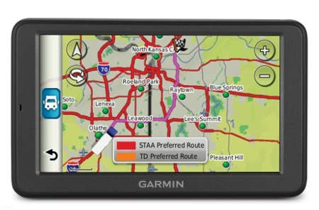
The Garmin dezl 560LMT is a new top of the line navigator designed for commercial truckers (though it is likely to be quite popular with RVers as well). It has an ultra-wide 5” screen, preloaded maps of the US, Canada and Mexico, and comes with lifetime map updates and traffic.
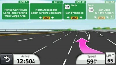
The 560LMT comes with a dashboard mount, and includes many features from the nuvi line like Lane Assist, Junction View, and Garmin’s new historical road speed database, trafficTrends.
Related units
- UPDATE: The newer Garmin dezl 760LMT has a a larger 7″ screen and adds voice command, a headphone jack/audio line out, and display of the elevation grade for the road you’re driving
- Drop down to Garmin dezl 560LT and you’ll lose the lifetime map updates but retain the rest of the feature set
- Garmin’s nuvi 465T is a first-generation trucker-specific model sporting a smaller 4.3” touchscreen; it also comes in a 465LMT version with lifetime map updates
I was fortunate to convince a nearby trucker to try out the dezl. I’ll start with his take on it, and then wrap up with anything I have to add. We’ll just call our guest author/trucker John Anon…
Out of the box, the dezl was easy to put together and setup in the truck. The base stayed firmly in place through a 550+ mile trip. Before the trip, I was asked to setup a driver and truck profile. The driver profile went fine, but I was hauling a set of double trailers and during the “interview”, the dezl didn’t ask how many trailers I was carrying. I later found the option for trailer quantity under the truck profile, but it wasn’t asked during the initial setup questions.
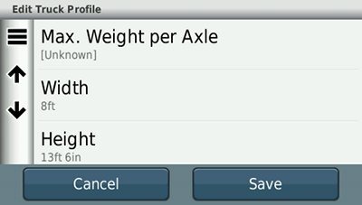
I’ll chime in long enough to say that the following items are available under truck profile:
- Odometer
- Gross weight
- Max. Weight per axle
- Width
- Height
- Overall length
- Number of trailers
- Hazardous material
- Avoid traffic
- Tractor VIN
- Tractor number
- Trailer number
Using the software was fairly easy and I found that common sense told you where a lot of the options would be found. I liked the fact that you could touch the truck on the screen and get the options for finding truck stops, etc., and touching the map itself showed you truck approved roads.
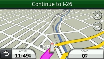
I tried the different views, but stayed with the 3D view for the majority of the trip. One thing I really liked about the 3D view was that, if you had the zoom level high enough, you could “see” all of the major roads around you and which direction they ran in. It always kept me thinking about possible alternate routes if an emergency hit. One of the drawbacks, however, was that the unit had no zoom level indicator. If you were at a particular zoom level and changed to a closer or farther away level and then wanted to get back, you had no reference point and just had to guess.
On the trip north, I used map mode and did not set a destination. After passing an exit, the name and number of the next exit would appear at the top of the screen. If there was a rest area ahead before you got to the next exit, the unit notified you of the rest area ahead. The only thing missing from the notification was any indicator showing you the mileage to the next exit or to the rest area ahead. In the vast majority of states, the interstate exit numbers run in accordance with the mile markers. However, in a few states, the exits are numbered in sequential order and do not follow the mile markers. The next exit could be 20 miles up the road and you would still be going from exit 5 to exit 6. Not knowing how far ahead a rest area is could prove to be detrimental as well.
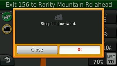
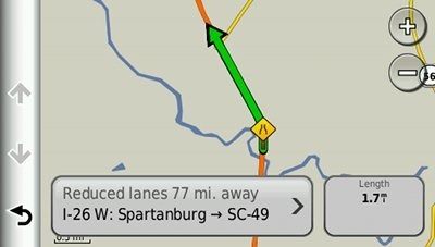
The program has built-in proximity alarms for things that would pertain to driving a truck. There were indicators for steep grades, weigh stations and red light cameras (a 30 day trial subscription is included for the latter). There was an option for a sharp curve warning alert and I had the option checked, but I went through three different places with sharp curves signs that are there to let trucks in particular know about the dangers up ahead. The alarm never went off for any of those curves. I’m not sure if a map update would have solved that issue, but the curves are not new and there have been many accidents in each of them. I was surprised this feature didn’t seem to work. There was also one instance where I was informed a rest area was up ahead and it was actually a weigh station that was open. Not a mistake you want to see in a GPS unit geared towards truck drivers.
The speed limit changes were very accurate. There was an area I came through on the way back that had been under construction and was finally open for travel free and clear. New speed limits had been set and the next software update will probably have those new speed limits set in them. I did use the option to adjust the speed limit on the screen and the unit saved the info for the next trip. The unit didn’t change speed limits when there was a split speed limit for cars and trucks. The speed limit for the cars was still showing when the speed limit for trucks was 10mph slower. That could be an issue for a rookie or someone who has never been on a particular stretch of highway.
The volume level was adjustable for both the routing and the in-call volume. Connecting my bluetooth phone was a snap and I was paired in no time. The pitch and volume for the routing and alarms was fine, but using the dezl for wireless calling was less than ideal. The speaker had a real tinny sound to it and even at the highest volume level, it was still difficult to have a conversation and understand what was being said with the cabin noise inside a truck. I was driving a very late model Volvo tractor that night and it’s one of our quietest trucks.
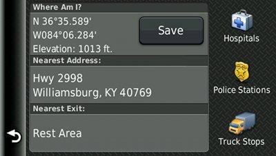
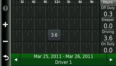
The trip meter and log book functions were very accurate and having a record of your hours of service handy makes filling out that log book a breeze. One of the best features is the option to find the nearest address. There have been so many times where I’ve taken a break somewhere and ended up guessing where I was either because there were no signs indicating where I was or there was no one on the CB radio who knew where we were. Very, very big help!
On the return trip, I used the navigation mode and entered the address of my destination and took off. I had intended to go a different route on my return and decided that was a good time to put the dezl to a test. I hit the detour button and the dezl rerouted me on the exact route I would have chosen myself. I knew that the route had hazmat restrictions as there was a tunnel at the top of a mountain you had to go through and certain hazmat loads are not allowed to go through the tunnel. I reprogrammed my truck info to show I had hazmat and that I was carrying explosives, a big no-no in the tunnel. The Garmin instantly rerouted me around the tunnel on a truck-approved route. I was very impressed and not having to hunt down a route and make phone calls was a huge time saver.
I reset everything back to normal and continued on my journey. One of the other nuances I liked was that, regardless of your zoom level, the dezl adjusted your zoom level when you were expected to take an exit or when it was directing you which lane to stay in to make it through a series of intersections. It adjusted in so you could see exactly where you needed to be with arrows pointing the way and an icon of your truck showing you which direction you were going. After the guidance was over, the zoom level adjusted back to where you were. I’ve been in large cities where you were merging in from the right and needed to be 5 lanes over to the left to get off at an exit. This feature will be worth its weight in gold should someone be in an unfamiliar city and need the assistance.
A feature that I would like to see would be for a temperature indicator made available. Black ice can form from around 37 degrees and lower and knowing what temperature it is outside is a must. Most tractors have some sort of outside temperature gauge built into the trucks computer, but I would almost expect a GPS unit for trucks to have that included.
There are pluses for employers who might be thinking about putting a GPS in their company tractors, yet haven’t decided which one to go with or haven’t had the time to do the research. The dezl has a lockout feature where the unit can be placed in “safe mode” and cannot be programmed when the truck is moving. There is a pin number that can be used to lock the unit’s programs and settings in place and an employer might feel better putting the dezl in their tractors knowing that they can control the safety features.
By the end of the night, I had become comfortable with what the dezl would do and the information it gave me. On a scale of 1 to 10, I’d rate it a solid 8. There were a couple of more things I’d still like to see in a truck-oriented GPS unit and a couple of items I think Garmin needs to tweak, but overall I was impressed and would definitely recommend the dezl to any of my fellow drivers.
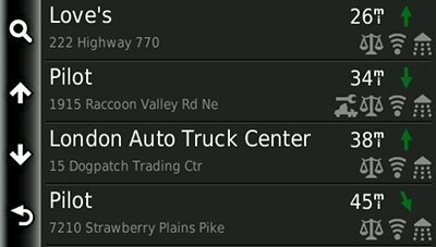
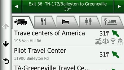
PS – One last thing I didn’t mention from my notes was that included in the list of truck stops was a list of amenities those truck stops had. I could see if the truck stop had shower, a scale, tractor repair shop, etc. Very handy.
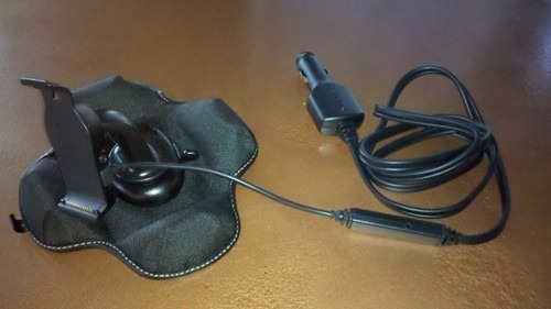
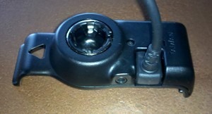
Garmin dezl 560LMT mount
The dezl is the first Garmin model I’ve seen that actually comes with a friction dashboard mount; I’m assuming that’s more practical to operators of large vehicles than a windshield mount.
In the mount detail pic below, you can see where the mini-USB cable plugs in. This “powered mount” setup means you don’t have to fuss with a connection each time you use the device. Just clip the device into the mount and go. You can also see a composite video input below for a backup camera.
Other notable Garmin dezl 560LMT features
Portions of the following were adapted from recent hands on reviews of other Garmin models.
Exit Services
This feature, similar to Magellan’s Exit POIs, shows you points of interest (POIs) for the next 10 exits or so. It is found by going to Where To? > Exit Services, and can be added to the customizable main menu as described below.
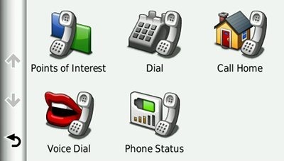
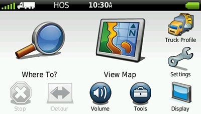
Customizable main menu
Garmin is taking advantage of the 5” screen real estate on the dezl series by allowing you to customize the main menu. Here’s how mine is set up…
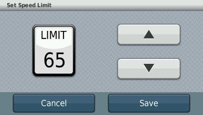
Speed limit adjustment
I’ve discussed this before, and I’ll refer you there for details, but the short story is you can correct speed limits when the device has them wrong.
Customizable data field display
There are a couple of options here. Tap the left data field on the map screen to bring up a range of choices. These vary depending upon whether you are actively navigating or not.
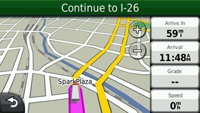
And if you go to Tools > Settings > Navigation, then choose Truck, RV or Automobile, you can select Map Data Layout and choose More Data. This will shift the data fields to the right, picking up two more that you can modify, as shown below. Note that Grade is a new option found on the dezl series.
Custom avoidances and Advanced detours
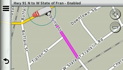
Custom avoidances allows you to specify individual streets or sections thereof (see image below) and complete areas to avoid. Advanced detours gives you some new options when you tap the Detour icon, including the ability to exclude specific roads from routes on the fly.
One tip – It appears that the custom avoidances must be from intersection to intersection. If you simply picked two points near the east and west ends of the road above, the dezl would ignore the custom avoid. For more details on these features, see my post on custom avoidances and advanced detours.
Lifetime traffic
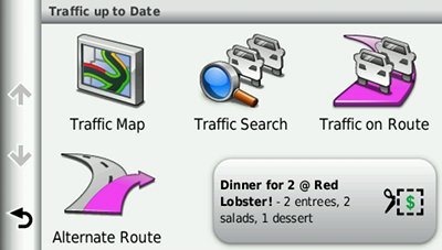
The lifetime traffic feature is ad-supported, which is a big turn off for a lot of people. But the ads are very low-key, and will primarily display when you are stopped or viewing traffic details.
Multi-destination routing
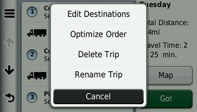
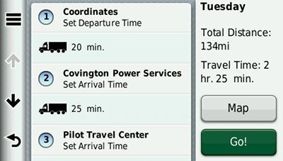
The dezl 560LMT allows you to add multiple via points on the fly, using Where To. To pre-plan a multi-destination route, select Tools > Trip Planner. Once a route is created, you can access the menu for the options shown below.
You can tap a via point to select an item and specify an arrival time and/or duration of stop. I find this feature quite useful — I plugged in the duration of several stops, the time I wanted to arrive at my final destination, and was able to determine when I needed to start my trip.
Dragging destinations to change their order in the Trip Planner is much easier than when I tried it on the nuvi 37xx series. I’m assuming that is about firmware improvements, although I suppose it could be a resistive vs. capacitive touchscreen issue.
Unlike my experience with the nuvi 2400 series, I was not able to transfer routes from MapSource. An update to allow this has been promised for the nuvi 23xx and 37xx series, so hopefully this will be extended to the dezl series as well.
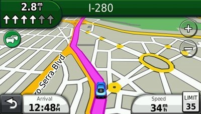
Lane Assist and Junction View
Lane Assist (see below) is a very useful feature, showing you which lane you should be in. Coverage seems to be fairly extensive for Interstate highways, with some surface street coverage in large metros.
Junction View coverage (shown below), on the other hand, still seems pretty sparse. Expect to see this only if you live in the very largest metropolitan areas.
Speed limit display and warning
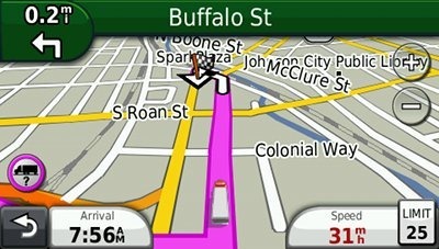
Back to something with good coverage, you’re likely to find speed limits displayed for even secondary roads on the dezl 560LMT. And your current speed field turns red if you’re over the limit, and as noted earlier, you can correct speed limits where you see errors.
trafficTrends
Garmin’s historical road speed database is a feature that can be helpful, but can also be counter-productive. The idea is that the device knows that certain roads lock up with traffic from say, 4:20 to 5:45 pm on weekdays. On the good side, I’ve seen significantly improved routing, putting me on limited access freeways rather than older two-lane highways paralleling an Interstate. On the other hand, I’ve seen it send me on longer routes as well. To be fair, those have almost always been in a car, involving (one way or another) minor residential streets – something not likely to affect truckers. I’ll have a little more to say on this subject in my conclusion.
This feature also results in some increased routing time; a trip of 150 miles using another trafficTrends model took 9 seconds to calculate. While I haven’t see any significant lag for local routes, I have seen recalculation times of 7 to 8 seconds following a missed turn on a longer route.
Garmin dezl 560LMT pros
- Has truck, auto, RV and pedestrian modes
- Routes according to truck and trailer profile
- Truck-specific points of interest
- IFTA fuel logging capability
- Tracks drivetime and provides HOS notifications
- Preloaded NTTS Breakdown Directory
- 5” screen
- Powered mount
- Includes dashboard friction mount
- Advanced detour functionality allows you exclude roads on the fly
- Ability to exclude specific roads and areas from all route calculations
- Lane Assist
- Junction View
- Lifetime traffic
- Lifetime map updates
- myTrends learns preferred routes for routine trips
- Customization options
- Speed limit display, warnings and adjustment
- Multi-destination routing
Garmin dezl 560LMT cons
- Bluetooth quality worse than expected
- Traffic is ad-supported
- trafficTrends historical road speed database results in increased route calculation times and occasionally produces routing errors
- Junction View coverage limited
Conclusion and recommendation
Highly recommended. Garmin has made significant improvements since releasing the trucker-friendly nuvi 465T. For one thing, the 5” screen is much more appropriate for this audience. The dezl is based on the Garmin nuvi 2400 series, which offers quite a few high-end features, the best being custom avoidances and advanced detours. It is true that trafficTrends can occasionally generate a wonky route, but this is much less likely with the dezl using truck-preferred routes than it is in a passenger car. And after all, with the advanced detour functionality, you can exclude routes on the fly.
More Garmin dezl 560LMT reviews
- Consumer-authored Garmin dezl 560LMT reviews
are starting to be posted at Amazon
- More trucker reviews of the dezl 560LMT have been posted at GPS City
I’ll be posting more hands on GPS reviews as they appear, but in the meantime, here are some…
Other Garmin dezl 560LMT resources
- A PDF version of the Garmin dezl 560LMT owners manual
- Want to see how the 560LMT stacks up against other trucker-friendly units? Use this Garmin comparison tool
- While written for nuvi auto units, these tips will work for the dezl series too
- The official Garmin dezl 560LMT web page
- RAM is coming out with a locking mount/case for this model
Compare prices on the Garmin dezl 560LMT at these merchants:
- Check the current Garmin dezl 560LMT
price at Amazon
- Find the low price on a Garmin dezl 560LMT trucking GPS w/ Free Lifetime Maps and Traffic
at BuyDig.com
- Get a great deal on the Garmin dezl 560LMT 5″ GPS Navigator with Lifetime Map & Traffic Updates
at J&R Computer/Music World
- Check out the deal on the Garmin dezl 560LMT Bluetooth Trucking Bundle with Lifetime Maps & Traffic Updates
at TigerGPS

Thanks again for presenting interesting device.
I think that TMC support is step back comparing previous generation of nuvis. On old nuvis you can see not only red icon but estimated time delay too. If delay is short, there is no need to react, usually obstacle will disappear before reaching it. On new nuvis you never know how serious is obstacle. You need to check it periodically, which isn’t convenient nor safe while driving. I can’t stop thinking that this change is intentional, to make you watch advertisements. Maybe Garmin expect us to use automatic recalculation, but for me it never worked, TMC is not enough precise or reliable.
One note – promise to update 23xx and 37xx is no longer valid, it disappeared before fulfilling, lol. But I thought dezl already have better software, similar as 24xx.
Yeah, I liked seeing length of delay. Never thought about how it relates to ads though. Huh.
Have they said they won’t update the 23xx and 37xx or is it just delayed?
I don’t know Garmin plans. Info about intended update disappeared from Garmin FAQ without any explanations.
That’s bizarre!
I was going to order this unit this past Friday when I read your review. The site you have linked BuyDig.com had it for the best price. I called them on the phone and the recording said they were closed already on Friday and also would be closed on Saturday reopening Monday. I just got around to trying to place the order today, Monday, and they no longer have it listed, at any price. What gives??? I want to buy a Truck GPS asap! What to do? I guess I’ll pay 30 bucks more at Amazon but I’m teed off now.
Yeah, prices and stock fluctuate dramatically at online retailers. If you see a good deal, I’d buy it online and not wait to call.
love this unit,traffic is not reliable all the time.sometimes i am driving through a area where it shows traffic delay and there is nothing there but i can live with that.
what i hate..badly…
(1) is it takes way too long to calculate/recalculate a route.
i run nc. to ca. and back.From LA it takes 3.5 min to calculate route and its all interstate.
when i was in dallas tx.i put it to recalculate to nc. Its 1015 miles all interstate.it took 10 min,i timed it. i called customer service, didnt help
when i got to a trafic jam it showed a 28min delay so i told it to bypass it,it took for ever,i jumped off the exit and took a diffrent route and eventualy it re calculated but got me mad that i payd so much for it(450 for lmt-lifetime map and traffic updates at amazon.com) and had all this problems
(2)it routes you right through major citys that you are not allowed to go through with a tractor/trailer unless you deliver or pick up there, like Atlanta ,Fhoenix where you have to take the bypass. -good thing for the custom avoidances
(3)in california it shows truck speed for trucks 55mph but the time to get there it calculates it at about 66mph.
over all its a realy great gps but its got its problems and costs too much
Wow, that’s pretty bad. FWIW, you can go into the navigation settings and disable trafficTrends. Turning off that historical road speed database should dramatically improve recalculation times.
Mine was doing this too and locking up. Last week I called support and we deleted a lot of foreign files, then support walked me through resting back to factory and then re-installing new updates, and now it cal faster and has NOT locked up once.
customer service sayd to stop the current route and then to calculate a new route but 3 min its still to long for 1000 ml trip all interstate.
i have done a master reset and it fixed the problem.i think it was the safety/red lihgt camera free trial version i downloaded from garmin.com that slowed it down.now it calculates even long routes prety fast now
i was going to return it ,thaught it was defectiv but i like it now.im keeping it.
i would still like to have the red camera alert but i need something that does not slow it down
Glad you got it straightened out. I wonder if a third-party camera database would avoid the issue.
well it slowed down again after about 3 days of use and i done a master reset again then it calculated fast again.the safety camera is still on there,master reset does not erase it or the map upgrade but it erases all my info i put in/recently found/favorites/ truck profille, got to put it all in again.
i think i discovered the glitch.i turned off /mytrends and traffictrends/and its been working fine since then.it looks like once you have some trips it saves it and that is what slowes down the gps.
traffic cameras works great i like it a lot.
i just recomend to enyone who has gps calculating slow problem-to do a master reset and then disable mytrends and traffic trends.you will still get traffic info on it with no problem.
how to do a master resset:
with gps off, touch and hold for about 10 seconds lower right corner of the screen (where speed limit would show normaly).with your other hand turn on the gps .when it says (erase all user data?) remove your finger from the lower right corner and press yes and your done.
Thanks Dan. Before doing a hard reset, you can save all your Favorites by copying the GPX/Current.gpx file from the device and replacing it following the reset.
I figured disabling myTrends and trafficTrends would sped things up. Glad to hear it worked.
my dezl did the same thing, i had to reset it every couple days as it was slowing down and rebooting for no reason , reset would fix route calculation issue but it only last for couple of days depending on how much i drove.
i just came back home and called Garmin, tried everything with no luck
so they gave me RMA # and shipped it for repair. I would suggest you do the same, not to wait when you warranty expired
I’m 99% positive it is hardware issue, not software. I know at least 2 people who has dezl 560 and i setup everything for them when they bought it and they have no problem with it. Like Dan said disable this and that. it’s just a work around but it will not fix the problem, basically “don’t use your gps and it will work just fine”
Contact Garmin and have it fixed, most likely build in memory is defective in the unit, that’s what i think
Glad to hear it’s not all units. Sounds like good advice.
I just got my RMA replacement unit from Garmin, very disappointed, they send me refurbished
4GB unit instead of 8GB and when i called them they saying all of the Dezl 560 unit are 4GB
this is lie, can some one get a screenshot of there dezl 560 diagnostic menu, from the main screen (where to? View Map) press and hold Battery icon, first page
http://jpegbay.com/gallery/001611612-.html
this is my old gps which is 8GB
http://jpegbay.com/gallery/001611616-.html
Rich Owings
I called Garmin and told them that I’m not satisfied with the replacement unit and i need it to be replaced for normal 8GB unit, they got me RMA number and prepaid label to ship it back, i also emailed few screenshots where saying 8gb on them here is what they say:
Thank you. I’ll reply to you as soon as I hear from our escalation team. They will have to contact various departments in our IT and software groups to determine the cause and solution so please allow approximately 7-10 business days before I will be able to provide you with additional information. Thank you again for your assistance.
hope the pic helps
I would call Garmin back and ask for a supervisor. And be nice but persistent.
http://jpegbay.com/gallery/001613048
http://jpegbay.com/gallery/001613048-.html
We have the Rand McNally TND 510 now. Just found out that RM does not have any repair facilities for their units! Unbelievable. It needs a new USB connection installed as it seems to have become loose. We have friends with Garmin units and are going to buy the 560LMT. The reason we went RM to begin with was for the maps. They haven’t updated their truck maps in over a year now. They keep saying next month. The one feature it has that the Garmins didn’t have was mileage by state for IFTA records. The 560LMT seems to have that. I don’t think a unit that costs more than $450 should be a throw away by design. RM can bite me!
Am just about to buy the 560. I deliver for road construction and on my older ( non truck ) Garmin I often use the intersection function for my destination address. Does the 560 have intersection as well as street address for destination programing ?
I believe that all Garmin dezl and nuvi models have this feature, but I don’t have a dezl unit anymore. Can someone else verify this? It should be under Where To.
After I asked this question, I found a completely different review on Crutchfield and they listed intersection as a search function. I just ordered one and will keep this site in mind for questions and posts.
Regards Rob
Cool;. Would love to have you post your impressions after a few runs with it.
Likes ur comments on the dezl!!
Thinking about getting one!
One question:: does gps show cross street names while just driving AND WHILE IN THE MODE TELLING U WHERE TO GO????
It depends upon your speed and zoom level, but it will generally show some, but not all. You can see that some of the screen shots above show none, where others show one or many.
Rich is correct, the more zoom the more streets. Also on the top of the screen it tells you the name of the next cross street. I think this is just in map mode only.
This unit is way tooooooo sloooow, some time I have to pull over and wait until it’s done recalculating
it takes 9:30 min to calculate route from FL to NY total of 1300 mi(very very slow)
Hours Of Service option is useless, I don’t like this model, for $500 unit they could of made faster processor
I like nuvi 465 better, very fast too
If your in a hurry or know the area your working in set to car mode and it will work like a regular car GPS. I have found on local runs with unit set for my triaxle dimensions unit will take you on less than desirable routes sometimes. Does it get you to the right spot yes but does better set on car mode.
You can disable trafficTrends and it should speed up routing dramatically. Have you updated your firmware?
I did buy the 560LMT. Have been running it for about a month now. I don’t have the slow re-routing problem but I never enabled traffictrends. What I miss most from the Rand McNally are the icons on the map itself designating truckstops, rest areas, weigh stations, etc. Does anyone know if there is a downloadable file available to load these?
They “may” show up using a custom POI file. I’m not sure though. This post is ancient, but it should point you towards some resources: http://gpstracklog.com/2006/03/custom_pois.html
If you try it, let us know how it works out for you.
i have found the slow route calculating problem the more favorites u store in the slower it will work.also dont customize the “where to”page that will realy mess with it.thats where u can push + and add things to it.
solution=do a master reset and keep your favorites page as short as possible and delite your resently found more often.
it has a memory problem,the more info you input to store the worse it slowes down
i now got about 6 favorites in now and its been working fine.
i had mine for about a year and after i returned 1 and got a replacement still had the slow problem, till i fuigured it out.
its still the best truck gps around i think
Interesting. I haven’t heard this issue being reported on the latest nuvis with a similar feature. Perhaps they’ve improved it as a result of their experience with the dezl series. Have you updated your firmware? If it’s a bug known to them, I’d think they would try to fix it.
tried everything, only one thing fixed the problem, factory reset
and i noticed as soon as i customize “Where To” screen it messes up again,
Thanx Dan
Have you called Garmin about this?
No, i didn’t
also 1 big disadvantage that you can not set speed your driving, it always calculates by the speed limit not the speed you driving at
even the old 465 model has this option, would be very nice if they add in edition to “Fastest, Shortest add Limited speed” where you can set maximum speed you driving, just like TomTom model has
Has any one hooked up a reverse camera to their unit. If so how does it function ? Does it activate when you go into reverse and back up power turns camera on ? This would NOT be good for me I’m. In paving operations and want to see whenever I’m on site and don’t need mapping.
I found this great website for new vehicles. Tons of cars,bikes,Simi Trucks, sports cars.
http://www.vehiclesforgarminnuvi.com/
Cons:
1. On the highway the GPS is indicating the clearance of the underpass below the road you are.
2. When the trucks are not allowed in the left lane, you are instructed to leave the route and choose an alternate road.
3. Telling you are not allowed at the service areas where is a special truck parking?!
4. Places with car speed of 45 mph and truck speed limit of 25 mph, indicates as 45 limit.
5. Really dangerous curves in USA are not marked, when even a light curve warns you as dangerous in Canada.
6. Doesn’t know the truck routes in small cities. As a general rule, as soon as you exit the, limited access highways, you are on your own.
7. Most of the overhead clearances in Quebec are wrong.
8. Very frequent data corruption occurs, thank God there is a backup done regularly.
9. When the unit is on batteries, you will not hear most of the voice directions. Very short battery life.
10. Bluetooth is useless, can’t hear anything even with maximum volume on the cord power.
11. Annoying advertising for the Best Western coupons. It is better to pay for, or not to get traffic reports at all, as most of the time they are outdated.
12. No NTTS info for Canada.
13. There is no odometer reading on the state mileage or at the pump reports, that is required by the IFTA.
14. The gravity pad will not stay in its place even in a Volvo truck.
15. Jurisdiction summary needs more work; no periods or filters.
Pros:
1. Many nice functions for trucks.
2. Shows location on search by default.
3. Big enough screen.
4. At the pump function.
5. IFTA logging
6. Toll roads mileage logger (only if the route was setup and active)
Wish list:
1. More powerful speaker or external speaker option.
2. Return to the map button from any screen (now you have to go back as many screens as you have gone through). Will save time and will be safer on the road.
3. Search ahead function (now it is searching everywhere); “On my driving side” if I am on a limited access or divided median highway, “On my route” for regular roads, “in a ## miles” from the route.
4. Cancel button next to OK button on driver status update screen.
5. Map scaling on a map view, or favorite settings list.
6. Larger fonts in the HOS violation description text.
7. In the Truck mode, the GPS pointer should be on the Cab level, not in the middle of the trailer.
8. Faster loading for the maps would be a big asset.
That’s all.
Great stuff. Thanks for taking the time to share!
Hi, has any one used this gps with a backup camera?
Yes, I have it hooked up in my car. Works fine. You can set it up to come on when you go into reverse or you can turn it on from the screen.
@bugJB – Slow, but it sounds like progress.
I used the 465t for a few years, and thought it a decent GPS. I just bought the Dezl and like a lot of what they’ve done. But one thing that absolutely blows my mind, is that you cannot search for Favorites along your current route! Any $99 GPS does this, and it’s certainly what you’d expect. This feature is probably more important to me than getting from A to B.
When I find a good place to eat, (or whatever), that has truck parking, I save it. This is particularly important in the age of corporate consolidation of truck stops, where food choices are minimal. Then, once I plug in my route, I look for these places along my route. I find it unbelievable that a pricey GPS wouldn’t be able to do this.
In the end, I had to convert my old .gpx file with the Garmin POI Loader app into POIs. It works, but I’ll have to do this every week, or so, as I add new Favorites. Kind of a hassle for someone on the road. And completely unnecessary. Had I known this, I probably would’ve gotten another 465t.
Where To? > then tap the menu icon (three horizontal lines) > Near should bring up an Along Route option if you are actively routing somewhere.
Great review on the 560 deal lt, I am going to buy one soon, I do have the 465t but it’s a few years out of date for the maps, I do have LT traffic but I like it, it’s saved me a lot of aggravation and I never leave home without it, the volume is kinda low but other that that, it’s perfect, but the ole eyes are needing a bigger screen and that’s my upgrade, thanks again for the review
Glad to help!
This GPS is not worth the money. Have used it less than 2 months and for the last month it has gone spastic. Gives wrong directions, miscalculates and freezes up. Don’t waste your money.
Is your firmware up to date?
In response to Don. Why don’t you set it to Automobile mode and see if it works better ? Also occasionally dump recently visited way-points. Mine works fine and I’ve had it for 2 years.
With out a doubt it will take you on a round-a-bout route which has to do with it being in truck mode and the set up you put in for your specific truck.
However, I have never had it take me to the wrong place…..
I am using the dezl-560 for about a year and it never did “stupid things”. One thing is for sure, that Garmin has no clue about truck roots and clearance in Canada, as I see wrong information everywhere I go in Quebec, Canada. Forget also using it as Bluetooth, you will not hear anything through the speaker, specially in the battery mode. Other then all I have mentioned in previous posts, it is not a bad device. Yeh, and one more thing, the traffic is never precise, so do not rely on it. But I do not think it is Garmin’s fault. Drivers records still get DB error, but gets restored from the backup.
Thanks for these reviews. With them and my own experience it appears no truck gps is worth its asking price. In fact another way the driver has money taken out of his pocket. Guess I’ll replace my Rand McNally with another Rand McNally, curse and swear along my travels until its screen stops working, or whatever, and I have to replace it with another.
The suggestions to use it in automobile mode, kinda defeats the purpose and it won’t help when that cop is issuing the summons cause you’re on a weight restricted st or you’re making good time along a parkway in NY when you realize you ain’t gonna clear that underpass . . . ***TRUCKERS STAY OFF PARKWAYS IN NY STATE!***
Re taking it out of truck mode. For him that was a suggestion for temporary use. Also when out of truck mode it stops the IFTA logging.
IS THIS A FREE SERVICE “the IFTA fuel logging capability” unlike the tomtom 7150 where there is a monthly charge?
How does the 560LMT compare to the TomTom 7150 at present these are the only 2 units that
would consider for my business the Rand Mcnally 510 originally looked good but the interface symbols looked too childlike.
Thanks for your help.
I can tell only for Garmin, as haven’t tried the others. The IFTA logging is free. I would suggest you to have your route setup before your departure and keep the unit on all time. This way you will have proper mileage and state reports and don’t forget to use the fueling option. One drawback I see with Garmin logging is, if you forget to change the driver duty status, you will not get any warning if you switch the unit off and it will stay in on duty not off duty and will escalate on duty time and very soon you will run out of your time.
Other problems you will get if you enter Canada. The unit has only one duty cycle setup, the one used in USA. In Canada you have different cycle, so Garmin’s driver log capabilities become useless. Plus you will get many warning about clearance or trucks prohibited on your route that are not true. For example, the trucks prohibited sign on the leftmost lane or low clearance on the rightmost lane, might take you completely off the freeway and suggest a detour or when you try to enter a truck stop, the GPS will tell you that trucks are prohibited on that road! I tried to contact Garmin with these issues, but ended up on the wall of silence, they don’t give a damn about it. And one more thing, the data is very old. The roads or addresses that exist for 2 years I do not see on my Garmin that is being updates every 6 months. Most of the time (in theses cases) I use the Google maps in my smartphone.
Bottom line, it is a good GPS, but not really for truckers. It is something like a “Kosher Style”, when it looks like kosher, but is not.
I wonder if anyone actually used the video input for a backup camera, a feature not mentioned nor tested in the review? Additional info on the camera itself, how it is used, routed in a particular vehicle is also appreciated. Thx
Regarding calculate mode. What is the difference between shortest distance and fastest time?
Currently the unit is set to shortest distance. The problem is that we are directed off the highway and through small towns, etc. We would prefer to remain on the highway as far as possible before we must exit to our destination. Would selecting fastest time help?
Yes, fastest time is the setting you want. Imagine a road, perfectly straight, going thru a town, but with 20 traffic lights. Yet it is the shortest route (distance).
An Interstate curves around the town, bypassing it. It is a longer distance, but is much faster in terms of time.
I’m a 20+ year driver and will never recommend this dezl 560 to anyone. It’s complete joke, have one replaced already and is same junk it was previous one. Mainly truck restrictions are all over the map even on old truck stops and interstate ramps and industrial parks areas, I know my routes and ignore this thing, it’s not worth a dollar, by the way I update this 4 times a year
we have had the dezl560 for just over a year now. We are long haul truckers together, never to the same place twice. Over all theunit has been good and works well until lately. it will shut itself off and then boot up again on its own about every 30 to 40 minutes. at this time you must do the agree pgs etc. then hit view map, most of the time this takes you back to your route….MOST of the time…other times it has erased the last route completely.
We have written to Garmin a coupla times with no response
Most probably you will not hear from them. Try to call. If you still have the warranty use it and have the unit replaced or repaired. The way you describe there is a problem with hardware. Try to update the software and firmware and if nothing will be changed that it is 100% hardware issue and must be repaired.
Yes, try calling. If it is barely out of warranty and if you are nice and if you get the right person, you might be able to get them to fix it for free. I agree with Ash though about updating the firmware first and maybe try a hard reset, but back it up before you do.
Updating firmware is almost a weekly deal with garmins. You may be finally experiencing a problem a firmware update will fix.
If your Garmin is out of warranty, they are now offing rebuilds for $100 if all else don’t work.
I loaded some Garmin TOPO US 2008 maps onto my DEZL560 of course they are not routable but will display. The display shows extra bold contour lines that are much larger than the roads and trails. It I purchase and load TOPO 24K will it display properly (normal contour lines) and will the routing work?