National Geographic has released TOPO! version 4.5, adding support for Garmin Oregon, Colorado, Edge and nuvi models. A Mac OS X version is also available. This is a welcome improvement, as too few mapping software programs support these models.
EDIT: The update allows transfer of data only, not maps. See the comments at the end of this post for more details.
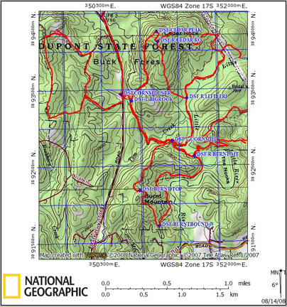
While there are other great mapping programs out there, TOPO! remains my favorite for generating high-quality printed maps to go with me into the field. My normal practice is to transfer waypoints and tracks to TOPO!, and overlay it with a UTM grid for easily referencing my position.
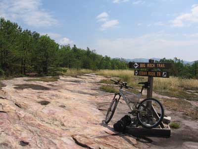
Shown below is a map similar to one I created for a recent trip on the Eastern Slickrock Trail in DuPont State Forest (photo at bottom).


Related post:

Rich,
What does support for the Garmin models mean? The ability to one click upload/download tracks/waypoints/routes instead of transferring gpx files? Or are they talking about map support? I’m assuming the former.
BTW, ExpertGPS also supports the Colorado and Oregon (send to/receive from GPS).
-Scott
Ah yes, I guess I could have been clearer about that. I’ve sent my Oregon test unit back to Garmin and haven’t tried this, but it should mean that you can transfer waypoints, tracks and routes from the Garmin device to TOPO!, and export waypoints and routes back to the device (I understand that better track support is forthcoming). And no, you can’t transfer maps to the unit. Thanks for letting me know about ExpertGPS BTW.
I purchased the upgrade to topo 4.0 and downloaded upgrade 4.5 so that I can download waypoints and routes to my Garmin Oregon 400t. Topo is still not recognizing my GPS so I still can’t download. Is there something else I must do?
Under Handhelds > GPS Settings, check your Receiver Type and Connection Settings
I have Natl gGeographic TOPO 4.6.0 for AZ. I also have a Garmin eTrex 20. I have created some routes, with waypoints and the export wizard of TOPO transferred them nicely. I created some waypoints in the field, and I cannot upload them to TOPO from my GPS using the import wizard. I have read the the newer GPS’s need a serial cable, instead of the UPS cable to be able to upload from the Garmin to TOPO.
Any ideas?
Thanks in advance.
Bob
Doesn’t work for me either. Older units use serial cables, newer ones use USB, so that’s not the issue. You can use Garmin’s free BaseCamp program to export them as a .gpx file and then try importing that file into NG Topo.