Sunday, March 18, 2012

REI Portland Offers GPS Basics Class

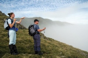
Hikers-with-GPS-hiking_thumb.jpg

While GPS is definitely not a new technology, it is surprisingly specialized. I am constantly shocked at how many of my friends and even my family are either completely oblivious, or else have absolutely ridiculous (and definitely incorrect) assumptions about how GPS works, how much it costs, how it can be used, and who uses it. It seems to be one of those technologies that, for most people, simply works.

So, if you have someone in your life who has been trying to understand your GPS device unsuccessfully, then Portland’s REI company has a solution. On February 22, REI will be hosting a beginner class titled GPS Navigation Basics, which anyone can sign up for. In this class, which lasts two hours, participants will learn the basics of how to use a handheld GPS device including use, marking waypoints, navigation, tracklogs, and other basic information. read more
GPS Enabled Pedal to Decrease Band Theft

smrt

Unfortunately, stealing from music groups in St. Louis is pretty common. It’s an issue that has been going on for years, and ultimately is hurting the music scene in the city. Robberies of tour vans have become so common, in fact, that many artists refuse to play in St. Louis anymore.

One musician who suffered from the robberies, a hip-hop artist that goes by Spose, went as far to say, “If you wanna see me perform in the future come to Chicago or something, cuz St. Louis is dead to me.” Obviously, there is a real need for something to solve this issue, so Jesse Caron, St. Louis native and owner of Gigbox, decided to take matters into his own hands.  read more

No Satellite Next-Gen Navigation System

uas

Credit: UCR

We all know that while GPS is great for getting us from point A to point B and about a million other things, but there are still flaws in the system. There are instances when GPS signals just can’t reach you, not to mention the signals put out from GPS are actually pretty weak, which leads to spoofing and jamming. Of course, GPS issues are no small problem for conventional cars, but with self-driving cars and unmanned aircraft systems (UAS) on the rise these issues could become a lot worse. We will need a much more accurate navigation system, or at least a back-up.

Currently, the only global navigation systems in place or developing operate by using satellites. This includes the United States’ GPS, Russia’s GLONASS, and Europe’s Galileo. Since all of these systems function primarily the same, they all have about the same accuracy. The University of California Riverside (UCR) has the Autonomous Systems Perception, Intelligence, and Navigation (ASPIN) team focusing on creating an alternative navigation system, and they’ve recently made some big discoveries.

read more

Government Calling For Solution to “Death By GPS”

driving-22959_640

It looks like people are starting to get fed up with geographic information systems (GIS) including information that is no longer up to date. Consumers are so reliant on the information stored in their GPS device that they actually follow the directions into danger sometimes, an event referred to as “death by GPS” by some national park rangers.

“Maps are getting so good at tying point A and point B together that they (people) are blindly following this data down roads that barely exist, that were abandoned years ago,” Rick Hamilton, member of the Civil GPS Service Interface Committee commented. read more

New UAS Rules Expand Drone Market

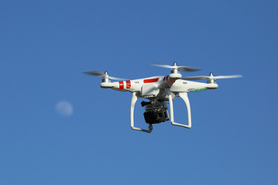
GPS drone (UAS) with GoPro camera

GPS drone (UAS) with GoPro camera; Creative Commons image courtesy Don McCullough

Drones somehow feel a little bit like the future to me, and it’s crazy to think that they are actually delivering things now. As with all growing industries, there are going to have to be some regulations put into play. Drones, also known as unmanned aircraft systems (UAS), had a new rule go into effect at the end of August.

The Small UAS Rule (Part 107) took away some of the limitations associated with U.S. commercial drone flights. This will lead to a big boost in the growing drone industry, which depends on GPS for most of its successes. During 2015, more than a million drones were sold throughout the U.S., but that’s less than half of the 2.4 million drones that were sold during the first half of 2016. read more

Telecommunication Networks Help Backup GPS

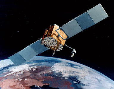
gps satellite IIF

GPS systems are actually pretty easily disrupted, whether it be by radio interference or weather outside of our control. For a while now, it has been a concern—especially with federal agencies—what would happen if GPS went down for some reason. While it might not seem like a big deal, GPS is used for many things more important than getting you to the closest Wal-Mart—including keeping time.

The National Institute of Standards and Technology (NIST) and the U.S. Naval Observatory (USNO) have been performing tests alongside two companies, CenturyLink and Microsemi, to see if there is a practical back up to GPS systems already in place so that a disruption wouldn’t effect major systems like timekeeping. read more

SPOT GPS Tracker Saves Hiker’s Life

wanderer-455338_960_720

Hiking can be dangerous at times, and so something like a GPS tracker is almost a necessity just in case the unimaginable happens. Recently, SPOT GPS has chalked up yet another life saved as a hiker was forced to use it after being injured on the trail.

Philip Herweyer of Park County was out on the trail with his horse when his lead rope tangled into his pistol, causing it to fire and shoot him in the leg. Herweyer was twelve hours from the trail head when he was injured, but luckily, his SPOT Gen3 device came with a 911 button, which sent a message to a central dispatch station. read more

Garmin Acquires DeLorme

Delorme_Garmin_Logo_Large

DeLorme, previously a private company, has been acquired by Garmin Ltd. This was completed in April of this year. DeLorme designs satellite tracking devices with two-way communication and navigation features. The company’s most well know products are its inReach series, which are GPS-enabled devices that allow users to send and receive texts, or an emergency SOS signal, via satellite from anywhere in the world.

“Our inReach technology is invaluable to hikers, hunters, boaters, and pilots who often find themselves in remote areas – Garmin’s core customers. We are looking forward to completing the acquisition and are excited to help leverage our expertise into enhancing their already outstanding products,” said Michael Heffron, CEO of DeLorme. Heffron went on to say the acquisition will expand DeLorme’s consumer base to more markets than they are used to, since Garmin has a global distribution network. read more

Could Pokemon Become The Next Big GPS Game?

MAIN-Pokemon-Go

Could 2016 be the year Pokemon dominates the geolocation game space? If Nintendo have their way, it very well could be.

Nintendo and the Pokemon Company have teamed up with Niantic Inc to announce that they intend to release the first Pokemon Geolocation game next year.  Called Pokemon Go, the game will be available free of charge for Android and iPhone mobile devices, although Nintendo does warn that there will be the dreaded in-app transactions.

The Pokemon franchise began life as a videogame for the Ninetendo Game Boy back in 1996 and has since spawned a number of sequels, comic books and movies.  However the Pokemon Go augmented reality app would be a new departure for the franchise. read more

Military Looking at Foreign GNSS Capability

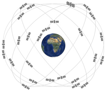
satelliteconstellation

While the United States’ GPS system was the first complete navigation constellation in the world and has provided millions of people with location information with increasing levels of accuracy, it is by far the only system available. I write a lot about Galileo and GLONASS–the two more popular GPS alternatives–but there are countless other countries that have their own regional satellites or partially-finished programs as well. And while GPS is still the most widely used system in many parts of the world, it’s a no-brainer that the more satellites a unit can see, the more accurate the positioning will be.

There are a handful of units that utilize both GPS and GLONASS–the only two fully completed worldwide constellations–and the accuracy is greatly improved. Just imagine if Galileo, once completed, was also incorporated. But, while Europe’s constellation isn’t yet complete and cooperation among the various global systems isn’t very high, Inside GNSS reported recently that the US military is currently looking into incorporating signals from international satellite systems for increased accuracy. read more