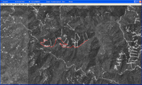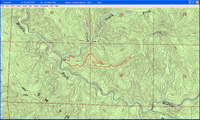
Everybody loves stuff they can get for free, right? Especially if it is way cool and quite useful. Well, USAPhotoMaps fits the bill. Created by Doug Cox, USAPhotoMaps is TerraServer-based, just like TopoFusion. And just like TopoFusion, you can look at aerial photos or topo maps of just about any location in the U.S. For some urban areas, you can even view color aerial photos down to 0.25 meters/pixel (see below left)!
One of the ways I’ve used USAPhotoMaps is to locate newer 4WD roads that don’t appear on topo maps, which are usually much  older than USGS aerial photos. In the image on the right below, I’ve drawn a track along a logging road. To the left below, you can see how I’ve been able to update a topo map with the hand-drawn track.
One of the other great things about USAPhotoMaps, is that Doug Cox just keeps updating it, adding new features and keeping it current.
USAPhotoMaps does lack some features, but all in all, it’s a great program, and you sure can’t beat the price. I believe it is  particularly useful for people new to the world of GPS, who may not be ready to lay out money for mapping software and aren’t quite sure what all they can do with it. If you’ve never transferred your track to your computer, to view it on an aerial photo, you’ve got a treat coming. And now you don’t have any excuse not to!
There is a full chapter on USAPhotoMaps in my book, GPS Mapping – Make Your Own Maps.

Other posts in this series:
- * Choosing the best mapping software: Introduction
- * CD-based mapping software: National Geographic TOPO!
- * Get maps and aerial photos online: TopoFusion
- * Software for power mappers: OziExplorer
- * Free waypoint manager: EasyGPS
- * Converting GPS file formats
