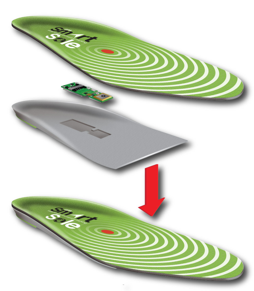
 The GPS world doesn’t have a shortage of ways to track just about anything—cars, freight, keys, pets and even people. GTX is introducing one of the stranger ways to track people—through their shoes. Their product, SmartSole, is a GPS tracker embedded in a removable insole that can fit in just about any shoe. According to their press release, it’s designed to help track children, elderly and at-risk patients. The sole is waterproof and can be controlled through a smartphone, computer or tablet. It comes with a rechargeable battery which, they claim, only has to be recharged every few days—a rather gross concept as you’d have to pull out your smelly insole and place it on a Qi charger every few days. read more
Archives for July 2014
SmartSole Allows Tracking Through Your Shoes
July 21, 2014 By 2 Comments
Iotera Brings GPS Tracker to Kickstarter
July 20, 2014 By Leave a Comment
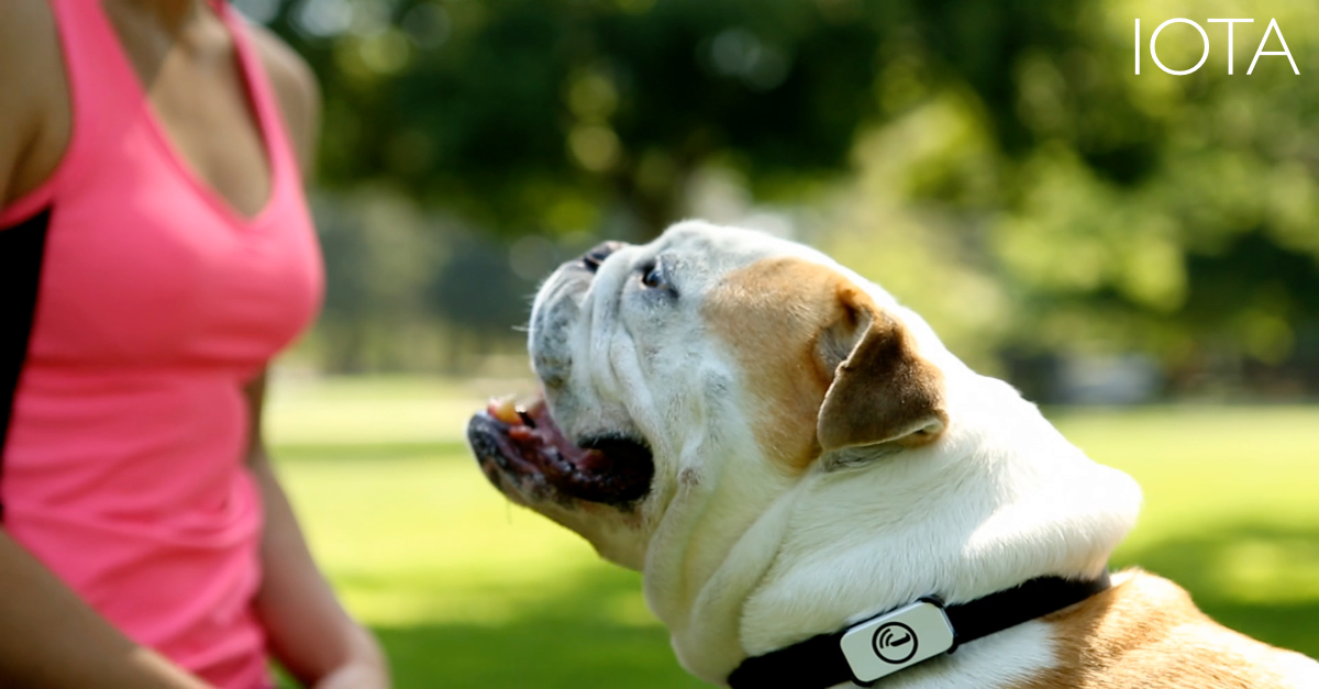
It seems like almost every week there is a new GPS tracker trying to gain ground on Kickstarter or Indiegogo, but this week I wanted to post about the Iota, a little GPS tracker with big dreams from Iotera. Last August, they raised $350,000 from Zenshin Capital to develop the tech, and have now taken to Kickstarter to crowdfund the testing and production costs. Now, you’re probably thinking that you’ve seen GPS trackers before, so what could possibly be so exciting about this one? Well, Iota is a little different from most of the GPS trackers that you find floating around the internet. And, while there are definitely some security concerns, the idea is pretty cool. read more
New Location Based App Game for Kids
July 20, 2014 By Leave a Comment
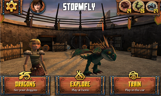
This location based App uses your GPS information to change gameplay
Windows has released a new location based mobile app for kids featuring DreamWorks Animation’s popular movie series “How To Train Your Dragon.” The app uses real-time GPS mapping technology in the gameplay, so real roads, buildings, traffic conditions, weather and other GPS location information will change virtual locations and conditions in the app.
The app also features a play-at-home Explore mode featuring quests across 16 real-world cities (with no physical travel necessary) and a Train Mode where kids can play quests during trips where real streets and buildings will show up in the game. The app also uses Foursquare social media-based interaction to help players find points of interest and unlock new characters and dragons.
While not incredibly useful, the app seems like a neat way to integrate GPS technology so kids can use it—and a good way to keep children occupied during travels. The game features favorite characters from the movie and a total of 38 quests. It is only available for Windows phones, and it is free. I haven’t had a chance to try it out, but I like the idea, and it sounds very similar to the popular Wherigo cartridges played on dedicated GPS devices.
Microsoft Announces Retirement of MapPoint Software
July 19, 2014 By 5 Comments
Microsoft has announced that they will be retiring their MapPoint Software, a Windows-only mapping and navigation software developed in 1999. This once-popular mapping program will likely go out with little fanfare, as Google Maps and Bing Maps have pretty much taken over the market of online mapping programs. AutoRoute and Streets & Trips will also be discontinued at the end of this year. According to Microsoft’s farewell page, they will continue online support of these programs until at least July 2015. read more
Endomondo App Syncs with Pebble Watches
July 19, 2014 By 1 Comment

Endomondo, the popular social fitness network, has introduced a new smartphone app that syncs with Pebble and helps users meet their fitness goals. This free app from Endomondo allows users to start, pause or stop a workout while exercising and can display up to three configurable data metrics, such as distance traveled, heart rate and workout duration – making it one of the most advanced fitness tracking apps for Pebble. Additionally, the app vibrates Pebble smartwatches for each mile or kilometer completed, and will briefly display a performance summary. read more
This Week in GPS – July 18, 2014
July 18, 2014 By 1 Comment
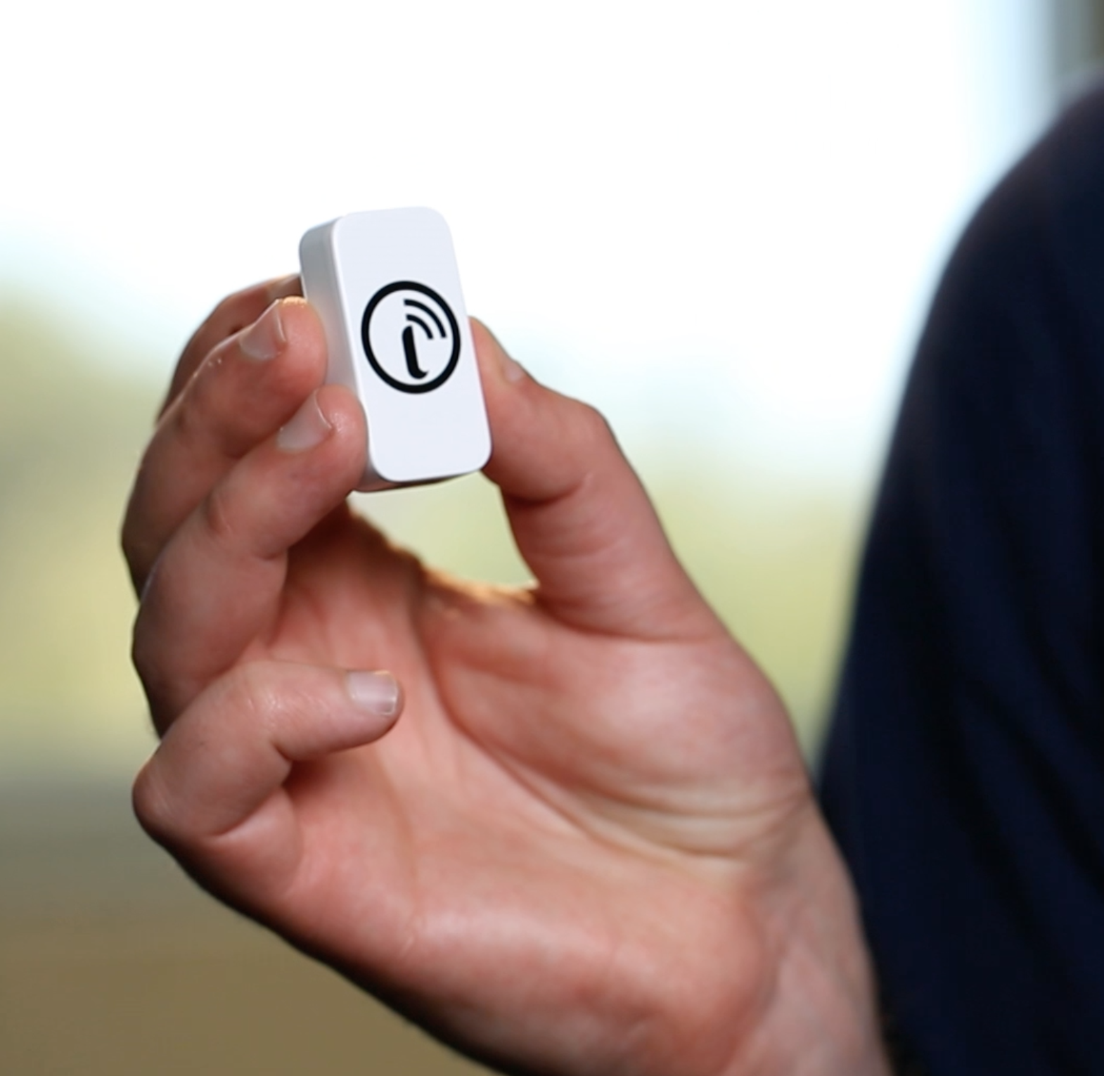 This week in GPS is a weekly link roundup of (mostly) GPS related odds and ends, from GPS Tracklog and other places around the Web. This week’s featured image is a new GPS tracker that looks at things a little differently. Watch for our article this Sunday for more information! read more
Garmin Pilot Goes Global With New Update
July 18, 2014 By Leave a Comment
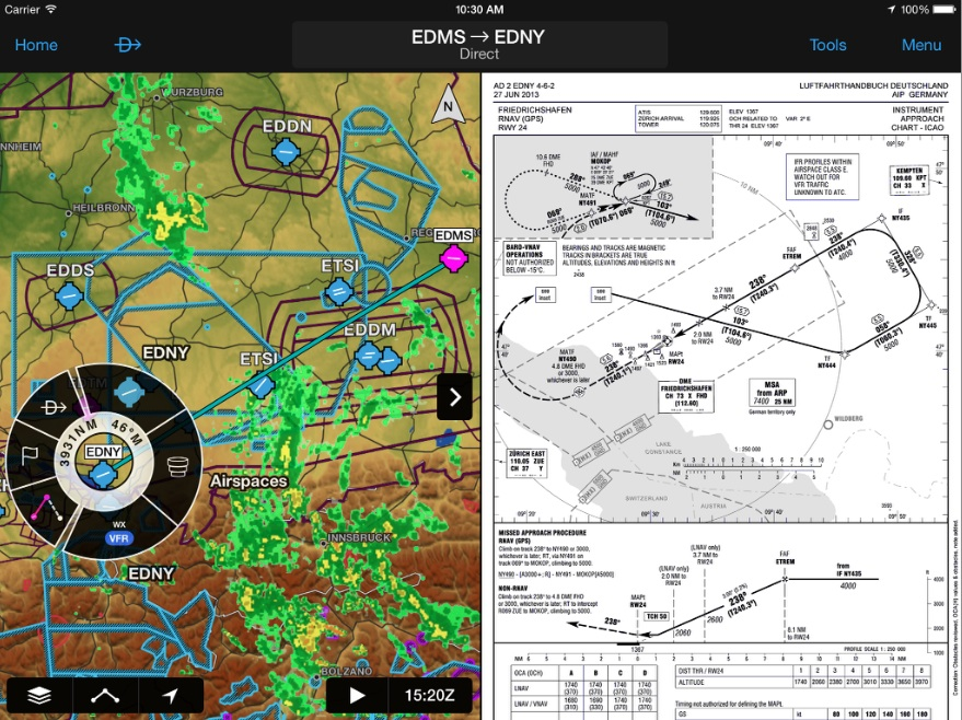
Garmin today announced worldwide coverage of the Garmin Pilot application for iPad and iPhone. The application, available from iTunes, is an excellent app for aviation, providing flight planning capabilities, comprehensive weather information and navigational aids. However, prior to the 6.2 update, it was only available in the U.S.. Garmin has clearly stepped up to the plate and is attempting to make a name for themselves on the international aviation market with this update.
New features include FliteCharts, SafeTaxi airport diagrams, FastFind, Smart Airspace and fully customizable 3D maps of ground, water, terrain and other features necessary (and convenient) for pilots flying in international and overseas airspace. read more
New Mars Map is Most Detailed Map Yet
July 18, 2014 By 5 Comments
So, I know this isn’t REALLY related to GPS (more just geology, really), but I saw this news story and just had to share it.
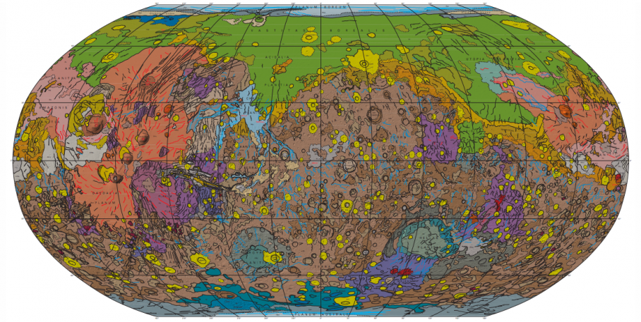
The U.S. Geological Survey has released a new map of Mars, with breathtaking detail and a fountain of useful information for future Mars residents. According to this article, the scientists who released the map were able to get such detail through combining years of information—more than 600 million individual altitude measurements—to map out the topography and geography of the red planet. read more
US, Russia Still Arguing Over GLONASS Station
July 17, 2014 By Leave a Comment
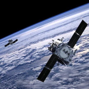 As you may be aware, Russia has been making rapid movements to expand and improve its GLONASS system to be a viable alternative to U.S. GPS systems. Earlier this year, Russia requested the permission to build a GLONASS station on U.S. soil and the U.S., unsurprisingly, refused on national security grounds. (Of course, we currently have several GPS stations built on Russian soil, but that’s beside the point, right?) read more
Creating Pocket Queries With GSAK
July 17, 2014 By 2 Comments
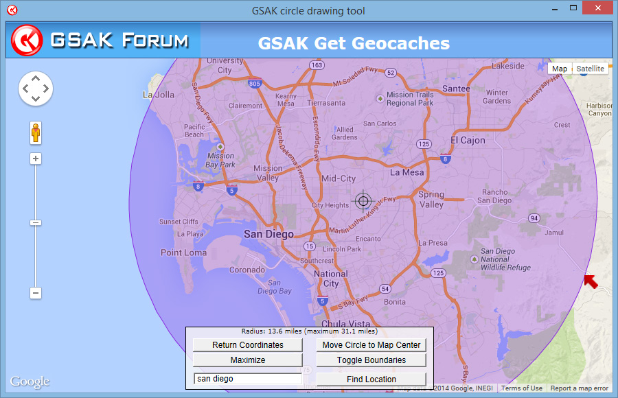
As regular readers will know, I’m a big fan of a piece of software called the Geocaching Swiss Army Knife (or GSAK) and recommend it to any serious geocacher. At its most basic, it’s a database for geocaches which you can use to generate advanced find statistics. But its flexibility means you can do a lot more with it, from speeding up your cache logging through the use of templates, to planning a day out.
One of the great things about GSAK is uncovering these really powerful, time-saving features that make geocaching less about administration and planning, and more about going out there and finding Tupperware. read more
