Sunday, March 18, 2012

Blog Action Day – Go geocaching with your kids

Bloggers Unite - Blog Action Day

Today is Blog Action Day, a day when bloggers from all over the world are posting on the same topic — the environment. According to their website, the idea is…"Every blogger will post about the environment in their own way and
relating to their own topic. Our aim is to get everyone talking towards
a better future."

So I’ve decided to post today on geocaching. These days video games, social networking sites and yes, blogs, keep kids (and me) at the computer way too much. Taking care of the environment is about taking care of future generations. But it’s not just recycling and reducing our carbon footprint that we need to worry about. We need to expose them to the environment too; give them an appreciation of nature.

read more

GeoJournal – Geocaching software for Mac

Applelogo
GeoJournal is a new geocaching program for Mac that allows you to "plan, manage and record your geocaching activities." It includes the following features:

  • .gpx and .loc support.
  • Multiple custom categories allow you to group geocaches by type, location, etc.
  • Multiple "home" locations allowed.  For all you folks with a vacation home or the need to get away from the in-laws!
  • Built-in use of Google Maps.
  • Itinerary generation to help plan caching expeditions. Viewable in Google Earth.
  • Built-in journal feature allows you to attach photos to each found cache. hence the name, GeoJournal.
  • POP3 importing for Pocket Queries.
  • Paperless geocaching support features includes CacheMate compatibility.

read more

Geodashing and other lesser known GPS games

Most people reading this already know about geocaching, but did you know there are a host of other GPS-enabled games? There is benchmark finding, the degree confluence project and GPS drawing, but the list is even longer than that.

I came across a post today at GIS Lounge that mentioned geodashing, which is defined here:

In each game, a large set of waypoints, called dashpoints, from all over the world is posted on the Web. Dashpoint locations are chosen at random by computer, with all the unpredictability that presents. Dashpoints might be in suburban neighborhoods or in the middle of
wilderness areas.


Then, the race is on to see who can reach the most dashpoints before the deadline.


Geodashing players can participate as individuals or as teams of up to five players to increase the number of dashpoints reached. The competition is friendly and teamwork helps to get high scores, so put your online acquaintances to good use.


Because the dashpoints are spread all over the world, it doesn’t matter where you live. Dashpoints are as likely to be near to you as to anyone else. It’s easy to start playing. Pick a dashpoint, visit it, report what you find.

read more

Another geocaching Christmas, this time with travel bugs!

Geocaching_travel_bug

Last year I reported on a geocaching Christmas, now a firmly ensconced family tradition. For those of you not familiar with
geocaching, it’s a way to have fun with your GPS and get kids
out of the house and hiking. And if you just got your first GPS, geocaching is a great introduction to GPS navigation.

This year we found several caches while in North Carolina, including Decaying Tunnel which had a couple of travel bugs in it. My nephew took one to Indiana and I took the other to California.

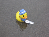
Daisy Mae Duck is the lucky bird that hitched a ride to California, where she awaits her next trip at Ploverlook in MacKerricker State Park. According to Daisy Mae’s web page, she wants to travel and see places like Florence, Tuscany, London, Australia, New Zealand and Germany. If you can help her out, give her a lift.


Points of Interest (POIs) resources

Last updated February 19, 2008

This thread originally dealt solely with custom points of interest
(POIs), but I’ve updated and reorganized it to include online sources
of POIs, conversion tools and more.

Custom points of interest (POI) resources

read more

Geocaching Software and Paperless Caching

GeocachingIn this, the latest in our best of the (discussion) boards series, we take a look at geocaching utilities. Before we get started, here’s the place to go if you haven’t heard of geocaching.

While my book, GPS Mapping, covers a wide range of mapping software, I did not get around to reviewing geocaching utilities in it. I was pleased last week to see this post on geocaching software show up on the official geocaching discussion board. Sputnik 57, a geocacher from Texas, was kind enough to pull this list together, giving a little bit of space to each manufacturer’s blurb, and a link to their product:

  • Geocaching Swiss Army Knife (GSAK) is the all in one Geocaching and waypoint management tool. Major features include: Multiple databases, sending/receiving waypoints to GPSr, conversion to many mapping formats, HTML output, extensive searching, macro support, backup and restore, distance/direction from other waypoints (including caches, locations, post codes) and much more.
  • CacheMate™ is a database for tracking GPS cache hunts. You can store information about caches or benchmarks, decode hints, and transfer data between CacheMate and the MemoPad application. Registered users can import LOC and GPX formatted XML files, which are available from Geocaching.com.
  • Watcher is a program that lets you view GPX files obtained from Pocket Queries (a membership benefit for Geocaching.com members). Offline viewing. filtering, and sorting are all possible, as well as merging multiple GPX files and outputting custom GPX files. Watcher is a GPX utility available at no charge (although tips are always appreciated) to paying members of Geocaching.com. It is our way of saying “thank you” to all those who support the site from which we have found countless hours of enjoyment.
  • Plucker is an offline Web and e-book viewer for PalmOS® based handheld devices and PDAs. Plucker comes with Unix, Linux Windows and Mac OSX tools, scripts, and conduits that let you decide exactly what part of the World Wide Web you’d like to download onto your PDA (as long as they’re in standard HTML or text format). These web pages are then processed, compressed, and transferred to the PDA for viewing by the Plucker viewer.
  • GPX Spinner puts a spin on your GPX files. Features include: Output a set of HTML files suitable for sending to a handheld device using Plucker or iSilo; Change the waypoint name to include the cache name, ID, difficulty, terrain, or any combination; Change the waypoint description to include the cache name, who it was placed by, difficulty, terrain, or any combination;Change the symbol to represent the type of cache (e.g. a camera for Virtuals, a penny for Micros, or a picnic table for Event Caches). Even change the default ‘Geocache’ treasure chest for regular caches; Change the symbol (e.g. to an animal) if the cache contains any travel bugs; Change the symbol (e.g. to a tombstone) if there are several recent Not Found logs; Fully configurable!
  • EasyGPS is the fast and easy way to create, edit, and transfer waypoints and routes between your computer and your Garmin, Magellan, or Lowrance GPS. Using EasyGPS, you can manage all of your waypoints and routes, and display them in lists sorted by name, elevation, or distance. EasyGPS connects your GPS to the best mapping and information sites on the Internet, giving you one-click access to street and topo maps, aerial photos, weather forecasts, and nearby attractions. And because EasyGPS is part of the TopoGrafix family of outdoor products, you’ll be able to exchange GPS data with EasyGPS and ExpertGPS users all over the world!

I should add that the focus here is on software for paperless geocaching, relying instead upon a Palm or Pocket PC device. Also, as long as EasyGPS was mentioned, I want to let you know that there is a full chapter on it in GPS Mapping, since it is such a great (and free) waypoint management tool.