UPDATE: It’s now live and available, and I’m enjoying the hell out of it!
UPDATE 2: How to transfer Garmin map downloads after your subscription expires.
Yesterday morning, I noticed there was a new product, Garmin BirdsEye Topo US and Canada, on the Garmin website. Pretty sweet – for thirty bucks, you can load USGS and NRC topos to newer Garmin handhelds for a year. I’ve been expecting and wanting this for awhile, so I subscribed right away, thinking I’d put it on my 62s and grab a few screenshots for this post. It didn’t quite work out that way, but let’s go over the product details before I get into my experience with it…
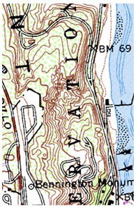
Most topos for handheld GPS units are vector maps; they are made up of lines and points, and look nothing like the USGS topos we know and love. BirdsEye maps are different. These are raster imagery, actual image files, that put USGS topo map images right on your Garmin. Up till now, you’ve had to use Garmin’s custom map process to do this, which can be a hassle, and then there’s that limit of 100 tiles (images) too.

