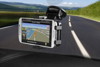
TomTom has expanded their product portfolio this week with the introduction of free internet-based mapping and routing. The TomTom Route Planner was introduced yesterday and is available on any internet-connected device. Functioning similar to Google Maps or other mapping programs, this free online route planner relies on TomTom’s extensive map database and is available in several countries worldwide. read more
App Gives GPS Guides to Alabama State Parks
In honor of the Alabama Park System’s 75th Anniversary, a new app has been released that will give users comprehensive guides to all state parks in Alabama in one app. The Alabama State Parks Pocket Ranger app joins a suite of apps mapping out state parks, fishing guides, hunting guides and more for nearly 30 states. These apps provide not only a wonderful tool for exploring your state parks, but they are all free on iTunes and Google Play. Just search “Pocket Ranger” with your state name. read more
Waze Updates Allows Geotagging, Parking Reminders
Waze, the popular social mapping program, got an update last week that introduced a set of features called “Places.” This feature allows users to add POIs to their Waze app to mark fun and interesting places that they find while traveling. In addition to information about POIs, users can add photos to help others know they are in the right place. Sounds an awful lot like the popular waymarking pastime, except instead of a scavenger hunt to try and find places, you can actually get directions there. read more
Sygic Maps Celebrates 55 Million Users With Sale
 Provided you are willing to fork out the money, Sygic is one of the better navigation and mapping applications for your smartphone available. Normally, I would say that the price is a little prohibitive for most but if you have been eyeing this application, then this might be your lucky day.
Sygic is celebrating reaching the 55 million user benchmark by having a 55% off sale on their World maps (marking them from $125.99 down to $55.99). While it’s still a chunk of change, if you find yourself travelling a lot, then it might just be worth the money, especially with such a hefty discount. Many of their regional maps are also reduced by 50% in honor of this landmark achievement. According to their site, this discount will be available until October. read more
Students Map Niger with GPS Tracking
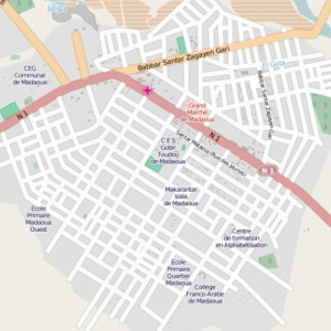
This map of Malamawa can be viewed on OpenStreetMaps thanks to the Mapping For Niger project
Sometimes I take for granted all of the maps available in the U.S. and many other countries. I just assume that if I am trying to find my way to Applebee’s in a new town, I can just punch it in and find the address and directions in seconds, but it isn’t like that everywhere. Places like Niger don’t have any reliable online maps and even the paper maps are sometimes outdated and many towns and roads simply don’t show up. For the last year, a handful of college students are working to change that using GPS tracking and mapping techniques. read more
SonarCharts Expands Compatibility to Multiple GPS Units
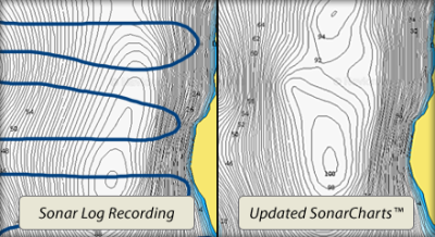
Navionics has announced that it’s award-winning SonarCharts is now compatible with Garmin, Hummingbird, Lowrance, Raymarine, Simrad and B&G units. This cutting edge software empowers individual users to easily improve the accuracy of their charts by uploading sonar logs and downloading updated charts as necessary. Navionics then processes and integrates your data quickly, giving more detail on critical areas, as well as continuous changes in sea, lake and river bottoms. read more
Researchers Investigate Scenic Route Options for GPS
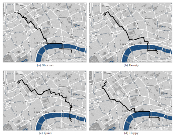
New route options, such as most beautiful, quiet or happy paths may be coming to online mapping programs.
When you search for a route using your GPS device or an application like Google Maps, you have several options for what kind of a path you want—walking, cycling, fastest, shortest—but what if you could plot the most beautiful route as well? Yahoo Researchers have conducted a study proposing methods for selecting the most scenic route to get from point A to B instead of just the fastest.
“We find that, on average, the recommended paths are only 12% longer,” the study states. In walking time, that would equal to about 7 minutes extra time in order to take the more scenic route.
Best GPS Apps for Android
Smartphones are incredibly powerful machines, capable of just about anything. So why is it so hard to find a good, functional app? We have searched through dozens of apps and found what seem to be the best free and paid apps on the market for Android. Many of these are also available on iPhone. read more
Handheld GPS 201: Mapping software
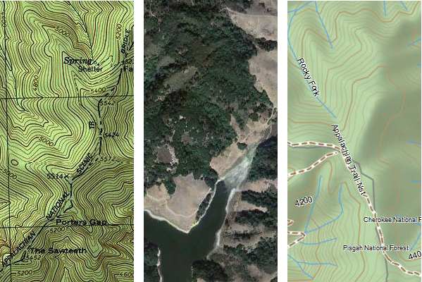
With today’s topic, I’m starting a new series, a follow up to my Handheld GPS 101 posts. Are you ready to move on to the next class? Alright then. Today’s topic is mapping software — and I’m not talking about maps for your GPS here, but rather desktop or laptop software that will turn you into a power user. read more
DeLorme World Basemap now available for download
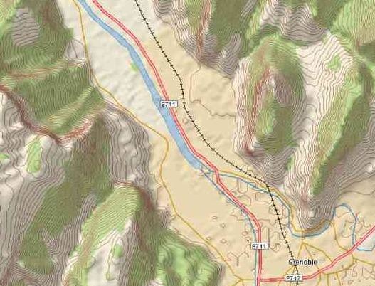 DeLorme has made their worldwide topo basemap available for download, at a cost of one cent per 100 square kilometers (minimum purchase $10). I’m flying today, sitting in a cramped seat, so I’m just going to link to some additional images and paste in the news release for more info…
