Hands on with the Magellan Crossover GPS
UPDATE: This model has been discontinued. For current recommendations, please refer to our auto GPS buyers guide or check out our other Magellan auto GPS reviews.
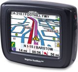
For the past few weeks I’ve been trying out the Magellan CrossoverGPS, which is billed as marrying auto navigation features with those of a ruggedized outdoor handheld. When first announced, this receiver was referred to as the Magellan RoadMate 2500T.
The Magellan CrossoverGPS is very similar to the model below it, the RoadMate 2200T, except that the Crossover GPS adds pre-loaded topo maps. Like the 2200T, The CrossoverGPS offers voice prompted turn-by-turn directions, a 3.5” color touch screen and pre-loaded highway maps of the U.S. and Canada. Additionally, both units feature the SiRFstar III chipset, an SD slot that allows you to load more detailed topo maps or marine charts, an MP3 player, photo viewer, and real-time traffic capabilities. I did not receive a traffic receiver and was not able to test that aspect of the unit.
According to the manual, the Magellan CrossoverGPS has 90 meter topographic maps included for the 48 contiguous United States, though the unit I tested had topo maps of all 50 states and all of the Americas. The manual also says that more detailed (30 meter) topographic maps can be added by purchasing one of the Magellan MapSend Topographic products from www.magellanGPS.com. The screen shows 20 foot contour intervals, but this is likely interpolated from 90 meter data, which can lead to inaccurate contours. The pre-loaded topo maps do not show trails or streams, giving you another incentive to buy detailed MapSend topo maps. Oh yeah, you can’t use your old copy of MapSend to load topos; you have to buy a new version on an SD card, but the U.S. version is not yet available.