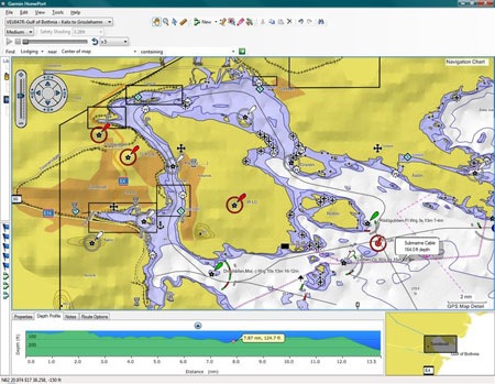
 Garmin has announced a new marine planning software desktop application dubbed HomePort. After the introduction of this and BaseCamp, perhaps we’ll see a new auto trip planner in the near future. Click here for the full news release.
Garmin intros HomePort marine planning app
Garmin Colorado 400c review
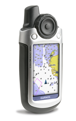
UPDATE: I’m recommending the new touch-screen Garmin Oregon series instead of the Colorado. It has a superior interface, along with almost all the other good things found on the Colorado. Read my hands-on review of the Oregon 400t for more information.
UPDATE 2: This model has been discontinued. For more current recommendations, please refer to our handheld GPS buyers guide or our Garmin handheld GPS comparison chart.
The Garmin Colorado 400c is the marine version of Garmin’s newest handheld GPS series. As such, it includes BlueChart® g2 coastal charts and a worldwide basemap with aerial imagery. The map detail includes includes shorelines, depth contours, navaids, harbors, marinas, port plans and coastal roads for the U.S. and Bahamas.
Free nautical charts

NOAA has a site where you can download free nautical charts for the entire U.S. The charts are in BSB/KAP format, and can be used in OziExplorer. I found this via a post on the OziExplorer message forum.
Garmin GPSMAP 376C review
UPDATE: This model has been discontinued. Check out our list of more current marine GPS receivers for alternatives.
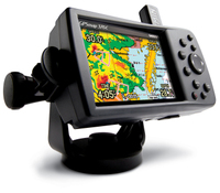
The Garmin GPSMAP 376C marine and vehicle chartplotter updates the 276C
, adding XM satellite radio and weather capabilities. Though listed as a marine unit, this is actually a dual-purpose device that supports City Navigator
maps and turn-by-turn routing.
The 376C comes with base maps; if you want detailed maps, you’ll have to buy those separately. Garmin is currently updating the 376C with the GPSMAP 378 and 478, which have preloaded land and sea maps, and are expected to become available in late May 2006.
Here’s what others have to say about the Garmin 376C:
Garmin GPSMAP 76CSx review
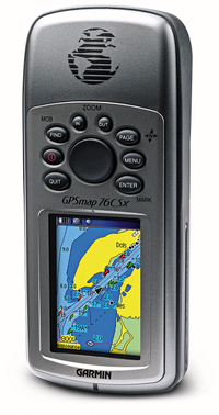
UPDATE: The GPSMAP 76CSx has been discontinued. For current recommendations, check out our handheld GPS buyers guide or our Garmin handheld GPS comparison chart.
The Garmin GPSMAP 76CSx updates the Garmin GPSMAP 76CS with two major improvements. First, the 76CSx includes the SiRFSTAR III chipset, which has been getting rave reviews for its fast acquisition time and awesome coverage under canopy, in urban canyons and even indoors!
UPDATE: In early 2009, it appears that Garmin stopped using the SiRFstar III chipet due to a patent dispute, substituting a MediaTek (MTK) chipset. While both are high-sensitivity chipsets, Garmin is still fine-tuning the MTK firmware. The switch to this chipset has reduced one of the advantages the 60/76 C(S)x series has enjoyed over newer Garmin models.
UPDATE 2: Here’s my 2010 take on SiRFstar III and the newer chipsets.
read more
Garmin auto / marine units – GPSMAP 378 and 478
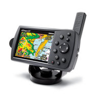
No, these aren’t GPS receivers for your amphibious vehicle. But if you’ve got a pickup truck and a boat trailer, they could be the units for you. Earlier today, Garmin announced the GPSMAP 378 and GPSMAP 478 (pictured at left).
These new receivers have pre-loaded marine AND highway maps for North America. Both units come with a marine mount and automotive kit, so you can use them to drive to the dock and then pop them into your boat. The GPSMAP 378 has 10-meter resolution charts for 3200 inland lakes, while the GPSMAP 478 has charts for the entire U.S. coastline, including Alaska and Hawaii.
Both units come pre-loaded with City Navigator ® NT for highway navigation, and optional XM radio weather capabilities. They are expected to be available in late May 2006 with an expected street price of $1199.99.
Inland Lakes maps released by Garmin
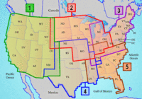
Garmin has released Inland Lakes mapping software for the U.S., described by Garmin as follows:
"From small, local lakes to large ones, this software contains highly detailed data for lakes of almost every size in the continental United States. With exceptional detail — including amazing contour lines on most inland lakes plus high-definition shoreline, river and creek channels, islands, boat ramps, campgrounds, rivers, streams, tide stations and predictions, U.S. Coast Guard aids to navigation, a wrecks and obstructions database, and road data…"
Unlike other recent releases, Inland Lakes is to be made available on SD cards, micro-SD cards and DVD, though the DVD version is not available yet. Five regions, shown at left above, are available on individual cards, or you’ll be able to buy the full set of five on DVD. The list price for the individual regional cards is $116.65. No word yet on the cost of the DVD. More detailed information on the regions is available here.
Garmin GPSMap 76Cx Review
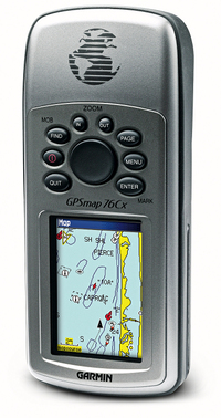
UPDATE: The GPSMAP 76Cx has been discontinued. We recommend the GPSMAP 78s as an alternative.
The Garmin GPSMap 76Cx is an update of the popular Garmin GPSMap 76C
, which has been well loved by mariners and landlubbers alike. The 76Cx has the new SiRFSTARIII chipset, which has been garnering accolades for its fast acquisition time and awesome coverage under canopy, in urban canyons and even indoors! The other significant upgrade is that the 76Cx no longer utilizes the built in memory for MapSource maps, but loads them to a microSD card slot instead (the unit comes with a 128 MB card). This means you have unlimited map storage capability, plus you can use some of the newer MapSource software like City Select Mexico. Stepping up to the 76CSx adds a barometric altimeter and electronic compass. To see how the 76Cx stands up against other Garmin models, check out my Garmin handheld GPS comparison chart.
Compare prices on the Garmin GPSMAP 76Cx
UPDATE: In early 2009, it appears that Garmin stopped using the SiRFstar III chipet due to a patent dispute, substituting a MediaTek (MTK) chipset. While both are high-sensitivity chipsets, Garmin is still fine-tuning the MTK firmware. The switch to this chipset has reduced one of the advantages the 60/76 C(S)x series has enjoyed over newer Garmin models.
UPDATE 2: Here’s my 2010 take on SiRFstar III and the newer chipsets.
read more
Garmin GPSMap 76CS Review
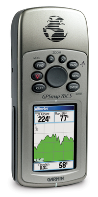
UPDATE: This model has been discontinued. For more current recommendations, please refer to our handheld GPS buyers guide or our Garmin handheld GPS comparison chart.
The Garmin GPSMap 76CS, while billed as a marine GPS unit, is very popular with landlubbers as well, due to its 115 MB of memory (enough to load highway maps
for almost the entire state of California). An ideal unit for boaters, the 76CS floats and is waterproof, and comes with an Americas marine database that includes navigational aids.
Confused about the 76 series? Here’s the low-down on the differences. The 76 and 76S have black and white screens, while the 76C and 76CS are color. The 76 has 8 MB of memory, the 76S has 24 MB, while the 76C and 76CS both have 115 MB of memory. Units with an S have an electronic compass and barometric altimeter, while the C units, in addition to color screens, have turn-by-turn routing capability. Finally, the 76CS has recently been updated with the new 76CSx.
14 readers at Amazon gave the GPS Map 76CS an average 4-1/2 out of 5 star rating.
Here are some other resources on the 76CS…
