Sunday, March 18, 2012

More free topo maps for Garmin receivers

Free_topo_maps

UPDATE: I’ve posted a more comprehensive set of resources for free topo maps for Garmin GPS receivers.

The list of states for which there are free high-resolution, Garmin-compatible topo maps continues to expand. The following are currently available:

read more

Magellan Triton custom maps

Triton_ozice_and_nav_n_go

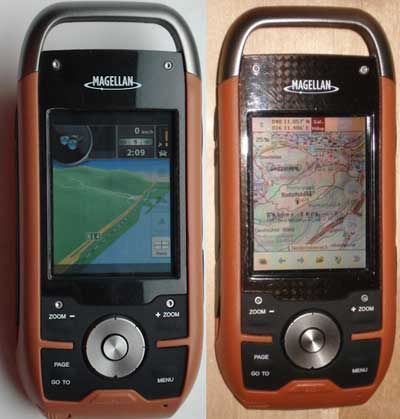
There’s been a lot of progress recently on making custom maps for the Magellan Triton series. For any of you with these handhelds, here are some resources to check out…

read more

National Geographic TOPO! adds support for new Garmin units

Ng_maps_logo
National Geographic has released TOPO! version 4.5, adding support for Garmin Oregon, Colorado, Edge and nuvi models. A Mac OS X version is also available. This is a welcome improvement, as too few mapping software programs support these models.

read more

Ten reasons TopoFusion rocks

Topofusion_header

TopoFusion is my go-to program for planning and tracking backcountry adventures. It’s typically the program I turn to first and there is rarely a day that goes by without me using it. Here are ten reasons that TopoFusion rocks:

1. The ability to toggle between USGS topo maps, aerial photos and hybrid imagery

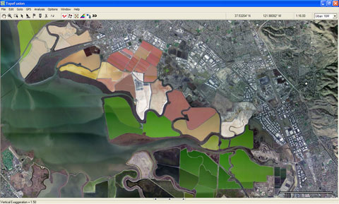
All you have to do is tap “a” on the keyboard to toggle between these views. The TerraServer aerial imagery includes B/W U.S. coverage to 1 meter/pixel and color urban coverage to 0.25 meters/pixel. TopoFusion also accesses Canadian topos, TIGER street maps and worldwide LandSat imagery. The color urban imagery below is of salt ponds at the south end of the San Francisco Bay (16 meters/pixel).

Topofusion_urban_imagery

read more

Moagu brings USGS maps to your Garmin handheld

Moagu
Last month, Leszek Pawlowicz of Free Geography Tools hinted at a new project code-named MOAGU. He may ascribe a different meaning to the acronym for legal reasons, but let’s call it what it is — MOAGU is the mother of all Garmin utilities. What Leszek has created is a utility that will place a USGS topo map on your Garmin GPS. Actually, it will put any scanned, georeferenced map on your Garmin. It won’t work on just any Garmin mapping handheld yet; I haven’t been able to get the maps on my Colorado 300, though I’m hoping some of our more technically inclined readers can figure that one out.

I have used it on my Garmin 60CSx and I have to say that Moagu rocks! This really is revolutionary. Handheld users have been asking for 1:24,000 scale USGS maps for their GPS units for years. The DeLorme PN-20 and Magellan Triton series have implemented this, more or less successfully (respectively), but we haven’t had an easy solution for Garmin devices until now.

read more

Open Street Map on a Garmin handheld

Osm_tiger
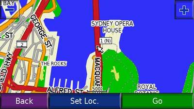
In last week’s Waypoints, I issued a challenge to Free Geography Tools’ Leszek Pawlowicz to check out Open Street Map (OSM) on a Garmin handheld, now that OSM has incorporated U.S. TIGER data. He good naturedly accepted the gauntlet and posted his findings. The screen shot at left shows a sample.

I’m disappointed that using OSM data in this way doesn’t allow for autorouting. Still, for those of you with Garmin handhelds that don’t want to lay out the bucks for MetroGuide or City Navigator, this is another option.

Thanks Leszek!

Free hi-res topo maps of CO and WY (and Utah soon)

Wyoming_40_foot_topos

UPDATE: I’ve posted a more comprehensive set of resources for free topo maps for Garmin GPS receivers.

One of the great things about Garmin units is the wide range of free maps that are out there for them. I recently became aware of another source, this one offering 40-foot contour interval maps of Colorado and Wyoming. The not quite accurately named site, Miscjunk, will soon add Utah to the mix too.

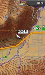
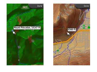
The screen shot at right shows a sample map loaded onto the new Garmin Colorado series. If you load a custom (U.S.) map onto the unit and have Topo U.S. 2008 (which has DEM data) loaded too, you’ll get the nice shading effects seen here.

read more

Free maps for your Garmin GPS

Free_international_maps

Free user-generated U.S. and international maps

UPDATE: Here’s a step-by-step guide to putting routable OSM maps on your Garmin GPS.

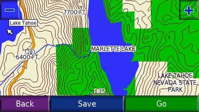
This was originally intended as a follow up to my international maps for your Garmin GPS post. Yet those sticking closer to home should investigate this too — the sources below include road maps of U.S. cities and some very nice topo maps of greater detail than you can find elsewhere. The image below is from a 1:24,000 scale Lake Tahoe map.

Lake_tahoe_24k_map

read more

International maps for your Garmin GPS

One of the more common questions I receive relates to international (non-U.S.) maps — where can I find maps of a particular country? There are actually many options, and I suspect that most people aren’t aware of them all. Some are even free. I’m going to focus on Garmin in this post, which has the greatest variety of international maps readily available, at least for any of the top selling GPS receiver brands in the U.S.

Lets go through the options one by one…

read more

Mio POI loader

Mio_logo
Mio has posted a Mio POI loader that allows you to transfer .csv or .xls POI files to an SD card and have them show up under My POI on your Mio device.

The POI loader may work with newer devices beyond those listed. I’m currently testing a Mio C720t and it worked fine with it.

I’m adding a link to this on my custom POI resource page, where you can find lots of POI sources to use with your GPS.

read more