Sunday, March 18, 2012

Garmin TOPO U.S. 2008 review

Topo_us_2008_dvd
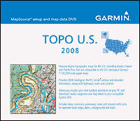
Garmin MapSource TOPO U.S. 2008 provides topographic map coverage of the entire United States and Puerto Rico. Ideal for the geocacher, hiker, mountain biker, etc., it is available on DVD or micro-SD cards. Considering the high cost of the micro-SD regional cards though, I’d recommend that you pay a little more and buy the DVD of the entire country.

Garmin TOPO U.S. 2008 allows you to transfer topo maps to compatible Garmin mapping receivers; these maps cannot be loaded to non-mapping units, such as the basic eTrex H. TOPO U.S. comes with and is used through Garmin’s standard MapSource interface, which also allows you to transfer waypoints, routes and tracks to and from your GPS receiver. This makes TOPO U.S. 2008 very useful planning trips right on your PC.

It does not allow you to auto-route (generate turn-by-turn directions on trails or streets). Routes created on TOPO U.S. 2008 produce straight-line, "as the crow flies" segments. They do not follow the trail, but go from waypoint to waypoint. Also, please note that while you can load both TOPO U.S. 2008 and City Navigator maps to your compatible Garmin receiver, you can’t view both at the same time.

One other point — this product is not "locked," so the maps can be loaded to multiple units.
read more

Video tutorial for making custom Garmin maps

Custom_garmin_map
A member of Groundspeak, Geocaching.com’s message board, has posted a video tutorial showing how easy it is to make custom maps for a Garmin GPS. Unfortunately, it’s hosted on MediaFire and I wasn’t able to embed it here. Follow the link above and look for "click here to start download." That’s the video tutorial, not the Paris Hilton video showing below it (the one I saw was family safe though)!

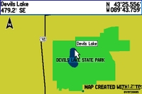
In the example, he traces the outline of a park boundary and lake in Google Earth, and uses it to create a map for his GPS as shown. The Groundspeak post links to the map making tools he used.

I covered many of these techniques in my 2005 book, GPS Mapping: Make Your Own Maps. The video only scratches the surface of what is possible. There is a ton of free GIS data on the Web that you can use to build custom maps. There’s a bit of a learning curve but if you use a handheld GPS and like to play with hacks, you should probably check it out.

read more

How many Points of Interest (POIs) do you need?

Pois
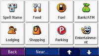
Points of interest (POIs) are, just as the name implies, a geographic point that may be of interest to you. They are typically divided into categories like dining, shopping, lodging, recreation, etc. If you are navigating to a business, you are likely to use a POI; if you are navigating to a residence, you’ll probably enter an address instead. 

These days, most auto GPS receivers come with anywhere from 750,000 to 6 million or more POIs. I find units with 2 million or less POIs to be extremely frustrating to use, since often, the business I am searching for is not in the database.

read more

GPS theft prevention with GadgetTrak

Gadgettrak
GadgetTrak, an Oregon company, has expanded the range of GPS devices they can protect from theft. Or more accurately, help recover if they are stolen.  Their system works when the thief, or someone he sells the stolen unit to, connects the device to a PC. The IP address, general location, computer name, user name, ISP and host name are relayed to you in an email. Of course, this doesn’t guarantee recovery. Here’s what GadgetTrak has to say about that:

read more

Garmin TOPO U.S. 2008

Topo_us_2008_screen
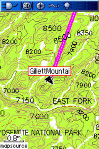
Garmin has announced an updated version of its backcountry maps for the U.S. – Garmin TOPO U.S. 2008. There’s not a huge amount of information available yet.

What’s known now is that the maps use 1:100,000 scale data, not 1:24,000 – a disappointment. The maps do include some new features, including the ability to generate elevation profiles on your PC or compatible Garmin receivers (shown below, after the jump), though that will be of little use if they are generated from straight lines rather than along trails. No word yet on whether there is auto-routing for trails or roads, nor do we know if this map product will be locked.

TOPO U.S. 2008 will be available on DVD or micro SD cards. Garmin has not posted an availability date.

There is a discussion thread on Groundspeak, Geocaching.com’s message board.

Via Allory.

read more

Navionics – a new provider of outdoor GPS maps

With auto systems dominating the GPS market, handheld users often feel neglected by the major manufacturers. We rarely see hardware improvements, and topo maps are updated even less frequently. The GPS maps that we do have usually show 40 meter (131 foot) contour intervals. Personally, I like to know if I’m approaching a cliff of say 100′; with these maps, it wouldn’t show!  Nor do most outdoor maps allow for auto-routing on trails, the way that GPS highway maps do.

read more

Tech tips for GPS map makers

This weekend, my publisher forwarded me a nice email from Jim Bosch, a reader of my book, GPS Mapping – Make Your Own Maps (Amazon). Jim has some great tips about free software that makes creating your own GPS maps even easier, and I’m including his entire email below, verbatim. I especially liked learning about a tool that directly converts SDTS files to shapefiles, eliminating one of the steps in the process that I described in Chapter 24. Thanks Jim!

read more

Transfer waypoints to your nuvi with MapSource

As noted in my last post, I just returned from a trip to the southwest. My wife and I visited many towns and cities in New Mexico including Santa Fe, Albuquerque, Las Cruces and Silver City, and we even made it as far north as Colorado Springs. My trusty Garmin nuvi 660 led the way.

We were gone 12 days and had many places we wanted to see. We’re considering relocating so we were checking out neighborhoods, open houses, restaurants, etc. When you’re doing a trip that complicated, in cities you aren’t familiar with, simply plugging destinations into your GPS isn’t always the best way to do things. There’s nothing like being able to visualize the whole city on your computer screen. So I used Garmin’s MapSource to find POIs and create waypoints, and then transfer them to my nuvi.

If you don’t have the latest version of MapSource, download it to enable this capability. In version 6.11.1 Garmin added support for transfer with Garmin mass storage devices, such as the nuvi. I found it to be very helpful.

read more

1:24,000 scale Colorado topo maps for Garmin receivers

24kcoloradotopomaps

UPDATE: I’ve posted a more comprehensive set of resources for free topo maps for Garmin GPS receivers.

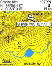
Above the Timber is about to release DVD’s of 1:24,000 scale topo maps of the Colorado Rockies for Garmin GPS receivers. I call them 1:24K scale maps even though that is a bit of a misnomer. These are digital maps, so the scale changes at each zoom level. However, the data on the screen is based on USGS 1:24,000 scale topo maps, and they show 40 foot contour intervals, as seen in the image shown here.

These are much more detailed than Garmin’s 1:100K-based U.S. Topo maps. And while Garmin does have a 1:24K scale product, it is limited (for the most part) to certain National Park areas.

The Colorado Topo Maps DVD will go on sale around May 1, at a special introductory price of $79.95. While you can “make your own maps,” the process is a bit laborious, so if you are a back country enthusiast in Colorado, this is a pretty good deal.

Related posts:

read more

Garmin c510/c530 voice hack

Streetpilot_c510
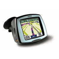
Here’s a hack to give your Garmin StreetPilot c510 or c530 text-to-speech capabilities, enabling it to call out street names. That way you’ll get "Turn left on Highway 128 in 500 feet" instead of just "Turn left in 500 feet."

Now when I say hack, I mean H-A-C-K! This isn’t a make your own maps kind of hack, this is one that can lead to the death of your unit. Phil Hornby, the hacker who came up with this, suffered the following while working it out:

  • Several lock-ups – remove the front Fascia and press RESET to recover.
  • Crash/reboot and loss of ALL user settings – Favourites, Navigation settings, Garmin Lock!!! , you name it. Nothing for it, but to reset everything manually. It even needed to relearn the initial satellite position (As in "Make sure you have a clear view of the sky")
  • A very scary TOTAL lock-up that necessitated removing the four screws that hold the C510 together and then unplugging and re-plugging the battery. I suppose I could have waited for the battery to go flat!. Actually, I’ve heard of this fault affecting real C550’s …
  • It didn’t happen to me during this experiment, but a related issue is the loss of the licence key file for the City Navigator NT maps.

Yikes! I’m not recommending this one to anybody.

Via GPSReview.net.