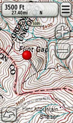
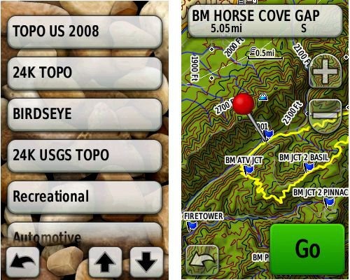
 Garmin rolled out several new updates yesterday for the Colorado, Dakota and Oregon series. There were a few fixes, but I want to concentrate on them adding BirdsEye control to profiles. I’m not really sure if you could do this with other map types before; regardless though, I want to point out the granular map controls now available to users of these units, allowing you to easily switch between map types.
Improved map controls for new Garmin handhelds
Two new tools for making Garmin custom maps
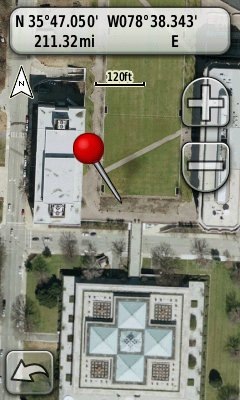 I didn’t think this would take long. Some of the more technically adept GPS enthusiasts among us have put together some great tools for creating custom maps for the latest generation of Garmin handhelds. Here are two new ones released in the last day or so. Both allow you to create maps without manually calibrating them in Google Earth.
G-Raster
Created by Lester Pawlowicz of Free Geography Tools, G-Raster allows you to create maps from imagery freely available online. The following formats are supported:
- GeoTIFF
- MrSID
- NOAA BSB (.kap)
- ERDAS (.img)
- USA PhotoMaps Big JPEG
- UTM world file images
- World file images for other coordinate systems
Imagery sources for Garmin custom maps
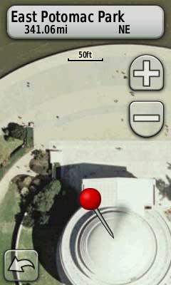 There are a lot of new map makers out there now that Garmin has opened the door to custom maps on their latest generation handhelds.
And the results are cool. Just don’t expect those people standing around the Jefferson Memorial to be in the same place when you visit!
The process for adding aerial photos and topo maps is simple enough, once you find the imagery. To get you up and running faster, I’ve posted a list of sources for aerial imagery and various types of maps below. But first, let’s look at some of the acronyms and terms you’re bound to come across as you delve into this…
Garmin custom maps – Day 2
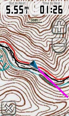 Owners of the Garmin Colorado, Dakota and Oregon series got a nice surprise yesterday, when the company rolled out the ability to create a custom map image in Google Earth, opening the door to viewing aerial photos, USGS topos and park maps on your GPS.
I immediately downloaded a US Forest Service topo (which often have greater FS road detail than USGS topos), transferred a portion to my Oregon, and hit the trail. You can see the results in the image to the left.
Accuracy is completely related to how well you georeference the image, but I was pretty pleased with the results. The red line is a track of the trail created by someone else, so I can’t vouch for the accuracy of that, but my own track lined up well with the USFS trail on the map, and had me on the proper side of the creek, so I was pretty pleased with my first attempt. I’ll also note that the Oregon was in a mesh pocket on the back of my pack, not the ideal spot for reception. Admittedly, I wasn’t going that fast (15 MPH tops), but I noticed no problems with redraws. Others are reporting sluggish behavior for larger mapsets.
Garmin adds custom raster imagery support to newer handhelds
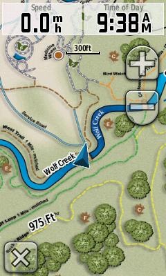 Garmin has added support for custom raster imagery to the Colorado, Dakota and Oregon product lines. This will allow you to add aerial photos, USGS topo maps, etc. to your device. You’ll need the latest beta firmware for the units (betas have not been posted for all units yet), but the process is laid out in this post. Basically, you create an image overlay in Google Earth as a .kmz file and transfer it to your unit.
I’m heading out into the field later today and will try to load a U.S. Forest Service topo quad, if Garmin posts a beta for the Oregon 400t this morning.
Scott at GPS Fix has more details, including beta firmware links.
UPDATE: Here’s the Oregon 400t beta firmware link and a screenshot from the USFS topo map I did this morning:
