Sunday, March 18, 2012

Archives for July 2014

Report Shows Wireless 911 Calls Lack Accurate GPS

Cell phones, like this iPhone 4s, don't always provide accurate GPS info inside---or out.

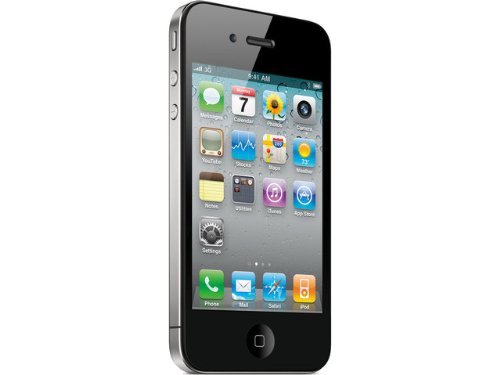
Cell phones, like this iPhone 4s, don’t always provide accurate GPS info inside—or out.

We have written about how dedicated GPS units are more reliable than A-GPS from your phone in debates about navigation, geocaching and other topics. But when it comes to security and emergency response, it turns out cell phones fall short yet again.

A report from the Washington Post shows that 9 out of 10 cell phone calls in to 911 responders in D.C. didn’t report accurate location to emergency teams. The A-GPS found in most cell phones requires both a satellite lock and a cell phone signal, and it generally doesn’t work indoors. The result is a coarse location based on the nearest cell phone tower. Generally, this type of information is only accurate within several hundred meters of the actual location, which leaves emergency responders searching an area about the size of three or four city blocks to find someone. read more

MapQuest to Receive Upgrade with TomTom Maps

tomtomAOL

According to a press release, the GPS company TomTom has entered a multi-year partnership with AOL Inc. to power its core mapping services for AOL’s MapQuest, Inc. MapQuest users will now have access to TomTom’s extensive digital map database, across all digital platforms including MapQuest.com and its smartphone and tablet iOS and Android apps. read more

World’s Smallest Industrial Tracker Released

GT0-09

The Geoforce Engineering team has released the GT0 Compact Asset Tracker for commercial and industrial use. The GT0 is the world’s smallest and lightest global satellite tracker with an internal battery that can last for years without recharging. The device is small, measuring just 2.7 inches square and 1.3 inches tall with an omni-directional antenna, so you can stick it wherever and not worry about the device. It is designed to last up to five years in the field and send location updates twice a day. read more

Waymarking for Beginners

waymarkingIf you are a geocacher, you have probably heard of virtual caches or webcam caches whilst tromping through geocaching.com’s extensive list of options. If you have, you will know that they’re not logging any more on that website and the reason is because the company behind geocaching.com, Groundspeak, has a better platform for this type of thing—waymarking.com.

What is Waymarking?

While geocaching is about treasure hunting for containers in unique locations, waymarking is all about visiting new places and just exploring what is there. Many of the waymarks are in cities and they point out interesting locations, fun activities, good food or just plan old weird stuff. For waymarkers, it’s all about discovering a new location and exploring places you otherwise might not have known existed. read more

This week in GPS — July 11th, 2014

tomtomAOL

This week in GPS is a weekly link roundup of (mostly) GPS related odds and ends, from GPS Tracklog and other places around the Web. I have included some articles from last week, as I didn’t get a chance to do a recap. This week’s picture is for an upcoming article explaining a new partnership and how it may change things. read more

TomTom GO 500 Review

TomTom GO Amazon

Hands on with the TomTom GO 500

The TomTom GO 500 is the top of the line in the most recent editions of the GO Series, launched in January 2014 (Not to be confused with the older, clunky GO 500 model released in March 2005). The new GO 500 is 5 inches and features lifetime map updates and lifetime access to TomTom Traffic (formerly HD Traffic) services which include Jam Ahead warning, Road Work detection, Road Closing Detection and traffic cam warnings. The GO 500 comes with a windshield mount and is preloaded with US maps. It features voice command and a friendly touchscreen interface. We’ll get into the details of all of that shortly. First, let’s look at…

read more

GPS Insight Receives M2M Evolution Asset Tracking Award

Print

GPS Insight, the leading technology provider of GPS fleet tracking software for fleet-based companies, has announced today that The GPS Insight Fleet & Asset Tracking Solution has received a 2014 M2M Evolution Asset Tracking Award from M2M Evolution Magazine, the leading publication covering the M2M (machine-to-machine movement). This award comes in addition to last month’s recognition for Product of the Year. read more

Wherigo Combines GPS with Computer Games

Computer games have become more and more popular over the years, and according to the ESRB, roughly 67% of all households play video games. In fact, video games have become so prolific, it can sometimes be hard to convince the  kids (or even your spouse) to get off the couch and go enjoy the great outdoors–and that’s where Wherigo comes in. read more

GPS Windshield Mounts Illegal in over Half the U.S.

We have posted articles about this before, but with the height of vacation season upon us, I thought it might be a good time to go over where you can place GPS mounts without getting a ticket. Each state in the U.S. has different laws about where you can (or can’t) mount an external automotive GPS device in your car, and if you get pulled over in a state with a different law, ignorance isn’t going to get you out of a hefty ticket! As a general rule, you can mount the device on your dashboard and have no issues–but if you intend to use a windshield mount, be sure to check this list before you take off.  The logic is that these devices obstruct the driver’s clear view of the road and are dangerous.

Currently, windshield mounts are illegal in more than half of the US–no matter where you mount it on your windshield, you can get a ticket passing through these states. Additionally, many of these states have laws about screens being operational in the car where the driver can see them. Windshield mounts in the following states should be avoided: read more

SonarCharts Expands Compatibility to Multiple GPS Units

SonarCharts

Navionics has announced that it’s award-winning SonarCharts is now compatible with Garmin, Hummingbird, Lowrance, Raymarine, Simrad and B&G units. This cutting edge software empowers individual users to easily improve the accuracy of their charts by uploading sonar logs and downloading updated charts as necessary. Navionics then processes and integrates your data quickly, giving more detail on critical areas, as well as continuous changes in sea, lake and river bottoms. read more