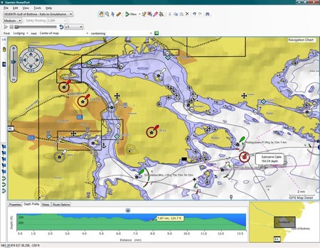
 Garmin has announced a new marine planning software desktop application dubbed HomePort. After the introduction of this and BaseCamp, perhaps we’ll see a new auto trip planner in the near future. Click here for the full news release.
Garmin intros HomePort marine planning app
Garmin nuvi 1690 and nuLink! announced
UPDATE: Read my hands on Garmin nuvi 1690 review.
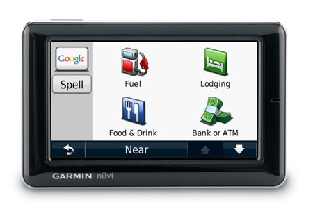
We first learned of the Garmin nüvi 1690 from the FCC a month ago, and today it’s official. As expected, the unit will sport a built-in wireless connection to a new service, dubbed nuLink!, which will provide access to Google™ local search, traffic, weather, fuel prices, movie listings, flight status, local events, white page telephone listings, and the Ciao!™ location-based social networking system. A nuLink! services coverage map is shown at the end of this post.
Garmin Forerunner 310XT review
UPDATE: An improved version, the Garmin Forerunner 910XT, has been released.
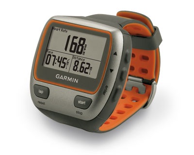
The Garmin Forerunner 310XT is the first and only GPS designed exclusively for triathletes. It is waterproof (to 50 meters!) and can go for up to 20 hours on one charge. Targeted to multi-sport athletes, the 310XT can categorize the activities in your workout and log transition times.
Free topo and trail maps for your Garmin GPS
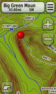 If you’re a Garmin owner and aren’t aware of all the free maps available for your unit, you’re in for a treat. Detailed 1:24,000 scale topo maps are available for most states in the US, as well as for some foreign countries. We’re also beginning to see transparent trail maps that can layer on top of topos.
Sources for free Garmin GPS topo maps
- GPS File Depot – The best source for US topo maps, this site also includes a limited selection of international maps, forums, and tutorials. If your state isn’t listed, be sure to check out the regional maps before giving up.
Mapcenter – The best repository of international maps, although you’ll see more highway maps than topo maps.UPDATE: This site is no longer available.
Trail maps too
A new trend has community mappers creating transparent trail maps that layer on top of topos. Here are a couple of notable ones:
- Northwest trails – covers Washington, Idaho, Oregon, Montana, Wyoming, British Columbia and Alaska
- Southwest trails – covers Arizona and New Mexico, with plans to expand to Utah and Nevada
Get free golf course maps for your Garmin (or make your own)
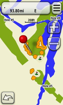 One of the nice things about Garmin units is the bevy of free maps you can download for them; international maps, highway maps, topo maps – and now we can add golf course maps to the list.
An enterprising golfer has created a site where you can download homemade golf course maps for several states, and even provided tools to make your own.
While these maps won’t give you all the capabilities of the real thing, they will give you a chance to see whether you like using a GPS on the links before you lay out hundreds for the Approach G5.
Via Groundspeak
Garmin’s got forums
 We first heard this was coming years ago, and now it’s finally here – Garmin has their own official forums. It’s still a bit limited, but fitness device fans, Garmin software users and Mac lovers will find dedicated sections up and running. Head on over and check it out.
Garmin nuvi 1200 review
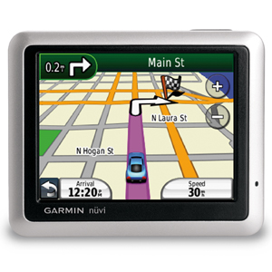
UPDATE: This model has been discontinued. For current recommendations, please refer to our auto GPS buyers guide.
Hands on with the Garmin nuvi 1200
The Garmin nüvi 1200 is the entry-level model in a line of Garmin GPS navigators introduced in 2009 (here is a list of more recent nuvi introductions). All of the units in the 1200, 1300 and 1400 series come with customizable data fields and the ability to utilize the pedestrian and mass transit features on Garmin’s CityXplorer maps. They also have text-to-speech, so you’ll hear “drive one-half mile, then turn left on Elm Street,” instead of just “drive one-half mile, then turn left.”
Garmin enables POI feedback for latest nuvi series
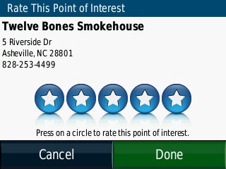 This morning I saw that Garmin had rolled out new firmware for the nuvi 12xx, 13xx and 14xx series. I wasn’t too excited until this caught my eye:
- Added ability to provide star ratings for built in Points of Interest
And sure enough, you can now give feedback on POIs. In addition to providing a star rating you can also report an error and have the item removed from future searches. I wonder how long it will be before we see map/road error reporting, ala TomTom’s Map Share.
Garmin, trails and missed opportunities
When planning a new outdoor adventure, I usually search online for tracks that I can download to my GPS. There are two places I typically look:
- Google, using the trail name, park name, etc. + gpx
- MotionBased, soon to be completely transformed to Garmin Connect
The latter is actually my first choice, since it is (IMHO) the best trail database in the US. What continues to amaze me is that Garmin doesn’t seem to realize what they have. We still get maps with plenty of missing trails, and they seem to be based on ancient USGS data.
I see no reason Garmin can’t utilize their MotionBased data to build a better trail map. They could decide how many tracks they would need for a given trail, and how much error was allowed before throwing out a track. A little follow up by hand (and even this could be automated) could establish trail junctions and where they connect to the nearest road (i.e., trailheads).
Garmin nuvi 1350 review
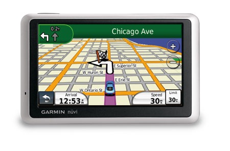 UPDATE: This model has been discontinued. For current recommendations, please refer to our auto GPS buyers guide.
The Garmin nüvi 1350 is a mid-range unit in a line of Garmin GPS navigators introduced in 2009 (here is a list of more recent nuvi introductions), and the lowest one to offer lane assist, shown above. All of the new units in the 1200, 1300 and 1400 series come with customizable data fields and the ability to utilize the pedestrian and mass transit features on Garmin’s CityXplorer maps. They also have text-to-speech, so you’ll hear “drive one-half mile, then turn left on Elm Street,” instead of just “drive one-half mile, then turn left.”
