Sunday, March 18, 2012

Free maps for your Garmin GPS

Free_international_maps

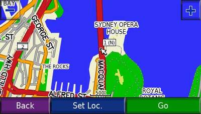
Free user-generated U.S. and international maps

UPDATE: Here’s a step-by-step guide to putting routable OSM maps on your Garmin GPS.

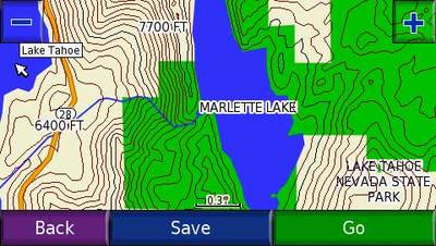
This was originally intended as a follow up to my international maps for your Garmin GPS post. Yet those sticking closer to home should investigate this too — the sources below include road maps of U.S. cities and some very nice topo maps of greater detail than you can find elsewhere. The image below is from a 1:24,000 scale Lake Tahoe map.
Lake_tahoe_24k_map

read more

International maps for your Garmin GPS

One of the more common questions I receive relates to international (non-U.S.) maps — where can I find maps of a particular country? There are actually many options, and I suspect that most people aren’t aware of them all. Some are even free. I’m going to focus on Garmin in this post, which has the greatest variety of international maps readily available, at least for any of the top selling GPS receiver brands in the U.S.

Lets go through the options one by one…

read more

An obsession with maps

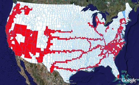
Years ago, long before I got my first GPS, I came across a map of U.S. counties, and I started using it to record my travels.  Over the years, that map became tattered and torn — "loved to death" as it were. Paper versions are still available, but it really needed to be replaced by the digital variety. So I was thrilled when Free Geography Tools recently wrote about Color Your Map, which allows you to color countries of the world, U.S. states, or counties within a state, and view them in Google Earth. So I assembled 50 files; you can see the results of 48 of them below.

Google_earth_us_counties_2

read more

Video tutorial for making custom Garmin maps

Custom_garmin_map
A member of Groundspeak, Geocaching.com’s message board, has posted a video tutorial showing how easy it is to make custom maps for a Garmin GPS. Unfortunately, it’s hosted on MediaFire and I wasn’t able to embed it here. Follow the link above and look for "click here to start download." That’s the video tutorial, not the Paris Hilton video showing below it (the one I saw was family safe though)!

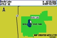
In the example, he traces the outline of a park boundary and lake in Google Earth, and uses it to create a map for his GPS as shown. The Groundspeak post links to the map making tools he used.

I covered many of these techniques in my 2005 book, GPS Mapping: Make Your Own Maps. The video only scratches the surface of what is possible. There is a ton of free GIS data on the Web that you can use to build custom maps. There’s a bit of a learning curve but if you use a handheld GPS and like to play with hacks, you should probably check it out.

read more

Garmin TOPO U.S. 2008

Topo_us_2008_screen
Garmin has announced an updated version of its backcountry maps for the U.S. – Garmin TOPO U.S. 2008. There’s not a huge amount of information available yet.

What’s known now is that the maps use 1:100,000 scale data, not 1:24,000 – a disappointment. The maps do include some new features, including the ability to generate elevation profiles on your PC or compatible Garmin receivers (shown below, after the jump), though that will be of little use if they are generated from straight lines rather than along trails. No word yet on whether there is auto-routing for trails or roads, nor do we know if this map product will be locked.

TOPO U.S. 2008 will be available on DVD or micro SD cards. Garmin has not posted an availability date.

There is a discussion thread on Groundspeak, Geocaching.com’s message board.

Via Allory.

read more

Navionics – a new provider of outdoor GPS maps

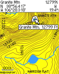
With auto systems dominating the GPS market, handheld users often feel neglected by the major manufacturers. We rarely see hardware improvements, and topo maps are updated even less frequently. The GPS maps that we do have usually show 40 meter (131 foot) contour intervals. Personally, I like to know if I’m approaching a cliff of say 100′; with these maps, it wouldn’t show!  Nor do most outdoor maps allow for auto-routing on trails, the way that GPS highway maps do.

read more

1:24,000 scale Colorado topo maps for Garmin receivers

24kcoloradotopomaps

UPDATE: I’ve posted a more comprehensive set of resources for free topo maps for Garmin GPS receivers.

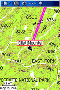
Above the Timber is about to release DVD’s of 1:24,000 scale topo maps of the Colorado Rockies for Garmin GPS receivers. I call them 1:24K scale maps even though that is a bit of a misnomer. These are digital maps, so the scale changes at each zoom level. However, the data on the screen is based on USGS 1:24,000 scale topo maps, and they show 40 foot contour intervals, as seen in the image shown here.

These are much more detailed than Garmin’s 1:100K-based U.S. Topo maps. And while Garmin does have a 1:24K scale product, it is limited (for the most part) to certain National Park areas.

The Colorado Topo Maps DVD will go on sale around May 1, at a special introductory price of $79.95. While you can “make your own maps,” the process is a bit laborious, so if you are a back country enthusiast in Colorado, this is a pretty good deal.

Related posts:

read more

Over 50,000 free maps

Free_the_maps
Late this past summer, Jared Benedict posted a ransom note for maps. But he wasn’t holding them hostage; on the contrary, his goal was map liberation. And now he has succeeded. The Libre Map Project  has posted over 50,000 free USGS topo maps.

I’ve been following this for awhile, and last weekend, all the maps  were finally made available. These are 1:24,000 scale, 7.5′ digital raster graphic (DRG) quadrangles. I’ve posted before about free USGS topographic quad maps, and about OziExplorer, my favorite mapping software that allows you to use DRG’s with (but not on) your GPS. Here is a good resource on importing DRG’s into OziExplorer.

Related post:


Source for U.S. Forest Service topo maps and vector files

USFS topo mapA decade ago, B.G. (before GPS, at least for me), I lived in a part of the Southern Appalachians surrounded by National Forests. I loved exploring the area by mountain bike, and while I wasn’t yet into GPS, my love of maps was already deeply ingrained.
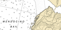
Not yet to the point of filling my hard drive with maps, I instead had a wall full of USGS topo quads, the collars cut from them, detailing a mosaic of the regional landscape. But one day my good friend, fellow biker and map junky, Sparrel, told me about U.S. Forest Service (USFS) maps.

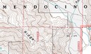
The image above shows a portion of a map near my new neighboorhood, the Mendocino National Forest. Note that the map is brown and white, even though this is a heavily forested region. Unlike USGS quads, these maps don’t show vegetation. What you gain though, are Forest Service road and trail numbers, gate locations, and more legible boundaries. Sometimes these quads are even more up to date than the standard USGS 7.5’ series. Once I discovered these, I was well on my way to acquiring a second set of topo maps for the region!

I recently discovered a great portal for USFS maps and vector data. I stumbled across this via the OziExplorer message forum. They don’t have all the USFS topos, but you might want to check it out to see what they have for your favorite stomping grounds.

read more

Free nautical charts

Free_noaa_bsb_charts
NOAA has a site where you can download free nautical charts for the entire U.S. The charts are in BSB/KAP format, and can be used in OziExplorer. I found this via a post on the OziExplorer message  forum.