Sunday, March 18, 2012

Navionics Marine & Lakes for iOS review

Hands on review of Navionics Marine & Lakes: US & Canada HD

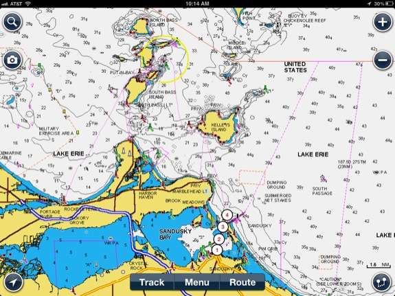
The Navionics Marine Charting app is targeted for recreational boaters.  This app allows viewing the proprietary Navionics Nautical Vector Charts on your favorite iOS device.  Users can create routes and record tracks, which can be shared with friends using Facebook, Twitter, and email.  The routes can also can be uploaded to certain fixed mount chart plotters that might be found on a boat.  The Navionics app will function as a chart plotter displaying your position on the chart with the enabled route making it somewhat practical to use as a chart plotter while underway. read more
Garmin Smartphone Link review

Update: Now available for iOS (compatible with 2013 Bluetooth nuvis).

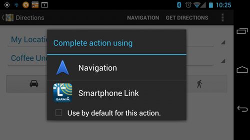
I’ve been living with Garmin’s Smartphone Link Android app for a few months now, and there are a lot of things I like about it. I haven’t tested all the features, but I’ll walk you through the ones I have tried. read more

Garmin adds LiveTrack feature to Fit app

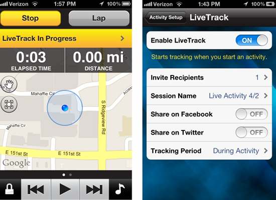
Garmin has just announced a new LiveTrack feature for their Fit smartphone app, that allows you to share your location by email, Facebook or Twitter. At an in-app purchase price of $19.99 a year or $1.99 per month, I think they are going to sell a lot of these. There are enough runners and road bikers with anxious spouses that I think it will be a big hit.

read more

Garmin StreetPIlot onDemand goes social

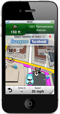
Garmin is rolling out several new features for its StreetPilot onDemand app for iOS, including Facebook and foursquare check-in, a Wikipedia layer, and the ability to add new voices and custom vehicle icons. Also new is an update to the Garmin Tracker iOS app for the GTU-10, allowing continuous tracking and the option to share a link so others can view the location as well. And in case the new features have piqued your interest, Garmin’s StreetPilot onDemand and Navigon apps will be on sale for $10 off during Macworld (January 26-28):
read more

Garmin StreetPilot Onboard iPhone app gets traffic camera option

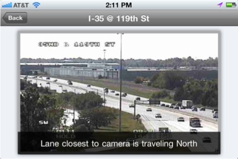
Garmin StreetPilot 2.0 PhotoLive Traffic 3Tired of inaccurate traffic data? How about live traffic camera images instead? Well that’s a new option as of today’s update to the Garmin StreetPilot Onboard app for the iPhone. The update will also add live weather info and the ability to share points of interest via Facebook and SMS. While the update is free, the photoLive Traffic Cameras feature will cost you $9.99 as an in-app purchase.

read more

Garmin Fit Apps and ANT+ adapter announced

Garmin Fit screens 1

UPDATE: Looks like the ANT+ adapter for iPhone will be available later this week.

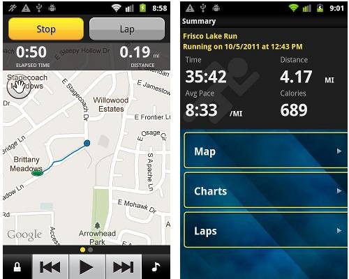
Garmin has announced the Garmin Fit app for iPhone and Android this morning, and an ANT+ adapter for the iPhone (that link wasn’t live when I posted this, but it probably will be later this morning). This is Garmin’s first fitness app, allowing users to track speed, pace, distance, time and calories. And at $0.99, it’s likely to gain a lot of users pretty quickly.

read more

Enter traffic circle and keep left?

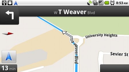
Traffic-circle-failOkay, maybe it’s unfair to call out Google Maps Navigation for this error. After all, every GPS can give you faulty directions, no matter what database they are using for road data. But I’ve never seen this type of error on a unit using NAVTEQ or TeleAtlas maps. Fail!

Garmin StreetPilot Onboard iPhone app

Garmin-StreetPilot-onboard-3dRecalculating! Garmin has done a course correction with their iPhone app, rolling out a version with onboard maps, eight months after the release of their original StreetPilot app that used offboard maps. Considering AT&T’s reception problems in many areas, it’s probably a smart move.

read more

Google Maps Navigation to use onboard maps?

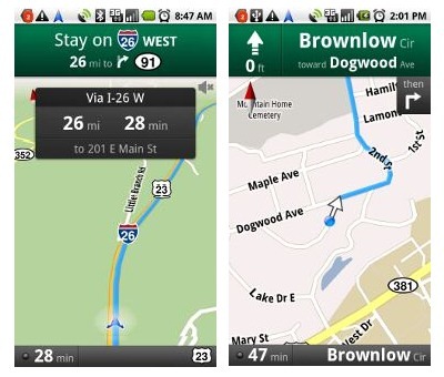
Nav screensAccording to All About Phones, a Dutch website, Google Maps Navigation will soon have a full-blown offline mode. Late last year, with the introduction of Google Maps 5.0 for Android, GMN moved to vector graphics and improved route caching. But this new capability would allow you to plug in a destination while outside of cell range, which means that some maps and associated data would always be cached on your device.

read more

Preserving cellphone battery life in the backcountry

Dazzle-Android-batteryI imagine that a lot of our readers are trying out their smartphones in the backcountry, using mapping applications for navigation. One of the problems with this (and there are several), is that few things will drain your battery faster than your phone searching for a signal where there is none, or where reception is marginal.

read more