Sunday, March 18, 2012

Archives for November 2006

Magellan RoadMate 2000 update

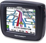
I recently had the opportunity to spend some quality time with a Magellan RoadMate 2000, and I learned some interesting things, like the fact that this is not really a "crossover" GPS unit designed for backcountry use! Check out my Magellan RoadMate 2000 review for the update.

Related post:

read more

I got my nuvi!

Nuvi_660_menu_screen_1
Yep, I finally broke down and bought a nuvi 660. From GPSNow of course (and I noticed today that Amazon’s price has gone back up). I gotta say, I was impressed with the speed of delivery. I ordered my nuvi on the day after Thanksgiving (Friday), and it was here Monday afternoon. Total shipping and handling? $7.55 for USPS Priority Mail. And no sales tax. Man, you can’t beat that!

So far, I’ve been very pleased with the nuvi. As always, Garmin comes through with very intuitive menus. This is one of their true strengths.

What else have I noticed?

read more

Bushnell GPS to feature aerial photos and satellite imagery

Bushnell_gps_with_aerial_photo

Bushnell has announced two new handheld GPS receivers that can accommodate aerial photos and satellite imagery (and apparently USGS topo maps). This comes hot on the heels of Lowrance announcing their iWAY 600C auto receiver. Assuming someone else doesn’t beat them to the punch, Bushnell will have the first non-PDA, consumer handheld GPS with this capability. Outdoor enthusiasts have been waiting a long time for a ruggedized GPS with this capability.

There are two models — the Onix200 and Onix200CR — the only apparent difference being that the CR has a color screen with higher resolution. Amazon says that the Bushnell Onix200 will be available sometime after December 22. The Onix200CR is due in February 2007.

Bushnell is hyping a screen layering feature, but it appears to only layer a navigation compass on the screen, rather than allow you to blend topos and aerial imagery. I’m a little disappointed that you can’t layer topo maps and aerial photos, but another concern is cost.

At first glance this doesn’t look too bad — $1 per map or photo, 25 for $20 or an unlimited annual subscription for $79. Which begs the question, after a year do I own the imagery or do I have to download it again every time I want to change images?

And consider this quote: "The ONIX200 series unit will store up to 12 photography (satellite or aerial) downloads at one time. Choose images of the same land at different levels of zoom, or broaden your coverage area by storing photos of separate areas."

With only 32 MB of user memory, the Onix200 series will accept only 12 images. And from that quote, and the layout of the download site, I assume that each time you change zoom level, it’s a different image and therefore another map or photo you are charged for.

Sounds a bit limited to me. Maybe Garmin will bring this capability to CES.

read more

Garmin zumo 550 review

Garmin_zumo_550

UPDATE: This model has been discontinued. For a look at current models, check out our GPS for motorcycles page. The Garmin zumo 550 GPS is designed especially for motorcycles. The zumo comes pre-loaded with maps of Europe or North America, and Bluetooth allows for hands free cell phone calling through the cyclist’s helmet. This high-end unit includes the SiRFstar III chipset for excellent reception, an MP3 player, and optional XM radio, traffic and weather. TMC traffic alerts are another available alternative. read more

GPS gift guide

The holiday gift season is upon us and judging from the growth in the GPS market, there are lots of people out there wishing for the coolest toy tool on the planet. But how do you decide what to buy? Where do you start? I’ve assembled a number of tools to help you make the right choice. Most will lead to our reviews of individual GPS units. Be sure to check these out, because they are designed to (among other things) help you find the best price. And if you still can’t make up your mind, just pick up an Amazon gift certificate.

Okay, ready? Let’s look at some choices:

What will this GPS be used for?

Here are a number of posts that should help you find the right GPS for your use:

read more

GPS for geocachers

EtrexhmapLast updated December 16, 2009

Geocaching is an extremely popular sport, and I’d venture to say that over 99% of geocachers use a GPS. But which one to choose? I’ll narrow the field, look at choices in multiple price ranges, and delve into other uses, mapping software, etc. By the way, all the units below have a high-sensitivity chipset for superior reception under canopy and in natural or urban canyons.

Budget GPS for geocaching

The Garmin eTrex Venture HC has a sunlight-readable color screen and the ability to accept detailed maps, such as the free Garmin-compatible topo maps available for most states. It comes with a USB cable for transferring waypoints, tracks and routes to and from your computer. The retail price is $200, but I typically see it selling for about $115 to $130.


A lower cost model, the Garmin eTrex H, has a monochrome screen and you lose the cable and the ability to load maps. The eTrex H is available for around $80 at the time of this update. I highly recommend getting the Venture HC instead.

Another budget model worth considering is the Geomate.jr, which comes with 250,000 caches pre-loaded!

read more

The amazing flying 60CSx

Garmin_60csx_dismount

Why do I have a picture of my wife’s foot at the start of this post? What you see to the left is the re-enactment of a GPS accident this afternoon. We had come to a locked gate, lifted our bikes over, and then we proceeded to climb over ourselves. Except my dear wife’s foot grazed the antennae, which sort of acted like a lever. Yes, the 60CSx flipped out of the mount, went tumbling through the air, and plop — on the pavement.

Oh, see the railing behind her foot? A couple more feet and it would have gone into the river (see photo at right below). Now I’m just having bad luck with my 60CSx. My old unit, a 60CS, never took a tumble out of my mount, yet this is the second such impact for this unit.

read more

GPS with MP3 players

Nuvi_660_center_mp3_1
Many auto GPS receivers come with an integrated MP3 player, allowing you to control musical selections in your car via the GPS. Some even work with Audible audio book (.aa) files, or come with XM Radio receivers. Typically, playback is paused when navigation directions are announced; some units even rewind a couple of seconds when the music starts back.

There are a number of things to consider when purchasing a GPS receiver with an MP3 player; speaker quality, whether or not you can import playlists, the amount of disk storage available for files (if the unit doesn’t use an SD/MMC card for storage), how intuitive menus are, etc. The variations are too great to delve into here. Our GPS reviews link to many user reviews, so dig deep and check them out, or find a message board for the unit you are interested in, and search or ask.

read more

GPS for golfers

UPDATE: Read my Garmin Approach G5 review and my GolfLogix 2008 review

It seems like GPS is everywhere these days, and the golf course is no exception. There are two main types of golf GPS systems. One is owned by the course and integrated into your cart. The other is a handheld unit that golfers can carry along, no matter what course you play. Here are the four popular forms of the latter type (product descriptions are adapted from the manufacturer and / or Amazon):

  • SureShot GPS (pictured at right) – The SureShot GPS is a compact, hand-held, easy to use GPS device specific to golf. With the option of attaching to your belt or golf cart, the SureShotGPS means never having to look for a distance again. Wherever in the world you play golf, the SureShot GPS will allow you to obtain distances from tee to green. Experience the difference with better club selection, speedier play and statistical information per round. There are thousands of courses available, and if by chance your’s is not, it can be mapped for you within a few days. Official SureShot GPS web page.

read more

GPS for hikers

Hikers_with_gps_hiking

Last updated December 3, 2009

When selecting a GPS for hiking, two key criteria come to mind. It’s likely that a hiker will want a unit that’s good for navigation, and will not want to have to hold it out at arm’s length for the entire hike, which means that…

Reception is important for hikers

I recommend a unit that will get great satellite reception, so I’m going to limit my recommendations to models with a high sensitivity chipset, such as the SiRFstar III or MediaTek chipset. With these receivers, you can stick them in your pocket, or a mesh pocket on a day pack, and you are still likely to have adequate reception. Some of this is dependent upon how the satellite constellation is configured for your location on any given day, but overall, I think you’ll be happy with the performance of these units.

read more