Sunday, March 18, 2012

Garmin GPSMAP 376C review

Garmin_376c

UPDATE: This model has been discontinued. Check out our list of more current marine GPS receivers for alternatives.

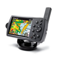
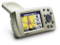
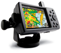
The Garmin GPSMAP 376C marine and vehicle chartplotter updates the 276C, adding XM satellite radio and weather capabilities. Though listed as a marine unit, this is actually a dual-purpose device that supports City Navigator maps and turn-by-turn routing.

The 376C comes with base maps; if you want detailed maps, you’ll have to buy those separately. Garmin is currently updating the 376C with the GPSMAP 378 and 478, which have preloaded land and sea maps, and are expected to become available in late May 2006.

Here’s what others have to say about the Garmin 376C:
read more

Garmin GPSMAP 76CSx review

Garmin_76csx

UPDATE: The GPSMAP 76CSx has been discontinued. For current recommendations, check out our handheld GPS buyers guide or our Garmin handheld GPS comparison chart.

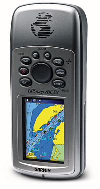
The Garmin GPSMAP 76CSx updates the Garmin GPSMAP 76CS with two major improvements. First, the 76CSx includes the  SiRFSTAR III chipset, which has been getting rave reviews for its fast acquisition time and awesome coverage under canopy, in urban canyons and even indoors!

UPDATE: In early 2009, it appears that Garmin stopped using the SiRFstar III chipet due to a patent dispute, substituting a MediaTek (MTK) chipset. While both are high-sensitivity chipsets, Garmin is still fine-tuning the MTK firmware. The switch to this chipset has reduced one of the advantages the 60/76 C(S)x series has enjoyed over newer Garmin models.

UPDATE 2: Here’s my 2010 take on SiRFstar III and the newer chipsets.
read more

Nuvis, pocket queries and a US geocache database

I received an email the other day from a reader (Mike) looking for an automotive GPS he could transfer geocaching info to. He asked about doing this via POIs, with a possible goal of getting all U.S. geocaches loaded. I pointed Mike towards some resources and we corresponded a bit more. He ended up buying a Garmin nuvi, and I asked him to keep me posted on his quest. I heard back from Mike today and he’s given me permission to share his experience:

read more

Garmin Vista Cx Review

Vista_cx_2

UPDATE: This model has been discontinued. For more current recommendations, please refer to our handheld GPS buyers guide or our Garmin handheld GPS comparison chart.

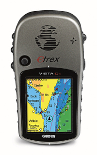
The Garmin eTrex Vista Cx updates the very popular eTrex Vista C, adding expandable memory via a micro-SD card, which will provide plenty of room for optional highway and/or topo maps. This is a nice compact unit, ideal for use in the great outdoors and for navigating city streets.


read more

Garmin auto / marine units – GPSMAP 378 and 478

Gpsmap_478
No, these aren’t GPS receivers for your amphibious vehicle. But if you’ve got a pickup truck and a boat trailer, they could be the units for you. Earlier today, Garmin announced the GPSMAP 378 and GPSMAP 478 (pictured at left).

These new receivers have pre-loaded marine AND highway maps for North America. Both units come with a marine mount and automotive kit, so you can use them to drive to the dock and then pop them into your boat. The GPSMAP 378 has 10-meter resolution charts for 3200 inland lakes, while the GPSMAP 478 has charts for the entire U.S. coastline, including Alaska and Hawaii.

Both units come pre-loaded with City Navigator ® NT for highway navigation, and optional XM radio weather capabilities.  They are expected to be available  in late May 2006 with an expected street price of $1199.99.


Technorati tags: GPS, marine

Iraq maps for your Garmin GPS

Iraq_map

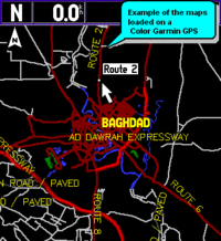
LeadDog Consulting and Global Map have released what appears to be a new version of their Garmin compatible maps of Iraq. Complete with major roads, freeways and secondary roads, detailed street maps of 13 cities, and contour lines, it is also MGRS compatible.


Garmin StreetPilot 7500 Review

Streetpilot_7500 UPDATE: Most of the several generations old StreetPilot series, including this model, has been discontinued. For a more current recommendation, check out our Auto GPS buyers guide or go straight to our Garmin nuvi comparison chart.
 

The Garmin StreetPilot 7500 is identical to the StreetPilot 7200 with one added feature, described by Amazon this way — “As a step-up feature from the 7200, the 7500 includes dead reckoning sensors to track your vehicle’s course when the GPS signal is blocked, which can occur when driving in urban areas or tunnels. If you lose GPS coverage in areas with tall buildings or tunnels, the StreetPilot 7500 keeps on navigating. This feature requires professional installation.”

Like the 7200, the 7500 has a big seven-inch touch-screen, and was designed with RV’s, buses and semi-trucks in mind. And like it’s sister unit, it includes an audio book reader, an MP3 player and XM satellite radio. With XM radio, you not only get music, but also weather and real-time traffic conditions that overlay maps in major metropolitan areas in the U.S. The StreetPilot 7500 uses this data to automatically calculate and suggest faster alternate routes before traffic starts backing up. Of course this is all in addition to pre-loaded maps of North America, a touch screen interface and voice-prompted routing.

Compare prices on the Garmin StreetPilot 7500

read more

Inland Lakes maps released by Garmin

Us_inland_lakes

Garmin has released Inland Lakes mapping software for the U.S., described by Garmin as follows:

"From small, local lakes to large ones, this software contains highly detailed data for lakes of almost every size in the continental United States. With exceptional detail — including amazing contour lines on most inland lakes plus high-definition shoreline, river and creek channels, islands, boat ramps, campgrounds, rivers, streams, tide stations and predictions, U.S. Coast Guard aids to navigation, a wrecks and obstructions database, and road data…"


Unlike
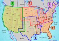
other recent releases, Inland Lakes is to be made available on SD cards, micro-SD cards and DVD, though the DVD version is not available yet. Five regions, shown at left above, are available on individual cards, or you’ll be able to buy the full set of five on DVD. The list price for the individual regional cards is $116.65. No word yet on the cost of the DVD. More detailed information on the regions is available here.


Garmin Quest 2 Review

Quest_2

UPDATE: This model has been discontinued. For current recommendations, please refer to our auto GPS buyers guide.

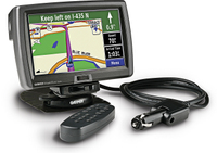
The Garmin Quest 2 is an updated version of the original Quest GPS receiver. The Quest 2’s internal memory comes pre-programmed with either the North American or European version of City Select NT. This is a significant improvement over the original unit, which would hold only 115 MB of maps, and had to be transferred from CD.

Four readers at Amazon gave an average 3-1/2 out of 5 star rating in their Garmin Quest 2 reviews.

Some additional info on the Quest 2:

read more

New version of National Geographic TOPO! – GPX support added

Ng_topo_new
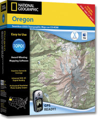
National Geographic is selling a new version of its TOPO! state series mapping software. Instead of separate Windows and Mac versions, the new edition integrates support for both in one box. This release also incorporates the features found in the TOPO! Streets & 3-D Views expansion pack:

  • 3-D views and fly-throughs
  • Updated street layer information
  • Live map update feature allows you to download new USGS quads
  • Support for more GPS models including those using a USB interface

If you have one of the older versions (3.X), you’ll need to buy Streets & 3-D Views to upgrade. If you already have Streets & 3-D Views, you can download the latest upgrade to version 4.1.5. A Mac version of the upgrade is expected to be posted any day now.

The latest version also adds GPX file support, although at this time it only allows import of GPX files. I have been told that the next upgrade, due to be posted in April, will allow GPX file export. No word yet on whether this will allow the export of tracks, the current lack of which is the only major fault I can find with TOPO!

Finally, although the image on the TOPO! state series website shows the new version, it does not appear to have been otherwise updated. The current GPS compatibility list doesn’t even show the Garmin USB units made compatible by Streets & 3-D Views.

UPDATE: A conversation at Groundspeak tipped me off that, even though the update says v. 4.1.5, it is in reality now v. 4.2.2. This update includes support for Garmin x-series receivers and Magellan eXplorist. Still no .gpx file export though.

Related posts:

Technorati tags: GPS