Sunday, March 18, 2012

Points of Interest (POIs) resources

Last updated February 19, 2008

This thread originally dealt solely with custom points of interest
(POIs), but I’ve updated and reorganized it to include online sources
of POIs, conversion tools and more.

Custom points of interest (POI) resources

read more

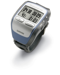
Garmin Forerunner 205 Review

Forerunner_205_1

UPDATE: This model has been discontinued. For information on current models, check out our GPS for runners page.

The Garmin Forerunner 205 is a stylish update of the Forerunner 201. But don’t judge it just by looks. The 205 has the new SiRFSTAR III chipset that has been garnering rave reviews for its amazing performance under canopy, in urban canyons, and even indoors!

The primary difference between this unit and the Forerunner 305, is that the 305 has a heart-rate monitor; the 205 does not.

Compare prices on the Forerunner 205

Here’s what others are saying about the Forerunner 205:

read more

How are Garmin and Magellan topo maps different?

Over at Groundspeak, Geocaching.com‘s message forum, Peter gave a great explanation of the differences between Garmin and Magellan topo maps:

"As Sputnik indicated, the approaches taken by Magellan and Garmin are different. Garmin uses Digital Raster Graphics (DRG) to basically create an image of the USGS 1:100,000 series maps. Therefore their maps have all the detail and accuracy provided by those maps, and nothing else – which means they lack most road names and anything built since the maps were last updated (20 years or so ago in many areas). But they do show the features included by the USGS: springs, fire roads, quite a few trails, etc. Also note that the 1:100,000 maps are metric so the contour spacings are based on rounded numbers of meters. When your GPS is set to feet the spacings look a bit strange (e.g. contours at 164′, 328′, 492′, etc.)

Magellan’s topo maps are instead based on the Digital Elevation Model (DEM) technology where elevations are sampled in a grid pattern and the contour lines are then recreated by interpolation between grid points. That provides the contour line detail but by itself wouldn’t give you anything else. So Magellan combines this topology data with the same road data they use for their street maps (based on TIGER for the original Streets and Topo programs, based on NavTeq for DirectRoute and 3DTopo).

If you want to get by on just a single set of maps then Magellan’s approach is clearly superior. But anyone who wants auto-routing and elevation data (both good things to have) will need to get both sets of maps anyway. In that case each approach has its good and bad sides. Magellan lets you see all the data at one time on your screen since their street data is identical on both and therefore doesn’t cause a problem, but they lack many of the older dirt roads and trails that are included on the old USGS maps used by Garmin. And, as Sputnik said, you can load both sets of maps in your Garmin and toggle between them. I frequently use CitySelect to get to a trailhead and then switch to Topo to see the terrain and trails for a hike."


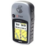
Garmin eTrex Legend Cx Review

UPDATE: This model has been discontinued. For more current recommendations, please refer to our handheld GPS buyers guide or our Garmin handheld GPS comparison chart.

The Garmin eTrex Legend Cx updates the popular Legend C model by adding a micro-SD card slot for expandable memory (hence the “x”). This is a great upgrade, since the Legend C’s 24 MB of internal memory was almost too small to effectively utilize City Select software for highway use.

read more

nuvi 310, nuvi 360 introduced by Garmin

Nuvi_310UPDATE: Check out our Garmin nuvi
360 review
.

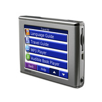
Earlier today, Garmin unveiled the nüvi 310™ and nüvi 360™, two new additions to this popular product line. The nüvi™ is described by Garmin as an all-in-one Personal Travel Assistant™.

Both units feature Bluetooth "wireless technology with a microphone and speaker that lets you make hands-free mobile phone calls. Simply dial numbers with the nüvi’s touch screen keypad to make a call on a compatible Bluetooth phone. To answer calls, just tap nüvi’s screen and speak directly into its built in microphone." Both units also feature anti-theft technology; "Garmin Lock™ disables the nüvi from performing any functions until the user types in a specific 4-digit PIN or takes the unit to a predetermined secure location code. If the user does not know the PIN or secure location, the nüvi will be inoperative." Finally, the new nüvi’s have an SD slot that can accommodate options like Language Guides, a Travel Guide for Europe (U.S. coming soon) or a Savers Guide. Both units are expected to be available in June 2006.

Garmin nüvi™ 310

The Garmin nüvi™ 310 (pictured at left above), is the successor to the nüvi™ 300 and is available only in Europe. It comes pre-loaded with City Navigator® NT Europe data for one of the nine regions. Of course, like the 300, the 310 comes with MP3 player, audio book player, JPEG picture viewer, travel alarm, and currency converters. An optional FM traffic receiver provides Nuvi_360real-time traffic information.

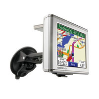
Garmin nüvi™ 360

The Garmin nüvi™ 360, pictured at right, updates the incredibly popular nüvi™ 350. Pre-loaded with City Navigator® NT North America or Europe (full coverage), the other main difference between this and the 310 is that the 360 features turn-by-turn voice-prompted directions that speak street names.

Technorati tags: GPS

Theme park maps for your Garmin GPS

Stonemaps offers GPS maps for theme parks including Disney World and Disneyland. They also have some maps for Utah ski resorts, and for other theme parks in California and Florida. Sorry, no Magellan maps yet. Found via Groundspeak.

Related posts:

Technorati tags: GPS, Disney World, Disneyland

Garmin GPSMap 60Cx Review

Gpsmap_60cx
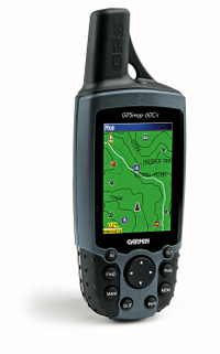
The Garmin GPSMap 60Cx is an updated version of the GPSMap 60C. This new unit comes with the SiRFSTAR III chipset, which has been getting rave reviews for its fast acquisition time and solid coverage under canopy, in urban canyons and even indoors!

UPDATE: In early 2009, it appears that Garmin stopped using the SiRFstar III chipet due to a patent dispute, substituting a MediaTek (MTK) chipset. While both are high-sensitivity chipsets, Garmin is still fine-tuning the MTK firmware. The switch to this chipset has reduced one of the advantages the 60/76 C(S)x series has enjoyed over newer Garmin models.

UPDATE 2: Here’s my 2010 take on SiRFstar III and the newer chipsets.

UPDATE 3: This model has been superseded by the Garmin GPSMAP 62.

UPDATE 4: This model has been discontinued. For more current recommendations, please refer to our handheld GPS buyers guide or our Garmin handheld GPS comparison chart.

The other significant upgrade is that the 60Cx no longer utilizes the unit’s built in memory for MapSource maps, but loads them to a microSD card instead (the unit comes with a 64 MB card). This means you have unlimited map storage capability, plus you can use some of the newer MapSource software that is available only on SD cards. Stepping up to the 60CSx adds a barometric altimeter and electronic compass. To see how the 60Cx stands up against other Garmin models, check out my Garmin handheld GPS comparison chart.

read more

Garmin GPSMap 76Cx Review

Gpsmap_76cx_1

UPDATE: The GPSMAP 76Cx has been discontinued. We recommend the GPSMAP 78s as an alternative.

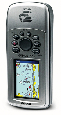
The Garmin GPSMap 76Cx is an update of the popular Garmin GPSMap 76C, which has been well loved by mariners and landlubbers alike. The 76Cx has the new SiRFSTARIII chipset, which has been garnering accolades for its fast acquisition time and awesome coverage under canopy, in urban canyons and even indoors! The other significant upgrade is that the 76Cx no longer utilizes the built in memory for MapSource maps, but loads them to a microSD card slot instead (the unit comes with a 128 MB card). This means you have unlimited map storage capability, plus you can use some of the newer MapSource software like City Select Mexico. Stepping up to the 76CSx adds a barometric altimeter and electronic compass. To see how the 76Cx stands up against other Garmin models, check out my Garmin handheld GPS comparison chart.

Compare prices on the Garmin GPSMAP 76Cx

UPDATE: In early 2009, it appears that Garmin stopped using the SiRFstar III chipet due to a patent dispute, substituting a MediaTek (MTK) chipset. While both are high-sensitivity chipsets, Garmin is still fine-tuning the MTK firmware. The switch to this chipset has reduced one of the advantages the 60/76 C(S)x series has enjoyed over newer Garmin models.

UPDATE 2: Here’s my 2010 take on SiRFstar III and the newer chipsets.
read more

Garmin GPSMAP 60CSx Review

Hands on with the Garmin GPSMAP 60CSx

UPDATE: The 60CSx has been superseded by the Garmin GPSMAP 62s.

UPDATE 2: This model has been discontinued. For more current recommendations, please refer to our handheld GPS buyers guide or our Garmin handheld GPS comparison chart.

UPDATE 3: Here are some reasons to look at a more up to date model.

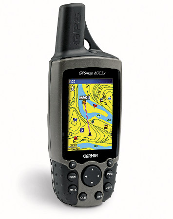
The Garmin GPSMAP 60CSx updated the now ancient Garmin 60CS with two important improvements. First, the 60CSx includes the SiRFSTARIII chipset, which has been getting rave reviews for its fast acquisition time and awesome coverage under canopy, in urban canyons and even indoors! Second, the 60CSx no longer utilizes the built in memory for MapSource maps, but loads them to a removable microSD card instead (the unit comes with a 64 MB card). This means you have nearly unlimited map storage capability.

read more

Garmin StreetPilot 7200 Review

Streetpilot_7200_1

UPDATE: This model has been discontinued. For current recommendations, please refer to our auto GPS buyers guide.

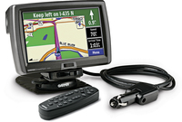
The Garmin StreetPilot 7200 is a new wide-screen GPS navigation device with a 7″ display, designed for larger vehicles such as RV’s, semi-trucks and buses. The 7200 includes an audio book reader, an MP3 player and XM satellite radio. With XM radio, you not only get music, but also weather and real-time traffic conditions that overlay maps in major metropolitan areas in the U.S. The StreetPilot 7200 uses this data to automatically calculate and suggest faster alternate routes before traffic starts backing up. Of course this is all in addition to pre-loaded maps of North America, a touch screen interface and voice-prompted routing.

So what distinguishes this unit from those above and below it? The primary difference between it and the StreetPilot 2730 is the big screen on the 7200. Step up to the StreetPilot 7500 and you’ll get a a dead-reckoning feature that allows drivers to continue receiving navigational cues when GPS signals are obscured – such as in tunnels – through a built-in solid state gyro and a connection to a vehicle’s odometer system.

read more