Sunday, March 18, 2012

Imagery sources for Garmin custom maps

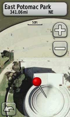
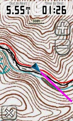
Garmin-custom-map-DC There are a lot of new map makers out there now that Garmin has opened the door to custom maps on their latest generation handhelds.

And the results are cool. Just don’t expect those people standing around the Jefferson Memorial to be in the same place when you visit!

The process for adding aerial photos and topo maps is simple enough, once you find the imagery. To get you up and running faster, I’ve posted a list of sources for aerial imagery and various types of maps below. But first, let’s look at some of the acronyms and terms you’re bound to come across as you delve into this…
read more

Garmin custom maps – Day 2

Garmin-custom-map Owners of the Garmin Colorado, Dakota and Oregon series got a nice surprise yesterday, when the company rolled out the ability to create a custom map image in Google Earth, opening the door to viewing aerial photos, USGS topos and park maps on your GPS.
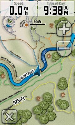
I immediately downloaded a US Forest Service topo (which often have greater FS road detail than USGS topos), transferred a portion to my Oregon, and hit the trail. You can see the results in the image to the left.

Accuracy is completely related to how well you georeference the image, but I was pretty pleased with the results. The red line is a track of the trail created by someone else, so I can’t vouch for the accuracy of that, but my own track lined up well with the USFS trail on the map, and had me on the proper side of the creek, so I was pretty pleased with my first attempt. I’ll also note that the Oregon was in a mesh pocket on the back of my pack, not the ideal spot for reception. Admittedly, I wasn’t going that fast (15 MPH tops), but I noticed no problems with redraws. Others are reporting sluggish behavior for larger mapsets.

read more

Garmin adds custom raster imagery support to newer handhelds

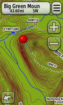
Garmin raster map Garmin has added support for custom raster imagery to the Colorado, Dakota and Oregon product lines. This will allow you to add aerial photos, USGS topo maps, etc. to your device. You’ll need the latest beta firmware for the units (betas have not been posted for all units yet), but the process is laid out in this post. Basically, you create an image overlay in Google Earth as a .kmz file and transfer it to your unit.
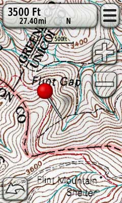
I’m heading out into the field later today and will try to load a U.S. Forest Service topo quad, if Garmin posts a beta for the Oregon 400t this morning.

Scott at GPS Fix has more details, including beta firmware links.

UPDATE: Here’s the Oregon 400t beta firmware link and a screenshot from the USFS topo map I did this morning:
Raster-on-OR-400t

Transferring features from a PDF map to your GPS

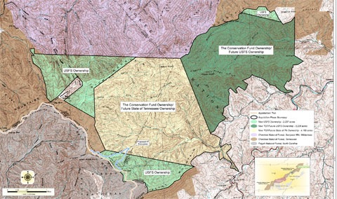
Transfer PDF map features to GPS I learned the other day about a new 10,000 acre tract of public lands near me. There are no trail maps of the area and I am dying to explore it (once all this rain stops). I’ll probably do another post on prepping my GPS for exploring there, but this one aspect warrants its own post.

read more

Free topo and trail maps for your Garmin GPS

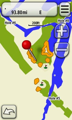
Free-GPS-topo-maps If you’re a Garmin owner and aren’t aware of all the free maps available for your unit, you’re in for a treat. Detailed 1:24,000 scale topo maps are available for most states in the US, as well as for some foreign countries. We’re also beginning to see transparent trail maps that can layer on top of topos.
Sources for free Garmin GPS topo maps

  • GPS File Depot – The best source for US topo maps, this site also includes a limited selection of international maps, forums, and tutorials. If your state isn’t listed, be sure to check out the regional maps before giving up.
  • Mapcenter – The best repository of international maps, although you’ll see more highway maps than topo maps. UPDATE: This site is no longer available.

Trail maps too

A new trend has community mappers creating transparent trail maps that layer on top of topos. Here are a couple of notable ones:

  • Northwest trails – covers Washington, Idaho, Oregon, Montana, Wyoming, British Columbia and Alaska
  • Southwest trails – covers Arizona and New Mexico, with plans to expand to Utah and Nevada

read more

Get free golf course maps for your Garmin (or make your own)

Free-GPS-golf-maps One of the nice things about Garmin units is the bevy of free maps you can download for them; international maps, highway maps, topo maps – and now we can add golf course maps to the list.

An enterprising golfer has created a site where you can download homemade golf course maps for several states, and even provided tools to make your own.

While these maps won’t give you all the capabilities of the real thing, they will give you a chance to see whether you like using a GPS on the links before you lay out hundreds for the Approach G5.

Via Groundspeak

Garmin CityXplorer review

CityXplorer-MARTA

I went to Atlanta this past weekend, armed with a nuvi 1490T and the Atlanta edition of Garmin’s new CityXplorer maps. And I have to say, I was quite impressed. I’m blessed with a good sense of direction (though I find it much easier to lose N, S, E and W in the city), but I’m not a real urbanite. I can probably count the number of times I’ve ridden a subway / light rail on one hand. So I had some nervousness about leaving my car behind and venturing into the city via MARTA, with only a nuvi to guide me. It turns out that my fears were misplaced. Quite simply, CityXplorer rocks. Read on for the details…

read more

TwoNav Aventura is a lust-worthy GPS

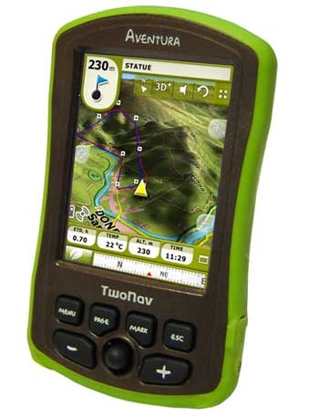
TwoNav-Aventura I don’t often write about GPS receivers that aren’t available in the U.S., but I’m making an exception today with the TwoNav Aventura. For one thing, the company is on the lookout for a stateside distributor, so we may see it here yet. Another reason is it will accept just about any kind of map – more on that in a moment. The Aventura is a dual-use device, but it’s the handheld possibilities that excite me, so if you’re an outdoor type, I encourage you to read on.

read more

Garmin App Store? Map Store?

Okay, they may not be calling it that, but Garmin is now making much of its map and software library available for download direct from their site. Essentially, this means any map that’s currently available as an SD card, cityXplorer maps, Language Guides, and Travel Guides. Hit the jump for the full list.

read more

Garmin BaseCamp for handheld GPS

Garmin has announced a new desktop application — BaseCamp — designed for backcountry GPS enthusiasts. It basically does the same thing MapSource does, adding 3D rendering, photo geotagging, and the ability to rotate to non-north up viewpoints. It will also bring improved printing capabilities, geocaching information display and data management functionality.

read more