Sunday, March 18, 2012

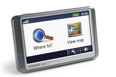
Garmin nuvi 250W review

Garmin_nuvi_250w

UPDATE: This model has been discontinued. For current recommendations, please refer to our auto GPS buyers guide.

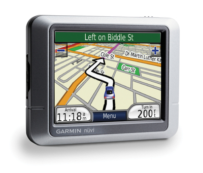
The Garmin nuvi 250W is a 4.3″ wide-screen version of the Garmin nuvi 250. Depending upon which side of the pond you live on, the nuvi 250W comes with pre-loaded maps of North America or Europe. This is a basic navigation device – no MP3 player, no Bluetooth, no text-to-speech. The one frill is the extra  wide touch-screen. Yet even without the bells and whistles, it’s Garmin nuvi quality through and through. Like all nuvis, it comes with nearly six million points of interest (POIs).

UPDATE: A new model, the nuvi 255W, offers these features and more.
read more

New Garmin eTrex models officially announced

Etrex_vista_hcx_2UPDATE: Read our eTrex H-series reviews:

Last week I reported on rumors of a new Garmin eTrex lineup with a high-sensitivity chipset. Today it’s official — Garmin has announced, and put up product pages for the following units:

  • eTrex H – Monochrome display, MSRP $99.99
  • eTrex Venture HC – Color display, MSRP $199.99
  • eTrex Summit HC – Color display, barometric altimeter, electronic compass, MSRP $249.99
  • eTrex Legend HCx – Color display, expandable memory, MSRP $269.99
  • eTrex Vista HCx – Color display, expandable memory, barometric altimeter, electronic compass, MSRP $299.99

It’s nice to see features previously limited to the 60 and 76 x-series in a compact unit. I’ve included the manufacturers suggested retail price (MSRP) above as we’re also seeing a price drop compared to some past eTrex models and units with comparable features.

All models are capable of accepting detailed maps except for the basic eTrex H. The Summit HC and Venture HC map capacity is limited, due to their 24MB of internal memory. The Legend HCx and Vista HCx offer autorouting.

The new eTrex line is expected to be available in the third quarter of this year.

Garmin opens up

Garmin_logo_pms_rgb_3
Garmin has published an API and taken several steps to open Garmin devices to third-party generated content.

The Garmin Communicator Plugin API beta "allows developers to transfer location data – such as waypoints, track logs, maps and points of interest (POIs) – to and from a website and Garmin device." I find it especially interesting that maps are included in that statement. Perhaps we’ll start seeing more third-party map providers now that Garmin has given them tacit approval. Geocaching.com and Motionbased.com are both using the technology behind this, though users may have to download a plugin to ensure that it works with their browser. Currently IE 6+ and Firefox 1.5+ are supported. Mac support is "coming soon."

Many of the other tools announced today move Garmin farther into the location-based services game:

read more

Garmin nuvi 270 review

Nuvi_270_right

UPDATE: A newer 3.5″ trans-Atlantic unit, the Garmin nuvi 275T, has recently been introduced.

UPDATE 2: This model has been discontinued. For current recommendations, please refer to our auto GPS buyers guide.

UPDATE 3: The latest trans-Atlantic navigators to be introduced are the Garmin nuvi 2475LT and nuvi 2370LT.

The Garmin nuvi 270 is the transatlantic offering in Garmin’s new entry-level nuvi lineup. Equipped with a 3.5″ screen, the nuvi 270 includes pre-loaded maps of the U.S., Canada and Europe (see coverage map below). Other units in the 200 series have less extensive coverage; the nuvi 200 has maps of all 49 continental United States, while the nuvi 250 offers all 50 states and Canada.
read more

Garmin TOPO U.S. 2008

Topo_us_2008_screen
Garmin has announced an updated version of its backcountry maps for the U.S. – Garmin TOPO U.S. 2008. There’s not a huge amount of information available yet.

What’s known now is that the maps use 1:100,000 scale data, not 1:24,000 – a disappointment. The maps do include some new features, including the ability to generate elevation profiles on your PC or compatible Garmin receivers (shown below, after the jump), though that will be of little use if they are generated from straight lines rather than along trails. No word yet on whether there is auto-routing for trails or roads, nor do we know if this map product will be locked.

TOPO U.S. 2008 will be available on DVD or micro SD cards. Garmin has not posted an availability date.

There is a discussion thread on Groundspeak, Geocaching.com’s message board.

Via Allory.

read more

Galileo and Garmin

Galileo
A couple of days ago, I posted a story about several new Garmin eTrex GPS units due this fall. At that point, the Canadian PDF catalog page was not available online, but it’s back now and the full story can be told.

The big news isn’t the high-sensitivity chipset, it’s this blurb from the ad…

Also “GALILEO” (the new navigation system under development in Europe) ready as a future path that will accommodate a drop–in chip when available in the future.

That’s pretty exciting except for the fact that Galileo literally can’t get off the ground. According to what I’ve been able to find, only one of 30 satellites has been successfully launched. So Galileo compatibility, while it does show Garmin adding a (potential) new feature to its handhelds, is hardly a good reason to buy one of the new eTrex units.

Navionics – a new provider of outdoor GPS maps

With auto systems dominating the GPS market, handheld users often feel neglected by the major manufacturers. We rarely see hardware improvements, and topo maps are updated even less frequently. The GPS maps that we do have usually show 40 meter (131 foot) contour intervals. Personally, I like to know if I’m approaching a cliff of say 100′; with these maps, it wouldn’t show!  Nor do most outdoor maps allow for auto-routing on trails, the way that GPS highway maps do.

read more

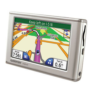
Garmin nuvi 650 review

Garmin_nuvi_650_l

UPDATE: Though still available and supported, Garmin has discontinued the nuvi 650. For newer models, check out my Garmin nuvi comparison chart.

The Garmin nuvi 650 is Garmin’s entry level unit in the 4.3″ wide-screen 600 series.  The touch-screen nuvi 650 comes with pre-loaded maps of the U.S. and Canada, an MP3 player, and the ability to call out upcoming street names. So you’ll get “turn left on North Main Street in 500 feet” rather than just “turn left in 500 feet.” Live traffic coverage is available as an add-on.

Step up to the nuvi 660 to get an integrated traffic receiver, Bluetooth for hands-free cell phone use, along with an FM transmitter to stream music, directions and phone calls through your car stereo speakers. The nuvi 670 adds European maps to the 660’s feature set, while the nuvi 680 adds MSN Direct services to the 660’s features.

read more

Transfer waypoints to your nuvi with MapSource

As noted in my last post, I just returned from a trip to the southwest. My wife and I visited many towns and cities in New Mexico including Santa Fe, Albuquerque, Las Cruces and Silver City, and we even made it as far north as Colorado Springs. My trusty Garmin nuvi 660 led the way.

We were gone 12 days and had many places we wanted to see. We’re considering relocating so we were checking out neighborhoods, open houses, restaurants, etc. When you’re doing a trip that complicated, in cities you aren’t familiar with, simply plugging destinations into your GPS isn’t always the best way to do things. There’s nothing like being able to visualize the whole city on your computer screen. So I used Garmin’s MapSource to find POIs and create waypoints, and then transfer them to my nuvi.

If you don’t have the latest version of MapSource, download it to enable this capability. In version 6.11.1 Garmin added support for transfer with Garmin mass storage devices, such as the nuvi. I found it to be very helpful.

read more

1:24,000 scale Colorado topo maps for Garmin receivers

24kcoloradotopomaps

UPDATE: I’ve posted a more comprehensive set of resources for free topo maps for Garmin GPS receivers.

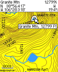
Above the Timber is about to release DVD’s of 1:24,000 scale topo maps of the Colorado Rockies for Garmin GPS receivers. I call them 1:24K scale maps even though that is a bit of a misnomer. These are digital maps, so the scale changes at each zoom level. However, the data on the screen is based on USGS 1:24,000 scale topo maps, and they show 40 foot contour intervals, as seen in the image shown here.

These are much more detailed than Garmin’s 1:100K-based U.S. Topo maps. And while Garmin does have a 1:24K scale product, it is limited (for the most part) to certain National Park areas.

The Colorado Topo Maps DVD will go on sale around May 1, at a special introductory price of $79.95. While you can “make your own maps,” the process is a bit laborious, so if you are a back country enthusiast in Colorado, this is a pretty good deal.

Related posts:

read more