Google recently announced their custom search engine tool. I didn’t really see how I would use it at first; then I thought about creating a search engine designed to go after GPS data. After all, I find myself searching for it often for trip planning. So give it a try, perhaps with the name of a popular trail or a geographical area:
Search for waypoints, tracks, POI’s, maps and aerial imagery
I’ve included over 30 sources so far, including National Geographic TOPO!’s MapXchange, the TOPO USA file exchange, MotionBased, several points of interest (POIs) sites, a great U.S. DRG resource, sites with free Garmin maps, aerial photos, and more. I’ve tried to keep out sites that charge for data, or sites that will return massive numbers of duplicate or irrelevant results. Oh, and if you find yourself dealing with data types that your software won’t handle, check out a GPS file converter.

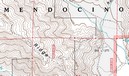 A decade ago, B.G. (before GPS, at least for me), I lived in a part of the Southern Appalachians surrounded by National Forests. I loved exploring the area by mountain bike, and while I wasn’t yet into GPS, my love of maps was already deeply ingrained.