Sunday, March 18, 2012

First looks at DeLorme PN-40

DeLorme PN-40 L

UPDATE: Check out my hands-on DeLorme PN-40 review

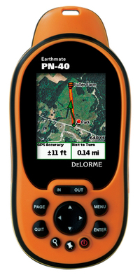
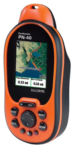
I'm fortunate to have a DeLorme Earthmate PN-40 in for testing, and I thought I'd share some initial impressions since this unit is due to become available in the next week or two.

Like the PN-20, this new model lets you view your position on aerial imagery. But a number of upgrades promise to make this an even more popular handheld than the original:

  • A dual-core processor makes map redraws and menu navigation very fast, and I can already attest to this; even at 60 MPH, map redraws were nearly instantaneous — I saw only brief flashes of blank areas on the screen
  • Tri-axial compass (meaning there is no need to hold it dead level)
  • Barometric altimeter
  • SDHC high-capacity SD card support
  • A more detailed base map

read more

DeLorme PN-40 and new low cost plan for aerial imagery

Delorme_pn40

We heard about the DeLorme PN-40 earlier this summer, so today’s announcement of its pending release this fall comes as no surprise. One new piece of info though — they’ve scheduled a September shipping date.

Low cost aerial imagery and USGS quads

The other new piece of information is that you’ll be able to download all the aerial imagery, USGS topo quads and NOAA charts that you want for an annual fee of $29.95. I’ve been merciless in my criticism of DeLorme pricing; prior to this thirty bucks would have only bought you two 7.5′ quads worth of imagery. So here’s a big thank you to DeLorme for giving us this deal. I can’t imagine owning a DeLorme handheld and not ponying up the extra bucks for imagery.

read more

Lowrance iWAY 600C review

Iway600csat_2
UPDATE: This model has been discontinued. For current recommendations, please refer to our auto GPS buyers guide.

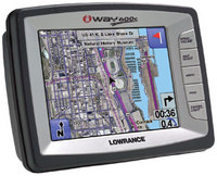
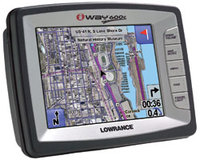
The Lowrance iWAY 600C is the new top of the line automotive and marine GPS navigator from Lowrance that, in addition to displaying maps, has aerial imagery of hundreds of U.S. and Canadian cities.

The iWAY 600C has a large 5″ touch-screen, pre-loaded maps of the continental U.S. and Canada, plus electronic charts with depth contours for U.S. inland lakes, the Great lakes and coastal waters. It also has an MP3 player, built-in FM transmitter and 5.5 million points of interest (POIs).

25 GB of its 30GB hard drive is dedicated to maps and aerial photos. The remaining 5 GB is available to store MP3s.

read more

DeLorme Earthmate GPS PN-20 review

Hands on with the DeLorme Earthmate PN-20

UPDATE: There are now two newer models in this series, the DeLorme PN-30 and PN-40.

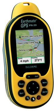
Finally, a GPS that displays aerial photos. The DeLorme Earthmate GPS PN-20 does just that, and displays USGS topo maps too. It is incredibly cool to be carrying a GPS that shows your position on an aerial photo. Having said that, DeLorme clearly has some improvements they need to make, and I hope they do, because this is one nifty device. Before we get into the details, let’s get up to speed on aerial photos, and why other GPS receivers lack this capability.

Aerial photos on the DeLorme Earthmate PN-20

Most GPS receivers utilize vector files — basically data files consisting of lines and points. The DeLorme PN-20 differs in that it can also accommodate images, such as aerial photos and USGS topo maps. The technical term is raster imagery, and they eat up much more memory than vector files. For a more detailed explanation of raster versus vector imagery, see What kind of maps can I put on my GPS (and what do you mean by raster and vector)?

Vector lines are redrawn, and therefore appear sharp, at every zoom
level. Aerial photos and USGS topo maps, on the other hand, will only
appear clear at one zoom level. DeLorme probably uses aerial photos
supplied by USGS which are available at multiple resolutions – 1
meter/pixel, 4 meters/pixel, 16 meters/pixel and 64 meters/pixel.
DeLorme appears to be utilizing the one meter/pixel imagery.

read more

Bushnell GPS to feature aerial photos and satellite imagery

Bushnell_gps_with_aerial_photo

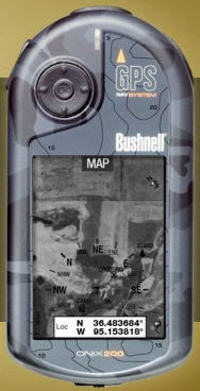
Bushnell has announced two new handheld GPS receivers that can accommodate aerial photos and satellite imagery (and apparently USGS topo maps). This comes hot on the heels of Lowrance announcing their iWAY 600C auto receiver. Assuming someone else doesn’t beat them to the punch, Bushnell will have the first non-PDA, consumer handheld GPS with this capability. Outdoor enthusiasts have been waiting a long time for a ruggedized GPS with this capability.

There are two models — the Onix200 and Onix200CR — the only apparent difference being that the CR has a color screen with higher resolution. Amazon says that the Bushnell Onix200 will be available sometime after December 22. The Onix200CR is due in February 2007.

Bushnell is hyping a screen layering feature, but it appears to only layer a navigation compass on the screen, rather than allow you to blend topos and aerial imagery. I’m a little disappointed that you can’t layer topo maps and aerial photos, but another concern is cost.

At first glance this doesn’t look too bad — $1 per map or photo, 25 for $20 or an unlimited annual subscription for $79. Which begs the question, after a year do I own the imagery or do I have to download it again every time I want to change images?

And consider this quote: "The ONIX200 series unit will store up to 12 photography (satellite or aerial) downloads at one time. Choose images of the same land at different levels of zoom, or broaden your coverage area by storing photos of separate areas."

With only 32 MB of user memory, the Onix200 series will accept only 12 images. And from that quote, and the layout of the download site, I assume that each time you change zoom level, it’s a different image and therefore another map or photo you are charged for.

Sounds a bit limited to me. Maybe Garmin will bring this capability to CES.

read more

Satellite imagery and aerial photos on your GPS

Iway600csat_large
Earlier this week, Lowrance announced a new GPS receiver, the iWAY 600C. What makes this unit so special is that it can display satellite imagery. It looks like they will beat DeLorme, manufacturers of the fabled Earthmate PN-20, to the punch (though no release date has been set). Actually, Garmin already has marine units that can accommodate aerial photography.

This is a rare feature, and one reason is memory. The points and lines you see on your GPS screen come from data files, not images. It takes a lot more room to store the latter. 25 GB of the iWAYs’s 30 GB hard drive is devoted to maps and satellite imagery. But hey, if they can make an 80 GB iPod, this stuff can’t be to far away for GPS. Hopefully, the manufacturers will get it right, and not charge us extra for imagery that is available for free on line.

Get the Lowrance iWAY 600C at Amazon.

read more

NAIP aerial photography

Naip_aerial_photo_mendocino

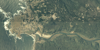
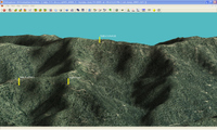
The Map Room recently covered the National Agricultural Imagery Program (NAIP). Now don’t be confused by the Agriculture part of the name, because the NAIP is of value to a much broader audience. NAIP offers very recent, natural-color aerial imagery of almost the entire U.S., at a relatively high resolution. Full county mosaics are $50. For my county, there is a 2006 image with a resolution of 2 meters/pixel, and a 2005 image at 1 meter/pixel. The image at left, of the Big River estuary and Mendocino, CA, is supposed to be 2 meter resolution. The resolution doesn’t look quite that sharp to me, but nevertheless, I can make out recent changes in logging roads in the area I frequent for mountain bike rides. The image to the right below, shows a 3-D view with waypoints, that I created using OziExplorer.

Ozi_3d_with

The color county mosaics are in MrSID format. You can use OziExplorer to work with these files, and the NAIP website lists several viewers. Quarter quadrangles are available in GeoTIFF format. Here’s the latest (2005) aerial photo coverage map for color county mosaics.

Unfortunately, we’re dealing with the feds here, so ordering is a pain and delivery is slow.


Free topos and aerial photos: USAPhotoMaps

Choosing_mapping_software_4

Everybody loves stuff they can get for free, right? Especially if it is way cool and quite useful. Well, USAPhotoMaps fits the bill. Created by Doug Cox, USAPhotoMaps is TerraServer-based, just like TopoFusion. And just like TopoFusion, you can look at aerial photos or topo maps of just about any location in the U.S. For some urban areas, you can even view color aerial photos down to 0.25 meters/pixel (see below left)!

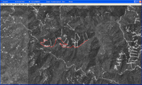
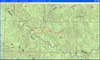
One of the ways I’ve used USAPhotoMaps is to locate newer 4WD roads that don’t appear on topo maps, which are usually much Usaphotomaps_color_urban_aerialolder than USGS aerial photos. In the image on the right below, I’ve drawn a track along a logging road. To the left below, you can see how I’ve been able to update a topo map with the hand-drawn track.
One of the other great things about USAPhotoMaps, is that Doug Cox just keeps updating it, adding new features and keeping it current.

USAPhotoMaps does lack some features, but all in all, it’s a great program, and you sure can’t beat the price. I believe it is Usa_photo_3particularly useful for people new to the world of GPS, who may not be ready to lay out money for mapping software and aren’t quite sure what all they can do with it. If you’ve never transferred your track to your computer, to view it on an aerial photo, you’ve got a treat coming. And now you don’t have any excuse not to!

There is a full chapter on USAPhotoMaps in my book, GPS Mapping – Make Your Own Maps.

Usa_photo_4_2
Other posts in this series:

read more

Get maps and aerial photos online: TopoFusion

Choosing_mapping_software_2
UPDATE: Check out ten reasons TopoFusion rocks.

Today we’re going to look at programs that download maps from  TerraServer, a partnership between Microsoft and USGS. With these  applications, you can view topo maps and aerial photos, and even detailed color imagery for urban areas.

My favorite application in this category is TopoFusion, which has a long list of advantages. Here are a few of them:

  • A free demo mode. The full version is $40 and well worth it.
  • A log book that captures a history of your trips in calendar format.
  • Ability to switch between topos and aerial photos of a location, or blend the two.
  • 3-D views.
  • PhotoFusion automatically links photos to where they were shot.

read more

Yahoo Maps adds satellite imagery

Yahoo Maps Beta has added satellite imagery to its site. This has been pretty well covered elsewhere today, so I’ll just provide a couple of links (Cartography and O’Reilly). Compare your favorite coordinates on Google Maps and see which you think is best.

Technorati tags: GPS