Hunting season is still a ways away, but in the cold winter months and the coming spring is when trail cams are among the most fun. In these months, you’re more likely to catch a glimpse of an animal wandering to search for food, shelter, or a mate. It’s also a good time to get a feel for where your favorite game animals are located so that you know where to start in the fall, when hunting season opens.
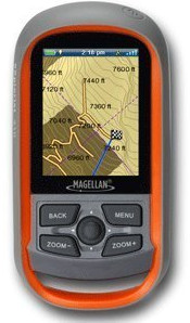
Each trail cam is slightly different and features different ways to view the images. Some of them require owners to wait til they get home to check the content, while others will include some sort of trail cam viewer which can be used at the site to review the images. However, there’s a much easier way; instead of lugging the viewer all the way to the site and back, simply use your Garmin. read more
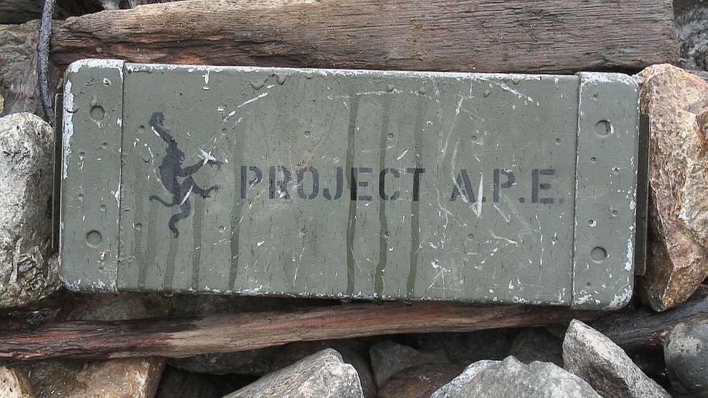
This week in GPS is a weekly link roundup of (mostly) GPS related odds and ends, from GPS Tracklog and other places around the Web. This week’s featured image is a picture of one of the missing APE Project caches, as the final vote for the fate of the cache recovered in 2016 is going on now. Read about this and other GPS news below! read more
Last year, we were excited to announce that one of the fabled missing APE caches, the Mission 9: Tunnel of Light, which was originally placed near Seattle, had been located. The original APE cache container, which had been archived after being reported missing and possibly muggled in 2011, was finally found in October 2016.
The discovery of Mission 9: Tunnel of Light sparked a debate in the community of what to do with the cache, and it was finally put up to a vote. According to Groundspeak, around 9,000 votes were tallied, and now the final fate of the APE cache has been narrowed down to four options, which users can vote now through March 5, 2017.
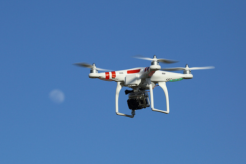
GPS drone (UAS) with GoPro camera; Creative Commons image courtesy Don McCullough
This week in GPS is a weekly link roundup of (mostly) GPS related odds and ends, from GPS Tracklog and other places around the Web. This week’s featured image is of a drone, because it’s been a rather busy week in the world of drones. Read some of the headlines for this, and other news, below! read more
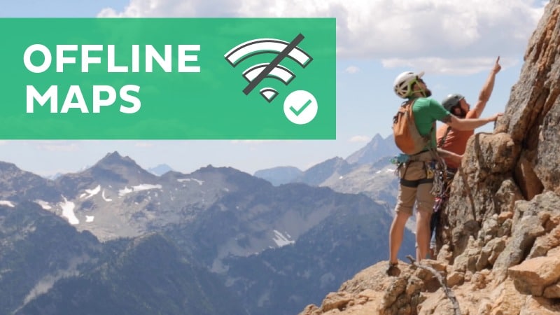
The folks over at Groundspeak recently announced that the popular Geocaching app has been updated with some features that geocachers have been requesting for a long time now: offline maps. Although it’s only available for Premium Geocaching members, this feature will be nice when you’re somewhere that has zero cell signal—as is common when you’re out geocaching in the wilderness.
Other updates added with the most recent patch include a My Lists beta and trail maps, and pending logs. It’s unclear whether all of these features are available for free members as well as Premium members, unfortunately (so if you’re a free member, please chime in below and let me know). We’ll take a closer look at each of the new updates below: read more
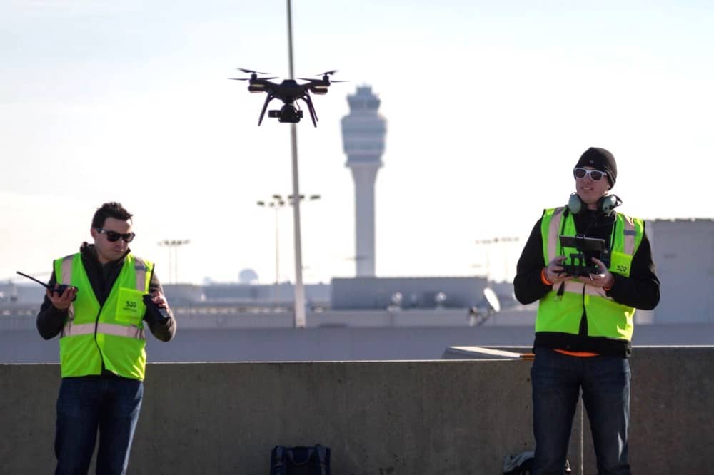
This week in GPS is a weekly link roundup of (mostly) GPS related odds and ends, from GPS Tracklog and other places around the Web. This week’s featured image is a team of drone operators who received the first-ever permit to fly in a major airport. Read more about this, and other GPS news, below: read more
If you’re a drone user, then you are probably aware of the almost draconian rules on flying your aircraft. There are restrictions to height and location which vary by region and even situation slightly. However, the one constant is that drones are not allowed to fly near airports. However, in a landmark moment, the FAA recently issued a waiver and allowed a drone to fly at the Hartsfield-Jackson Atlanta International Airport—one of the busiest airports in the world.
The exception, it should be noted, did come with some conditions: in order to allow the drone to fly in airspace, the drone would require three spotters to be watching the drone during its flight, and there would have to be intense coordination with air traffic control. Of course, this isn’t the first time a drone has flown at an airport, but it is the first time the special permit was granted for a major airport. read more
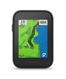
This week in GPS is a weekly link roundup of (mostly) GPS related odds and ends, from GPS Tracklog and other places around the Web. This week’s featured image is Garmin’s newest golfing GPS unit–the Approach G30. Read more about it, and other GPS news, below! read more
Garmin has announced that it has added a new device to the Approach line of golfing GPS devices. The new Approach G30 is the most recent in the line but, unlike previous devices, is not a watch but rather a small clip-on device that can be easily attached to a golfer’s bag, waist, cart, or wherever else. The small 2.3 inch color touchscreen allows users to view a variety of statistics and game information to help give golfers a competitive advantage and better understanding of their game.
Much like other Garmin Approach devices, the G30 comes preloaded wiht 40,000 courses around the world and free map updates so that users can always have the most accurate and up-to-date information. Other features include: read more
Since Europe’s Galileo system went live in December, the satellites have been transmitting navigational signals all across the world with only a few difficulties (such as clock malfunctions). And, now that the system is in the first stage of operability, it looks like the United States government is finally taking notice.
"We were desert mystics, my few friends and I, the kind
who read maps as others read their holy books."
– Edward Abbey from Slickrock —
The Canyon Country of Southeast Utah